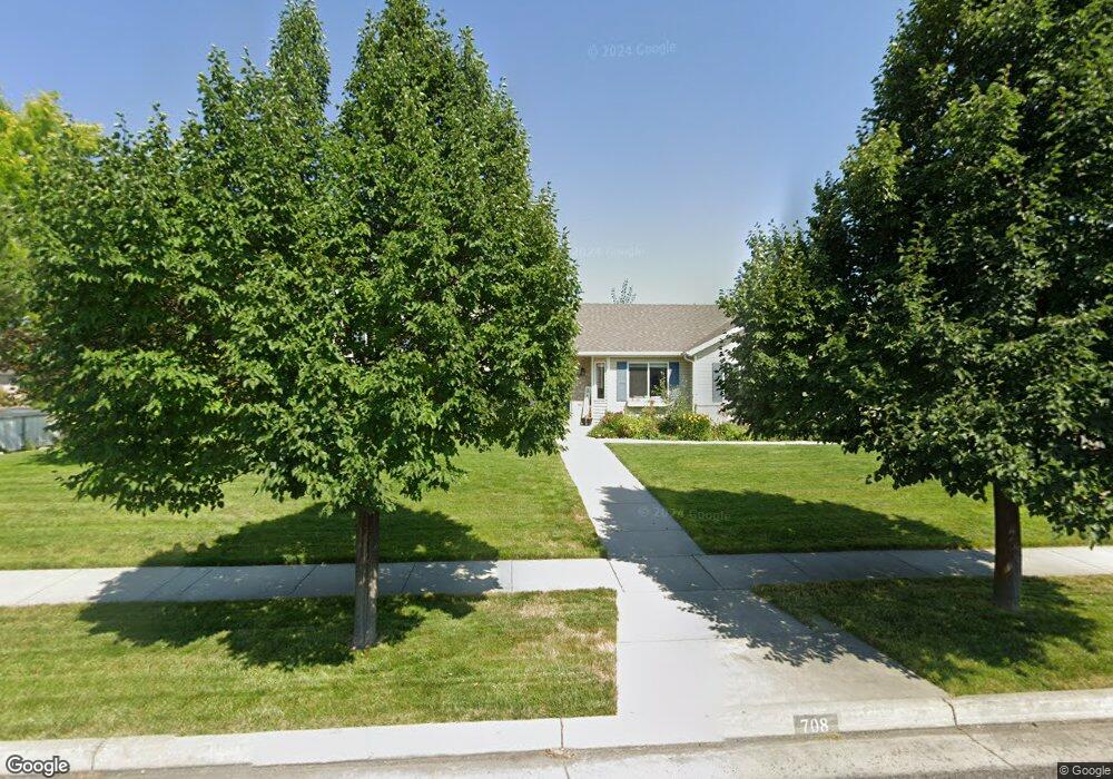
708 S 1250 W Logan, UT 84321
Woodruff NeighborhoodEstimated Value: $421,000 - $446,580
3
Beds
3
Baths
1,955
Sq Ft
$224/Sq Ft
Est. Value
About This Home
This home is located at 708 S 1250 W, Logan, UT 84321 and is currently estimated at $438,145, approximately $224 per square foot. 708 S 1250 W is a home located in Cache County with nearby schools including Mountainside School, South Cache Middle School, and Mountain Crest High School.
Ownership History
Date
Name
Owned For
Owner Type
Purchase Details
Closed on
Jun 3, 2020
Sold by
Purintun Nicholas and Purintun Tina
Bought by
Johnson Michael J and Johnson Jessie L
Current Estimated Value
Home Financials for this Owner
Home Financials are based on the most recent Mortgage that was taken out on this home.
Original Mortgage
$240,000
Outstanding Balance
$212,207
Interest Rate
3.3%
Mortgage Type
New Conventional
Estimated Equity
$225,938
Purchase Details
Closed on
Aug 31, 2001
Sold by
Jaren Taylor Construction Inc
Bought by
White Francis E and White Wanda C
Home Financials for this Owner
Home Financials are based on the most recent Mortgage that was taken out on this home.
Original Mortgage
$147,000
Interest Rate
7.05%
Mortgage Type
VA
Purchase Details
Closed on
Mar 29, 2001
Sold by
Parker Real Estate Development Inc
Bought by
Jaren Taylor Construction Inc
Home Financials for this Owner
Home Financials are based on the most recent Mortgage that was taken out on this home.
Original Mortgage
$123,200
Interest Rate
7.06%
Mortgage Type
Construction
Create a Home Valuation Report for This Property
The Home Valuation Report is an in-depth analysis detailing your home's value as well as a comparison with similar homes in the area
Home Values in the Area
Average Home Value in this Area
Purchase History
| Date | Buyer | Sale Price | Title Company |
|---|---|---|---|
| Johnson Michael J | -- | Us Title Insurance Agency | |
| White Francis E | -- | Cache Title Company | |
| Jaren Taylor Construction Inc | -- | Cache Title Company |
Source: Public Records
Mortgage History
| Date | Status | Borrower | Loan Amount |
|---|---|---|---|
| Open | Johnson Michael J | $240,000 | |
| Previous Owner | White Francis E | $147,000 | |
| Previous Owner | Jaren Taylor Construction Inc | $123,200 |
Source: Public Records
Tax History Compared to Growth
Tax History
| Year | Tax Paid | Tax Assessment Tax Assessment Total Assessment is a certain percentage of the fair market value that is determined by local assessors to be the total taxable value of land and additions on the property. | Land | Improvement |
|---|---|---|---|---|
| 2025 | $1,792 | $231,770 | $0 | $0 |
| 2024 | $1,841 | $230,620 | $0 | $0 |
| 2023 | $1,909 | $227,920 | $0 | $0 |
| 2022 | $1,729 | $192,720 | $0 | $0 |
| 2021 | $1,683 | $289,920 | $48,000 | $241,920 |
| 2020 | $1,617 | $250,630 | $48,000 | $202,630 |
| 2019 | $1,690 | $250,630 | $48,000 | $202,630 |
| 2018 | $1,656 | $224,200 | $48,000 | $176,200 |
| 2017 | $1,398 | $100,100 | $0 | $0 |
| 2016 | $1,449 | $100,100 | $0 | $0 |
| 2015 | $1,234 | $85,150 | $0 | $0 |
| 2014 | $1,116 | $85,150 | $0 | $0 |
| 2013 | -- | $85,150 | $0 | $0 |
Source: Public Records
Map
Nearby Homes
- 1220 W 575 S
- 1239 W 575 S Unit 152
- 548 S 1225 W Unit 115
- 542 S 1225 W Unit 116
- Hemlock Plan at Sugar Creek - Logan
- Eucalyptus Plan at Sugar Creek - Logan
- Blackberry Plan at Sugar Creek - Logan
- Magnolia Plan at Sugar Creek - Logan
- 518 S 1225 W
- 506 S 1225 W
- 1227 W 500 S Unit 151
- 1506 Silver Canoe Loop
- 1506 Silver Canoe Loop Unit 102
- 985 W 720 S
- 763 S 1500 W
- 1099 Three Pointe Ave
- 420 S 1400 W
- 552 Rivergate Dr
- 736 Majestic Dr
- 1585 W Silver Canoe Way
- 1242 W 710 S Unit 15
- 1227 W 710 S
- 705 S 1250 W
- 709 S 1250 W
- 1226 W 710 S
- 1298 Henry's Point Dr
- 1213 W 710 S
- 736 S 1250 W
- 1255 W Henrys Pt Dr
- 1210 W 710 S Unit 12
- 1210 W 710 S
- 1218 W 710 S
- 739 S 1250 W
- 1330 Henrys Point Dr
- 667 S 1250 W
- 1330 W Henry's Point Dr
- 761 S 1250 W
- 1307 W Henrys Pt Dr
- 734 S 1360 W
- 782 S 1250 W