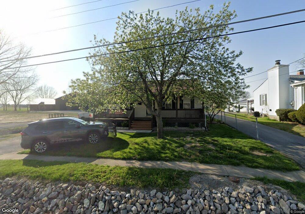
708 S Maple St Brighton, IL 62012
Estimated Value: $188,000 - $228,000
4
Beds
2
Baths
1,500
Sq Ft
$135/Sq Ft
Est. Value
About This Home
This home is located at 708 S Maple St, Brighton, IL 62012 and is currently estimated at $203,037, approximately $135 per square foot. 708 S Maple St is a home located in Jersey County with nearby schools including Southwestern High School.
Ownership History
Date
Name
Owned For
Owner Type
Purchase Details
Closed on
Sep 22, 2023
Sold by
Guthrie Mark A and Guthrie Joann M
Bought by
Reese Jay
Current Estimated Value
Purchase Details
Closed on
Mar 31, 2011
Sold by
Reno Randall
Bought by
Guthrie Mark A and Guthrie Joann M
Home Financials for this Owner
Home Financials are based on the most recent Mortgage that was taken out on this home.
Original Mortgage
$76,500
Interest Rate
4.92%
Purchase Details
Closed on
Nov 14, 2010
Sold by
American General Financial Services Of I
Bought by
Reno Randall
Purchase Details
Closed on
Jun 21, 2010
Sold by
Sheriff Of Jersey County
Bought by
American General Financial Services Of I
Create a Home Valuation Report for This Property
The Home Valuation Report is an in-depth analysis detailing your home's value as well as a comparison with similar homes in the area
Home Values in the Area
Average Home Value in this Area
Purchase History
| Date | Buyer | Sale Price | Title Company |
|---|---|---|---|
| Reese Jay | $170,000 | Serenity Title | |
| Guthrie Mark A | -- | -- | |
| Reno Randall | -- | -- | |
| American General Financial Services Of I | -- | -- |
Source: Public Records
Mortgage History
| Date | Status | Borrower | Loan Amount |
|---|---|---|---|
| Previous Owner | Guthrie Mark A | $76,500 |
Source: Public Records
Tax History
| Year | Tax Paid | Tax Assessment Tax Assessment Total Assessment is a certain percentage of the fair market value that is determined by local assessors to be the total taxable value of land and additions on the property. | Land | Improvement |
|---|---|---|---|---|
| 2024 | $3,269 | $58,165 | $6,085 | $52,080 |
| 2023 | $3,525 | $52,875 | $5,530 | $47,345 |
| 2022 | $3,425 | $51,335 | $5,370 | $45,965 |
| 2021 | $2,739 | $40,585 | $5,040 | $35,545 |
| 2020 | $2,522 | $39,595 | $4,915 | $34,680 |
| 2019 | $2,522 | $37,530 | $4,660 | $32,870 |
| 2018 | $2,508 | $35,915 | $4,460 | $31,455 |
| 2017 | $2,330 | $33,565 | $4,170 | $29,395 |
| 2016 | $2,334 | $33,565 | $4,170 | $29,395 |
| 2015 | -- | $33,565 | $4,170 | $29,395 |
| 2014 | -- | $33,615 | $4,175 | $29,440 |
Source: Public Records
Map
Nearby Homes
- 0 W County Line Rd Unit Tract 4
- 0 W County Line Rd Unit Tract 2
- 205 Jersey St
- 207 South St
- 10 Austin Ct
- 107 Park St
- 207 W Vine St
- 109 Spruce Ct
- 22 Islander Dr
- 213 N Cross St
- Tbd County Line Rd
- 34113 Canoe Ct
- Tbd County Line Rd
- Tbd County Line Rd
- 3305 Brown Rd
- 34105 Teakwood Place
- 16677 Oak Bridge Rd
- 1011 Voorhees Ln
- 0 Stone Circle Dr Unit MIS25076611
- 0 Lageman Ln Unit MAR25022629
- 706 S Maple St
- 702 S Maple St
- 702 S Maple St
- 614 S Maple St
- 312 Belvedere Cir
- 712 Randall Dr
- 314 Belvedere Cir
- 806 S Maple St
- 316 Belvedere Cir
- 720 Randall Dr
- 318 Belvedere Cir
- 620 Randall Dr
- 102 Belvedere Cir
- 612 S Maple St
- 308 Belvedere Cir
- 104 Belvedere Cir
- 106 Belvedere Cir
- 309 Belvedere Cir
- 115 Belvedere Cir
- 306 Belvedere Cir
Your Personal Tour Guide
Ask me questions while you tour the home.