Estimated Value: $209,000 - $267,000
3
Beds
2
Baths
1,550
Sq Ft
$159/Sq Ft
Est. Value
About This Home
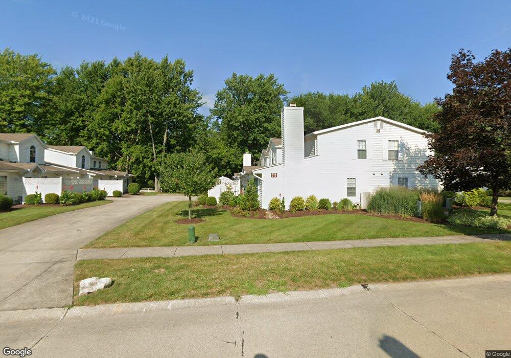
This home is located at 708 S Point Trail Unit D14, Berea, OH 44017 and is currently estimated at $246,263, approximately $158 per square foot. 708 S Point Trail Unit D14 is a home located in Cuyahoga County with nearby schools including Grindstone Elementary School, Berea-Midpark Middle School, and Berea-Midpark High School.
Ownership History
Date
Name
Owned For
Owner Type
Purchase Details
Closed on
Apr 14, 2004
Sold by
Miller Philip J
Bought by
Zwolinski Lisa M
Current Estimated Value
Home Financials for this Owner
Home Financials are based on the most recent Mortgage that was taken out on this home.
Original Mortgage
$124,100
Outstanding Balance
$55,718
Interest Rate
5.66%
Mortgage Type
Unknown
Estimated Equity
$190,545
Purchase Details
Closed on
Oct 23, 1998
Sold by
Vacca Christina V
Bought by
Miller Philip J and Miller Madge C
Home Financials for this Owner
Home Financials are based on the most recent Mortgage that was taken out on this home.
Original Mortgage
$30,000
Interest Rate
6.78%
Purchase Details
Closed on
Jan 1, 1993
Bought by
Vacca Christina
Create a Home Valuation Report for This Property
The Home Valuation Report is an in-depth analysis detailing your home's value as well as a comparison with similar homes in the area
Home Values in the Area
Average Home Value in this Area
Purchase History
We collect this data history from publicly available records. To have your information removed, we recommend requesting removal directly through your county’s website.
| Date | Buyer | Sale Price | Title Company |
|---|---|---|---|
| Zwolinski Lisa M | $146,000 | Maximum Title & Escrow | |
| Miller Philip J | $134,500 | City Title Company Agency In | |
| Vacca Christina | -- | -- |
Source: Public Records
Mortgage History
We collect this data history from publicly available records. To have your information removed, we recommend requesting removal directly through your county’s website.
| Date | Status | Borrower | Loan Amount |
|---|---|---|---|
| Open | Zwolinski Lisa M | $124,100 | |
| Previous Owner | Miller Philip J | $30,000 |
Source: Public Records
Tax History
| Year | Tax Paid | Tax Assessment Tax Assessment Total Assessment is a certain percentage of the fair market value that is determined by local assessors to be the total taxable value of land and additions on the property. | Land | Improvement |
|---|---|---|---|---|
| 2025 | $4,537 | $78,330 | $7,560 | $70,770 |
| 2024 | $4,526 | $78,330 | $7,560 | $70,770 |
| 2023 | $3,851 | $55,760 | $5,570 | $50,190 |
| 2022 | $3,827 | $55,760 | $5,570 | $50,190 |
| 2021 | $3,790 | $55,760 | $5,570 | $50,190 |
| 2020 | $3,393 | $44,240 | $4,410 | $39,830 |
| 2019 | $3,303 | $126,400 | $12,600 | $113,800 |
| 2018 | $3,030 | $44,240 | $4,410 | $39,830 |
| 2017 | $2,975 | $37,180 | $3,750 | $33,430 |
| 2016 | $2,953 | $37,180 | $3,750 | $33,430 |
| 2015 | $3,244 | $37,180 | $3,750 | $33,430 |
| 2014 | $3,244 | $43,230 | $4,340 | $38,890 |
Source: Public Records
Map
Nearby Homes
- 165 Dorland Ave
- 9207 Prospect Rd
- 8036 Fair Rd
- 8760 Priem Rd
- 9753 Prospect Rd
- 262 Stanmary Dr
- 11035 Steven David Dr
- 8345 Celianna Dr
- 80 Hamilton St
- 7679 S Eastland Rd
- 8902 Lincolnshire Blvd
- 21032 Breckenridge Ln
- 233 Baldwin Dr
- 7640 S Eastland Rd
- 9981 Woodhurst Dr
- 8407 Barton Dr
- 329 Baldwin Dr
- 10108 Fair Rd
- 723 Trotter Ln
- 50 S Rocky River Dr Unit 705
- 706 S Point Trail Unit D-16
- 710 S Point Trail Unit D15
- 712 S Point Trail Unit D13
- 706 S Point Trail
- 636 S Point Trail S
- 714 S Point Trail Unit C12
- 720 S Point Trail Unit C9
- 716 S Point Trail Unit C10
- 718 S Point Trail Unit C11
- 700 S Point Trail Unit 18E
- 704 S Point Trail Unit 17E
- 702 S Point Trail
- 698 S Point Trail
- 705 S Point Trail Unit B8
- 709 S Point Trail Unit B7
- 711 S Point Trail
- 707 S Point Trail
- 711 S Point Trail Unit B-5
- 713 S Point Trail Unit A4
- 715 S Point Trail Unit A2
Your Personal Tour Guide
Ask me questions while you tour the home.