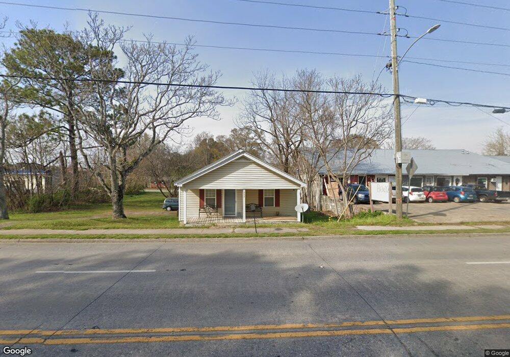
708 W Elm St Rockmart, GA 30153
Estimated Value: $127,000 - $157,000
2
Beds
1
Bath
924
Sq Ft
$158/Sq Ft
Est. Value
About This Home
This home is located at 708 W Elm St, Rockmart, GA 30153 and is currently estimated at $145,708, approximately $157 per square foot. 708 W Elm St is a home located in Polk County with nearby schools including Rockmart Middle School.
Ownership History
Date
Name
Owned For
Owner Type
Purchase Details
Closed on
Mar 11, 2011
Sold by
Thomasson Phillip
Bought by
White Carrie T
Current Estimated Value
Purchase Details
Closed on
Mar 21, 2005
Sold by
Williams Phillip
Bought by
Thomasson Phillip
Purchase Details
Closed on
Apr 24, 2000
Sold by
Thomasson Phillip
Bought by
Thomasson Phillip and Phillip William
Purchase Details
Closed on
Mar 5, 1980
Bought by
Garrett Garrett L and Garrett
Purchase Details
Closed on
Jan 1, 1901
Bought by
Upton W T Sr Mrs
Create a Home Valuation Report for This Property
The Home Valuation Report is an in-depth analysis detailing your home's value as well as a comparison with similar homes in the area
Home Values in the Area
Average Home Value in this Area
Purchase History
| Date | Buyer | Sale Price | Title Company |
|---|---|---|---|
| White Carrie T | $41,553 | -- | |
| Thomasson Phillip | -- | -- | |
| Thomasson Phillip | -- | -- | |
| Thomasson Phillip | $12,200 | -- | |
| Garrett Garrett L | -- | -- | |
| Upton W T Sr Mrs | -- | -- |
Source: Public Records
Mortgage History
| Date | Status | Borrower | Loan Amount |
|---|---|---|---|
| Open | White Carrie T | $43,122 |
Source: Public Records
Tax History Compared to Growth
Tax History
| Year | Tax Paid | Tax Assessment Tax Assessment Total Assessment is a certain percentage of the fair market value that is determined by local assessors to be the total taxable value of land and additions on the property. | Land | Improvement |
|---|---|---|---|---|
| 2024 | $1,111 | $39,006 | $10,000 | $29,006 |
| 2023 | $623 | $19,450 | $1,400 | $18,050 |
| 2022 | $335 | $14,100 | $1,400 | $12,700 |
| 2021 | $339 | $14,100 | $1,400 | $12,700 |
| 2020 | $340 | $14,100 | $1,400 | $12,700 |
| 2019 | $417 | $15,526 | $1,342 | $14,184 |
| 2018 | $415 | $15,070 | $1,342 | $13,728 |
| 2017 | $410 | $15,070 | $1,342 | $13,728 |
| 2016 | $410 | $15,070 | $1,342 | $13,728 |
| 2015 | $419 | $15,334 | $1,342 | $13,992 |
| 2014 | $386 | $14,041 | $1,130 | $12,911 |
Source: Public Records
Map
Nearby Homes
- 132 Highland Dr
- 750 W Church St
- 300 Church St
- 1 Pine Mountain Rd
- 00 Nathan Dean Pkwy
- 2979 Nathan Dean Pkwy
- 103 Ivy St
- 571 N Marble St
- 0 Nathan Dean Pkwy Unit 10366146
- 119 Pearl St
- 540 N Marble St
- 235 Mountain Way
- 0 Pine Mountain St Unit 10620510
- 0 Pine Mountain St Unit 10620492
- 0 Highway 278 Nathan Dean Bypass Unit 10134156
- 278 Oak Hill Dr
- 2470 Nathan Dean Pkwy
- 197 Oak Hill Dr
- 825 Wilson St
- 705 Mundy St
- 701 Mundy St
- 702 Mundy St
- 614 W Elm St
- 102 Williamson St
- 704 Mundy St
- 0 Mundy St Unit 8293429
- 0 Mundy St Unit 8237742
- 0 Mundy St Unit 7161981
- 0 Mundy St
- 61 Williamson St
- 70 Williamson St
- 103 Gordon St Unit 1,2
- 103 Gordon St
- 45 Williamson St
- 110 Williamson St
- 64 Williamson St
- 117 Gordon St
- 604 W Elm St
- 52 Williamson St