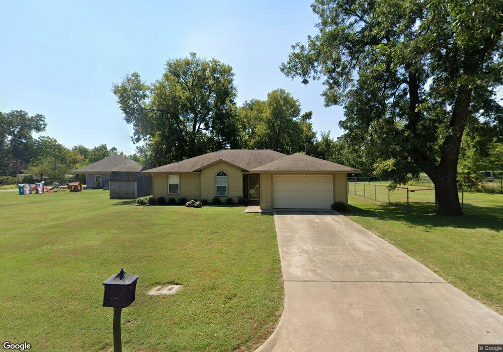
708 W Shepherd St Denison, TX 75020
Estimated Value: $189,000 - $207,109
3
Beds
2
Baths
1,201
Sq Ft
$165/Sq Ft
Est. Value
About This Home
This home is located at 708 W Shepherd St, Denison, TX 75020 and is currently estimated at $198,055, approximately $164 per square foot. 708 W Shepherd St is a home located in Grayson County with nearby schools including Houston Elementary School, Scott Middle School, and Denison High School.
Ownership History
Date
Name
Owned For
Owner Type
Purchase Details
Closed on
Jan 9, 2009
Sold by
Rumsey Robert
Bought by
Casteel Cecil Jack
Current Estimated Value
Home Financials for this Owner
Home Financials are based on the most recent Mortgage that was taken out on this home.
Original Mortgage
$80,550
Outstanding Balance
$53,075
Interest Rate
5.99%
Mortgage Type
Purchase Money Mortgage
Estimated Equity
$144,980
Purchase Details
Closed on
Sep 21, 2006
Sold by
Rumsey Robert
Bought by
City Of Denison
Home Financials for this Owner
Home Financials are based on the most recent Mortgage that was taken out on this home.
Original Mortgage
$70,350
Interest Rate
6.51%
Mortgage Type
Purchase Money Mortgage
Purchase Details
Closed on
Sep 1, 2006
Sold by
City Of Denison
Bought by
Rumsey Robert
Home Financials for this Owner
Home Financials are based on the most recent Mortgage that was taken out on this home.
Original Mortgage
$70,350
Interest Rate
6.51%
Mortgage Type
Purchase Money Mortgage
Purchase Details
Closed on
Jan 5, 2005
Sold by
Mitchell Amy and Mitchell Johnny
Bought by
Grayson County
Create a Home Valuation Report for This Property
The Home Valuation Report is an in-depth analysis detailing your home's value as well as a comparison with similar homes in the area
Home Values in the Area
Average Home Value in this Area
Purchase History
| Date | Buyer | Sale Price | Title Company |
|---|---|---|---|
| Casteel Cecil Jack | -- | Grayson County Title | |
| City Of Denison | -- | Grayson County Title | |
| Rumsey Robert | -- | Grayson County Title | |
| Grayson County | -- | -- |
Source: Public Records
Mortgage History
| Date | Status | Borrower | Loan Amount |
|---|---|---|---|
| Open | Casteel Cecil Jack | $80,550 | |
| Previous Owner | Rumsey Robert | $70,350 |
Source: Public Records
Tax History Compared to Growth
Tax History
| Year | Tax Paid | Tax Assessment Tax Assessment Total Assessment is a certain percentage of the fair market value that is determined by local assessors to be the total taxable value of land and additions on the property. | Land | Improvement |
|---|---|---|---|---|
| 2025 | $399 | $181,201 | -- | -- |
| 2024 | $3,827 | $164,728 | $0 | $0 |
| 2023 | $399 | $149,753 | $0 | $0 |
| 2022 | $3,235 | $136,139 | $0 | $0 |
| 2021 | $3,121 | $123,763 | $23,940 | $99,823 |
| 2020 | $3,071 | $126,798 | $17,640 | $109,158 |
| 2019 | $2,913 | $123,479 | $11,970 | $111,509 |
| 2018 | $2,669 | $102,342 | $10,185 | $92,157 |
| 2017 | $2,447 | $93,573 | $4,200 | $89,373 |
| 2016 | $2,225 | $79,524 | $3,780 | $75,744 |
| 2015 | $1,010 | $92,021 | $4,620 | $87,401 |
| 2014 | $1,160 | $86,139 | $4,620 | $81,519 |
Source: Public Records
Map
Nearby Homes
- 702 S Barrett Ave
- 621 W Munson St
- 511 W Munson St
- 701 W Hull St Unit 101-2
- 830 W Shepherd St
- 704 W Hull St
- 430 W Munson St
- 904 W Shepherd St
- 901 W Munson St
- 408 W Day St
- 615 W Texas St
- 919 W Day St
- 1011 S Armstrong Ave
- 513 W Texas St
- 708 W Texas St
- 326 W Day St
- TBD W Texas St
- 1401 W Texas St
- 0000 W Texas St
- 609 W Owing St
- 712 W Shepherd St
- 709 S Barrett Ave
- 701 W Shepherd St
- 709 W Day St
- 705 W Day St
- 715 W Day St
- 701 W Day St
- 717 W Day St
- 713 W Shepherd St
- 631 S Barrett Ave
- 721 W Day St
- 715 W Shepherd St
- 700 W Day St
- 727 W Day St
- 631 W Day St
- 712 S Armstrong Ave
- 625 W Day St
- 730 S Armstrong Ave
- 623 W Day St
- 800 W Shepherd St