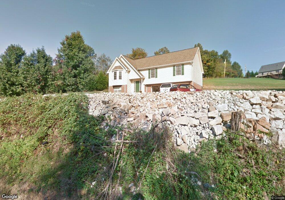
7083 State Route 243 South Point, OH 45680
Estimated Value: $185,000 - $250,000
3
Beds
2
Baths
1,333
Sq Ft
$159/Sq Ft
Est. Value
About This Home
This home is located at 7083 State Route 243, South Point, OH 45680 and is currently estimated at $211,341, approximately $158 per square foot. 7083 State Route 243 is a home located in Lawrence County with nearby schools including Dawson-Bryant Elementary School, Dawson-Bryant Middle School, and Dawson-Bryant High School.
Ownership History
Date
Name
Owned For
Owner Type
Purchase Details
Closed on
Feb 21, 2017
Sold by
Massie Ryan E and Massie Robin D
Bought by
King Stephen Emmett
Current Estimated Value
Home Financials for this Owner
Home Financials are based on the most recent Mortgage that was taken out on this home.
Original Mortgage
$163,000
Outstanding Balance
$134,654
Interest Rate
4.12%
Mortgage Type
VA
Estimated Equity
$76,687
Purchase Details
Closed on
Sep 20, 2013
Sold by
Gibson Robert J and Gibson Heather R
Bought by
Massie Ryan E and Massie Robin D
Home Financials for this Owner
Home Financials are based on the most recent Mortgage that was taken out on this home.
Original Mortgage
$148,500
Interest Rate
3.2%
Mortgage Type
Adjustable Rate Mortgage/ARM
Purchase Details
Closed on
May 22, 2003
Bought by
Gibson Robert J and Gibson Heatherr
Create a Home Valuation Report for This Property
The Home Valuation Report is an in-depth analysis detailing your home's value as well as a comparison with similar homes in the area
Home Values in the Area
Average Home Value in this Area
Purchase History
| Date | Buyer | Sale Price | Title Company |
|---|---|---|---|
| King Stephen Emmett | $163,000 | None Available | |
| Massie Ryan E | $165,000 | None Available | |
| Gibson Robert J | $120,000 | -- |
Source: Public Records
Mortgage History
| Date | Status | Borrower | Loan Amount |
|---|---|---|---|
| Open | King Stephen Emmett | $163,000 | |
| Previous Owner | Massie Ryan E | $148,500 |
Source: Public Records
Tax History Compared to Growth
Tax History
| Year | Tax Paid | Tax Assessment Tax Assessment Total Assessment is a certain percentage of the fair market value that is determined by local assessors to be the total taxable value of land and additions on the property. | Land | Improvement |
|---|---|---|---|---|
| 2024 | -- | $49,280 | $1,890 | $47,390 |
| 2023 | $1,394 | $49,280 | $1,890 | $47,390 |
| 2022 | $1,391 | $49,280 | $1,890 | $47,390 |
| 2021 | $1,220 | $42,450 | $1,790 | $40,660 |
| 2020 | $1,235 | $42,450 | $1,790 | $40,660 |
| 2019 | $1,230 | $42,450 | $1,790 | $40,660 |
| 2018 | $1,221 | $41,630 | $1,760 | $39,870 |
| 2017 | $1,218 | $41,630 | $1,760 | $39,870 |
| 2016 | $1,127 | $41,630 | $1,760 | $39,870 |
| 2015 | $969 | $34,390 | $1,760 | $32,630 |
| 2014 | $957 | $34,390 | $1,760 | $32,630 |
| 2013 | $955 | $34,390 | $1,760 | $32,630 |
Source: Public Records
Map
Nearby Homes
- 6881 State Route 243
- 1122 Township Road 266
- 1122 Township Road 266
- 9040 Ohio 243
- 4404 County Road 15
- 1225 County Road 15
- 48 Private Drive 1179
- 119 County Road 15
- 719 County Road 15
- 66 Township Road 1523
- 25 Township Road 1524
- 66 County Road 30
- 3569 County Road 6
- 3493 County Road 31
- 0 County Road 1
- 859 County Road 53
- 885 County Road 53
- 3171 County Road 31
- 571 County Road 52
- 6757 County Road 15
- 7075 State Route 243 Unit JO-23
- 7075 State Route 243
- 7145 State Route 243
- 7145 State Rt 243
- 7145 Ohio 243
- 86 Township Road 117
- 7174 State Route 243
- 7163 State Route 243
- 7196 State Route 243
- 7196 Ohio 243
- 128 Top St Unit 353
- 128 Top St Unit 353
- 128 Top St Unit 353
- 128 Top St Unit 117
- 128 Top St Unit 1020
- 7201 State Route 243
- 7210 State Route 243
- 7239 State Route 243
- 6928 State Route 243
- 84 Co Rd 17 Point S