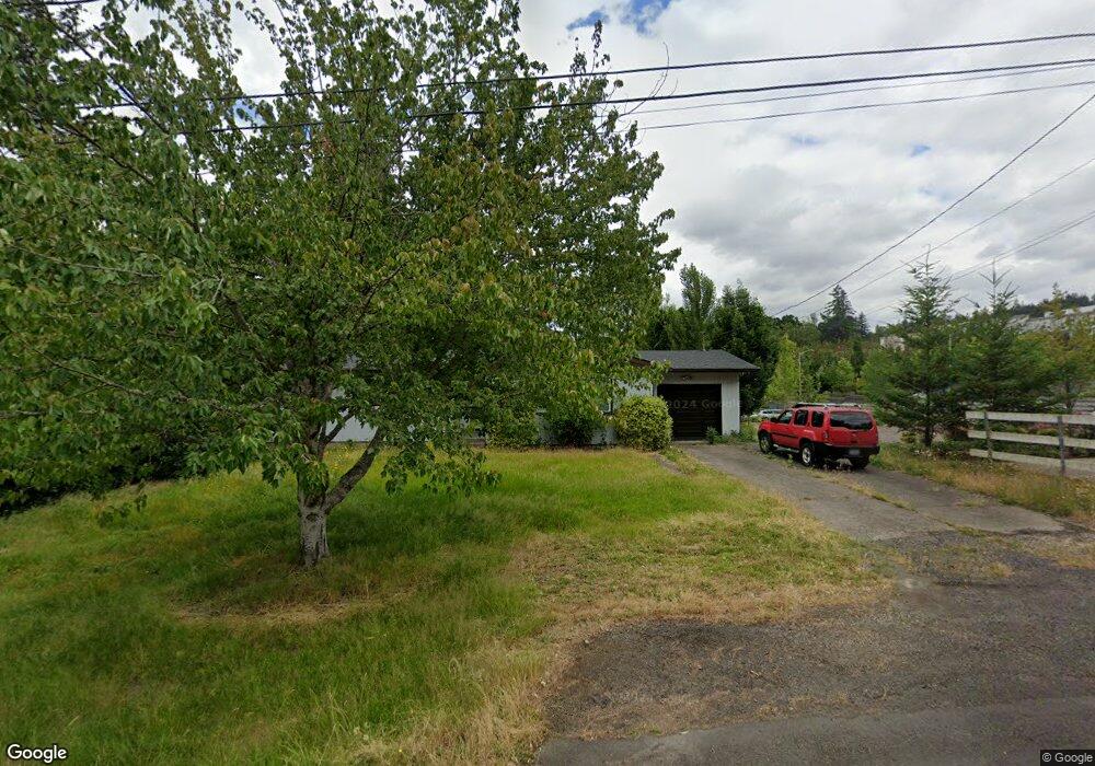
7085 SW Elmhurst St Portland, OR 97223
Tigard Triangle NeighborhoodEstimated Value: $546,000 - $627,103
3
Beds
2
Baths
1,372
Sq Ft
$429/Sq Ft
Est. Value
About This Home
This home is located at 7085 SW Elmhurst St, Portland, OR 97223 and is currently estimated at $588,368, approximately $428 per square foot. 7085 SW Elmhurst St is a home located in Washington County with nearby schools including Durham Elementary School, Thomas R. Fowler Middle School, and Tigard High School.
Ownership History
Date
Name
Owned For
Owner Type
Purchase Details
Closed on
Feb 10, 2020
Sold by
Pooya Llc
Bought by
Nadri Kazem Ken
Current Estimated Value
Purchase Details
Closed on
Apr 11, 2014
Sold by
Salarie Marzie
Bought by
Pooya Llc
Purchase Details
Closed on
Nov 14, 2011
Sold by
U S Bank National Association
Bought by
Salarie Marzie
Purchase Details
Closed on
Jun 17, 2011
Sold by
Scott John D and Scott Debora K
Bought by
U S Bank National Association
Create a Home Valuation Report for This Property
The Home Valuation Report is an in-depth analysis detailing your home's value as well as a comparison with similar homes in the area
Home Values in the Area
Average Home Value in this Area
Purchase History
| Date | Buyer | Sale Price | Title Company |
|---|---|---|---|
| Nadri Kazem Ken | -- | None Available | |
| Pooya Llc | -- | None Available | |
| Salarie Marzie | $192,199 | Accommodation | |
| U S Bank National Association | $245,000 | None Available |
Source: Public Records
Tax History Compared to Growth
Tax History
| Year | Tax Paid | Tax Assessment Tax Assessment Total Assessment is a certain percentage of the fair market value that is determined by local assessors to be the total taxable value of land and additions on the property. | Land | Improvement |
|---|---|---|---|---|
| 2026 | $4,611 | $278,540 | -- | -- |
| 2025 | $4,611 | $270,430 | -- | -- |
| 2024 | $4,487 | $262,560 | -- | -- |
| 2023 | $4,487 | $254,920 | $0 | $0 |
| 2022 | $4,358 | $254,920 | $0 | $0 |
| 2021 | $4,249 | $240,300 | $0 | $0 |
| 2020 | $4,121 | $233,310 | $0 | $0 |
| 2019 | $3,943 | $226,520 | $0 | $0 |
| 2018 | $3,783 | $219,930 | $0 | $0 |
| 2017 | $3,647 | $213,530 | $0 | $0 |
| 2016 | $3,482 | $207,320 | $0 | $0 |
| 2015 | $3,347 | $201,290 | $0 | $0 |
| 2014 | $3,248 | $195,430 | $0 | $0 |
Source: Public Records
Map
Nearby Homes
- 13541 SW 63rd Place
- 13002 Sierra Vista Dr
- 11047 SW Legacy Oak Way
- 5845 Ridgetop Ct
- 10910 SW 74th Ave
- 10900 SW 76th Place Unit 43
- 10900 SW 76th Place Unit 46
- 6111 SW Lesser Way
- 12449 SW 55th Place
- 11744 SW 61st Ave
- 7333 SW Pine St
- 8026 SW Pine St
- 11215 SW Hall Blvd
- 10534 SW 80th Ave
- 56 Galen St
- 11185 SW Hall Blvd
- 11110 SW 64th Ave
- 11790 SW 90th Ave
- 86 SW Kingsgate Unit 22
- 10200 SW 70th Ave
- 7105 SW Elmhurst St
- 7070 SW Elmhurst St
- 7100 SW Elmhurst St
- 7040 SW Elmhurst St Unit 1
- 7040 SW Elmhurst St
- 12120 SW 72nd Ave Unit 1
- 12120 SW 72nd Ave
- 12260 SW 72nd Ave
- 12280 SW 72nd Ave
- 12215 SW 72nd Ave
- 12320 SW 72nd Ave
- 12235 SW 72nd Ave
- 12190 SW 69th Ave
- 12170 SW 69th Ave
- 12335 SW 72nd Ave
- 11990 SW 72nd Ave Unit 2
- 11990 SW 72nd Ave
- 11990 SW 72 Av Sale Fail Unit 2
- 6900 SW Dartmouth St
- 11974 SW 72nd Ave