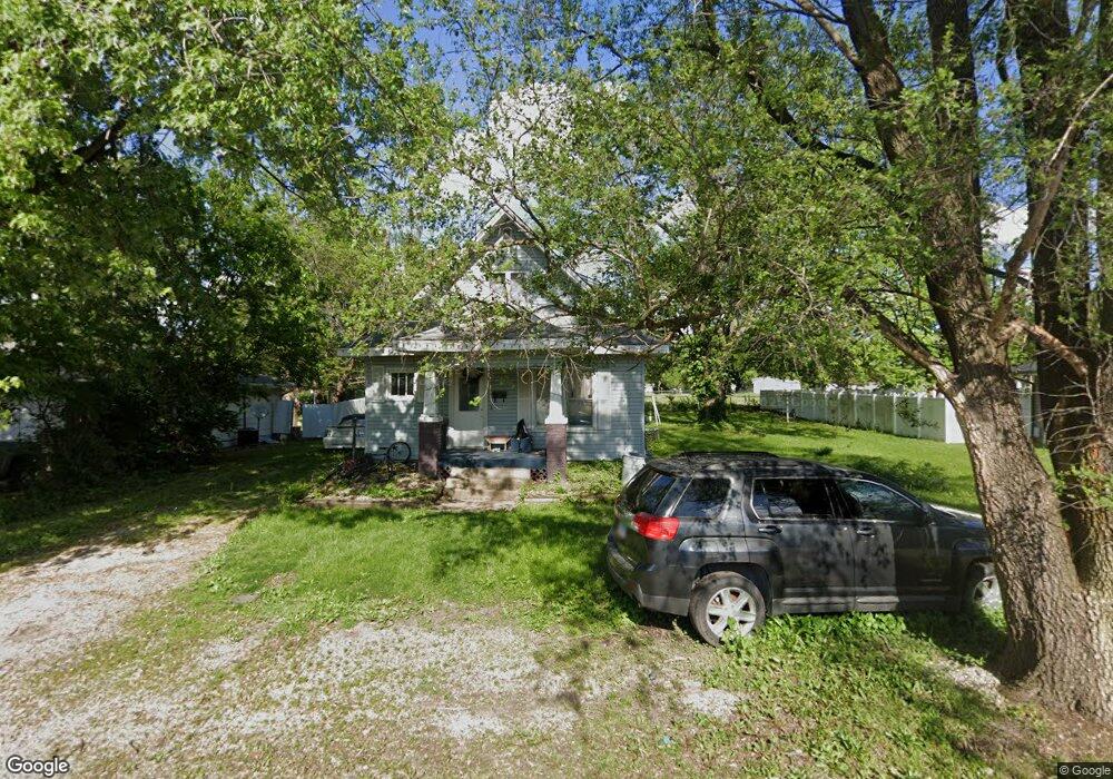
709 20th St Charleston, IL 61920
Estimated Value: $14,000 - $94,990
4
Beds
2
Baths
1,420
Sq Ft
$49/Sq Ft
Est. Value
About This Home
This home is located at 709 20th St, Charleston, IL 61920 and is currently estimated at $69,498, approximately $48 per square foot. 709 20th St is a home located in Coles County with nearby schools including Charleston High School and Charleston Christian Academy.
Ownership History
Date
Name
Owned For
Owner Type
Purchase Details
Closed on
Oct 16, 2025
Sold by
Leland R Grimes R and Leland Carol I
Bought by
Reyno Pu Juan Carlos
Current Estimated Value
Purchase Details
Closed on
Sep 15, 2015
Sold by
Grimes Leland R and Grimes Carol I
Bought by
Grimes Trust
Purchase Details
Closed on
Oct 18, 2011
Sold by
Pearcy Thomas M and Estate Of Richard E Pearcy
Bought by
Fuqua Charles William and Grimes Leland
Home Financials for this Owner
Home Financials are based on the most recent Mortgage that was taken out on this home.
Original Mortgage
$35,000
Interest Rate
5%
Mortgage Type
Purchase Money Mortgage
Create a Home Valuation Report for This Property
The Home Valuation Report is an in-depth analysis detailing your home's value as well as a comparison with similar homes in the area
Home Values in the Area
Average Home Value in this Area
Purchase History
| Date | Buyer | Sale Price | Title Company |
|---|---|---|---|
| Reyno Pu Juan Carlos | $15,000 | None Listed On Document | |
| Grimes Trust | -- | -- | |
| Fuqua Charles William | $25,500 | None Available |
Source: Public Records
Mortgage History
| Date | Status | Borrower | Loan Amount |
|---|---|---|---|
| Previous Owner | Fuqua Charles William | $35,000 |
Source: Public Records
Tax History
| Year | Tax Paid | Tax Assessment Tax Assessment Total Assessment is a certain percentage of the fair market value that is determined by local assessors to be the total taxable value of land and additions on the property. | Land | Improvement |
|---|---|---|---|---|
| 2024 | $1,816 | $23,396 | $4,220 | $19,176 |
| 2023 | $1,792 | $21,366 | $3,854 | $17,512 |
| 2022 | $1,792 | $21,013 | $3,790 | $17,223 |
| 2021 | $1,845 | $20,166 | $3,637 | $16,529 |
| 2020 | $2,297 | $25,553 | $5,302 | $20,251 |
| 2019 | $2,259 | $24,662 | $5,117 | $19,545 |
| 2018 | $2,235 | $24,662 | $5,117 | $19,545 |
| 2017 | $1,669 | $24,662 | $5,117 | $19,545 |
| 2016 | $1,162 | $24,102 | $5,117 | $18,985 |
| 2015 | $1,291 | $24,102 | $5,117 | $18,985 |
| 2014 | $1,291 | $24,102 | $5,117 | $18,985 |
| 2013 | $1,291 | $24,102 | $5,117 | $18,985 |
Source: Public Records
Map
Nearby Homes
- 1520 Harrison Ave
- 824 Hawthorne Dr
- Lot 55 Tippecanoe Ave
- 1422 Madison Ave
- 1404 Madison Ave
- Lot 35 Tanglewood Dr
- Lot 28 Tanglewood Dr
- 1201 Monroe Ave
- Lot 67 Hawthorne Dr
- Lot 65 Hawthorne Dr
- Lot 60 Hawthorne Dr
- Lot 52 Hawthorne Dr
- Lot 47 Hawthorne Dr
- Lot 43 Hawthorne Dr
- Lot 63 Hawthorne Dr
- Lot 59 Hawthorne Dr
- Lot 49 Hawthorne Dr
- Lot 45 Hawthorne Dr
- 1021 Jefferson Ave
- 109 N 12th St
- 707 20th St
- 711 20th St
- 1952 Van Buren Ave
- 2008 Van Buren Ave
- 2003 Van Buren Ave
- 2005 Van Buren Ave
- 710 20th St
- 713 20th St
- 1901 Van Buren Ave
- 2011 Van Buren Ave
- 714 20th St
- 715 20th St
- 2014 Van Buren Ave
- 805 19th St
- 716 20th St
- 819 19th St
- 2029 Van Buren Ave
- 631 19th St
- 2023 Van Buren Ave
- 717 20th St
Your Personal Tour Guide
Ask me questions while you tour the home.