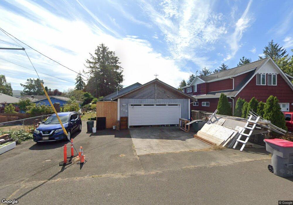
709 25th Ave Seaside, OR 97138
Estimated Value: $367,000 - $434,000
3
Beds
1
Bath
1,232
Sq Ft
$327/Sq Ft
Est. Value
About This Home
This home is located at 709 25th Ave, Seaside, OR 97138 and is currently estimated at $402,636, approximately $326 per square foot. 709 25th Ave is a home located in Clatsop County with nearby schools including Seaside High School.
Ownership History
Date
Name
Owned For
Owner Type
Purchase Details
Closed on
Jan 8, 2018
Sold by
Schafer Logan S
Bought by
Keane Kevin O and Keane Naemilyn O
Current Estimated Value
Purchase Details
Closed on
Jan 4, 2012
Sold by
Schafer Kim J
Bought by
Schafer Lynn B
Purchase Details
Closed on
Aug 29, 2011
Sold by
Schafer Kim J
Bought by
Schafer Kim J and Schafer Family Trust
Purchase Details
Closed on
Jun 1, 2010
Sold by
Hsbc Bank Usa N A
Bought by
Schafer Earle W
Home Financials for this Owner
Home Financials are based on the most recent Mortgage that was taken out on this home.
Original Mortgage
$120,000
Interest Rate
4.79%
Mortgage Type
New Conventional
Purchase Details
Closed on
Oct 20, 2009
Sold by
Donovan Steve L and Donovan Cindy L
Bought by
Hsbc Bank Usa Na
Create a Home Valuation Report for This Property
The Home Valuation Report is an in-depth analysis detailing your home's value as well as a comparison with similar homes in the area
Home Values in the Area
Average Home Value in this Area
Purchase History
| Date | Buyer | Sale Price | Title Company |
|---|---|---|---|
| Keane Kevin O | $131,137 | Pacific Coast Title | |
| Schafer Lynn B | -- | None Available | |
| Schafer Kim J | -- | None Available | |
| Schafer Earle W | $150,000 | Multiple | |
| Hsbc Bank Usa Na | $177,931 | Fidelity |
Source: Public Records
Mortgage History
| Date | Status | Borrower | Loan Amount |
|---|---|---|---|
| Previous Owner | Schafer Earle W | $120,000 |
Source: Public Records
Tax History Compared to Growth
Tax History
| Year | Tax Paid | Tax Assessment Tax Assessment Total Assessment is a certain percentage of the fair market value that is determined by local assessors to be the total taxable value of land and additions on the property. | Land | Improvement |
|---|---|---|---|---|
| 2025 | $2,678 | $186,370 | -- | -- |
| 2024 | $2,599 | $180,943 | -- | -- |
| 2023 | $2,523 | $175,674 | $0 | $0 |
| 2022 | $2,454 | $170,558 | $0 | $0 |
| 2021 | $2,402 | $165,591 | $0 | $0 |
| 2020 | $2,346 | $160,769 | $0 | $0 |
| 2019 | $2,282 | $156,087 | $0 | $0 |
| 2018 | $2,191 | $151,542 | $0 | $0 |
| 2017 | $2,091 | $147,130 | $0 | $0 |
| 2016 | $1,839 | $142,846 | $46,859 | $95,987 |
| 2015 | $1,775 | $138,687 | $45,495 | $93,192 |
| 2014 | $1,786 | $134,648 | $0 | $0 |
| 2013 | -- | $130,727 | $0 | $0 |
Source: Public Records
Map
Nearby Homes
- 802 25th Ave
- 000 Neawanna St
- 2624 Neawanna St
- 2657 N Hwy 101 Unit 6
- 782 Woodland Ct
- 790 17th Ave
- 0 Wellington Ave Unit 25-48
- 0 Wellington Ave Unit 1202
- 1265 D St
- 1350 13th Ave
- 0 Vacant Land Unit 159249124
- 820 12th Ave
- 196 Dylan Ct
- 337 16th Ave
- 310 15th Ave
- 717 12th Ave
- 3389 U S 101
- 3387-3389 U S 101
- 210 15th Ave
- 739 11th Ave
- 2481 Neawanna St
- 2501 Neawanna St
- 0 Neawanna St Unit 23490319
- 0 Neawanna St Unit 22334480
- 0 Neawanna St Unit 21482935
- 0 Neawanna St Unit 778180
- LOT Neawanna St
- 0 Neawanna St Unit 11209643
- 0 Neawanna St Unit 10020572
- 0 Neawanna St Unit 9023614
- 0 Neawanna St Unit 9013764
- 0 Neawanna St Unit 596732
- 0 Neawanna St Unit 596735
- 0 Neawanna St Unit 9069755
- 0 Neawanna St Unit 9069754
- 0 Neawanna St Unit 11640190
- 0 Neawanna St Unit 7 13604230
- 0 Neawanna St Unit 6 13128935
- 0 Neawanna St Unit 7
- 0 Neawanna St Unit 6