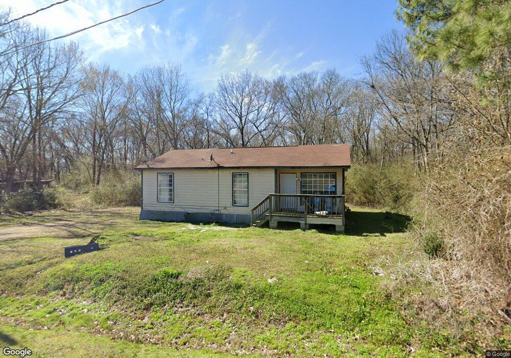
709 Bemis St Prescott, AR 71857
Estimated Value: $38,000 - $51,000
Studio
--
Bath
984
Sq Ft
$45/Sq Ft
Est. Value
About This Home
This home is located at 709 Bemis St, Prescott, AR 71857 and is currently estimated at $44,360, approximately $45 per square foot. 709 Bemis St is a home with nearby schools including Prescott Elementary School, Prescott Junior High School, and Prescott High School.
Ownership History
Date
Name
Owned For
Owner Type
Purchase Details
Closed on
Apr 1, 2021
Bought by
Esa Homes Inc
Current Estimated Value
Purchase Details
Closed on
Nov 30, 2011
Bought by
Jones Jean K Trustee Of The and Jean K Jones Family Trust
Purchase Details
Closed on
Dec 2, 2004
Bought by
Rooney Kirmet and Rooney Yolanda
Purchase Details
Closed on
Nov 18, 2004
Bought by
Rooney Kirmet
Purchase Details
Closed on
Nov 8, 2004
Bought by
Rooney Kirmet
Purchase Details
Closed on
Feb 17, 2004
Bought by
Hackbarth Wesley Wayne
Purchase Details
Closed on
Jun 22, 2000
Bought by
State
Purchase Details
Closed on
Feb 19, 1998
Bought by
Rooney Kirmet
Create a Home Valuation Report for This Property
The Home Valuation Report is an in-depth analysis detailing your home's value as well as a comparison with similar homes in the area
Home Values in the Area
Average Home Value in this Area
Purchase History
| Date | Buyer | Sale Price | Title Company |
|---|---|---|---|
| Esa Homes Inc | $376,000 | -- | |
| Jones Jean K Trustee Of The | -- | -- | |
| Rooney Kirmet | -- | -- | |
| Rooney Kirmet | -- | -- | |
| Rooney Kirmet | -- | -- | |
| State | -- | -- | |
| Hackbarth Wesley Wayne | -- | -- | |
| State | -- | -- | |
| Rooney Kirmet | -- | -- |
Source: Public Records
Tax History
| Year | Tax Paid | Tax Assessment Tax Assessment Total Assessment is a certain percentage of the fair market value that is determined by local assessors to be the total taxable value of land and additions on the property. | Land | Improvement |
|---|---|---|---|---|
| 2025 | $237 | $5,830 | $550 | $5,280 |
| 2023 | $198 | $3,640 | $890 | $2,750 |
| 2022 | $198 | $3,640 | $890 | $2,750 |
| 2021 | $198 | $3,640 | $890 | $2,750 |
| 2020 | $198 | $3,640 | $890 | $2,750 |
| 2019 | $176 | $3,470 | $470 | $3,000 |
| 2018 | $168 | $3,470 | $470 | $3,000 |
| 2017 | $168 | $3,470 | $470 | $3,000 |
| 2016 | $168 | $3,470 | $470 | $3,000 |
| 2015 | $168 | $3,470 | $470 | $3,000 |
| 2014 | $168 | $3,470 | $470 | $3,000 |
| 2013 | $163 | $3,360 | $460 | $2,900 |
Source: Public Records
Map
Nearby Homes
- 349 W Walnut St
- 516 E 2nd St S
- 527 E 2nd St S
- 519 E 4th St S
- 338 W 2nd St N
- 224 E 5th St S
- 0 3rd St
- 326 Rosston Rd
- 713 E Pine St
- 762 Ash St
- 718 Oak St
- 828 E Main St
- 116 Ridgewood Rd
- 0 Little Missosur River Unit 25050038
- 1208 Cale Rd
- 1210 Cale Rd
- 1306 Nevada 261
- 2361 Arkansas 19
- 228 Nevada 66 W
- 00 Nevada County 23 Rd
- 703 Bemis St
- 721 Moncrief St
- 723 Moncrief St
- 731 Moncrief St
- 735 Moncrief St
- 714 Moncrief St
- 745 Moncrief St
- 520 W Olive St
- 512 W Olive St
- 806 Moncrief St
- 438 W Olive St
- 624 W Olive St
- 511 W Olive St
- 451 W Vine St
- 435 W Vine St
- 503 W Olive St
- 609 W Olive St
- 443 W Vine St
- 814 Moncrief St
- 821 Moncrief St
Your Personal Tour Guide
Ask me questions while you tour the home.