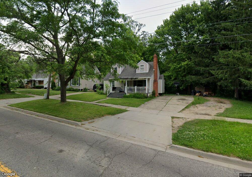
709 Bradley Ave Flint, MI 48503
Glendale NeighborhoodEstimated Value: $82,073 - $122,000
3
Beds
1
Bath
1,003
Sq Ft
$95/Sq Ft
Est. Value
About This Home
This home is located at 709 Bradley Ave, Flint, MI 48503 and is currently estimated at $95,268, approximately $94 per square foot. 709 Bradley Ave is a home located in Genesee County with nearby schools including Durant-Tuuri-Mott Elementary School, St. Paul Lutheran School, and St John Vianney Catholic School.
Ownership History
Date
Name
Owned For
Owner Type
Purchase Details
Closed on
Jul 11, 2024
Sold by
Fisher Clarence H
Bought by
Fisher Daniel J
Current Estimated Value
Purchase Details
Closed on
Sep 3, 2003
Sold by
Wells Fargo Bank Minnesota Na
Bought by
Fisher C Herbert and Fisher Carlene
Purchase Details
Closed on
Mar 27, 2002
Sold by
Donnelly Kelly Ann and Donnelly Patrick
Bought by
Wells Fargo Bank Minnesota Na and Option One Mtg Loan Trust 2001-C Asset B
Purchase Details
Closed on
Jan 10, 2001
Sold by
A Donnelly K
Bought by
Life Bank
Purchase Details
Closed on
Apr 20, 2000
Sold by
Donnelly T Donnelly P and Donnelly K A
Bought by
Donnelly Kelly Ann
Purchase Details
Closed on
Apr 18, 2000
Sold by
Secore Rosalie
Bought by
Donnelly Patrick T and Donnelly Kelly A
Create a Home Valuation Report for This Property
The Home Valuation Report is an in-depth analysis detailing your home's value as well as a comparison with similar homes in the area
Home Values in the Area
Average Home Value in this Area
Purchase History
| Date | Buyer | Sale Price | Title Company |
|---|---|---|---|
| Fisher Daniel J | -- | None Listed On Document | |
| Fisher C Herbert | $48,000 | -- | |
| Wells Fargo Bank Minnesota Na | $66,207 | -- | |
| Life Bank | $52,668 | -- | |
| Donnelly Kelly Ann | -- | Sargents Title Company | |
| Donnelly Patrick T | $43,000 | Sargents Title Company |
Source: Public Records
Tax History
| Year | Tax Paid | Tax Assessment Tax Assessment Total Assessment is a certain percentage of the fair market value that is determined by local assessors to be the total taxable value of land and additions on the property. | Land | Improvement |
|---|---|---|---|---|
| 2025 | $1,038 | $41,300 | $0 | $0 |
| 2024 | $964 | $36,600 | $0 | $0 |
| 2023 | $944 | $33,500 | $0 | $0 |
| 2022 | $0 | $27,000 | $0 | $0 |
| 2021 | $956 | $27,100 | $0 | $0 |
| 2020 | $882 | $22,700 | $0 | $0 |
| 2019 | $864 | $17,200 | $0 | $0 |
| 2018 | $848 | $17,100 | $0 | $0 |
| 2017 | $827 | $0 | $0 | $0 |
| 2016 | $827 | $0 | $0 | $0 |
| 2015 | -- | $0 | $0 | $0 |
| 2014 | -- | $0 | $0 | $0 |
| 2012 | -- | $12,100 | $0 | $0 |
Source: Public Records
Map
Nearby Homes
- 612 Bradley Ave
- 932 Bradley Ave
- 911 Hughes Ave
- 3320 Pencombe Place
- 3318 Norwood Dr
- 915 Stocker Ave
- 2464 Gibson St
- 2437 Zimmerman St
- 3302 Van Buren Ave
- 3018 Fielding St
- 3617 Sherwood Dr
- 2509 Corunna Rd
- 960 Mann Ave
- 2410 Corunna Rd
- 0000 Beecher Rd
- 825 Frank St
- 2621 Swayze St
- 2310 Gibson St
- 1017 Stocker Ave
- 2618 Brown St
- 705 Bradley Ave
- 801 Bradley Ave
- 701 Bradley Ave
- 621 Bradley Ave
- 807 Bradley Ave
- 2702 Mansfield Ave
- 2707 Coventry Ct
- 617 Bradley Ave
- 811 Bradley Ave
- 2701 Mansfield Ave
- 2715 Coventry Ct
- 613 Bradley Ave
- 2714 Mansfield Ave
- 2709 Mansfield Ave
- 2721 Coventry Ct
- 609 Bradley Ave
- 2714 Coventry Ct
- 2718 Mansfield Ave
- 2713 Mansfield Ave
- 2718 Coventry Ct
Your Personal Tour Guide
Ask me questions while you tour the home.