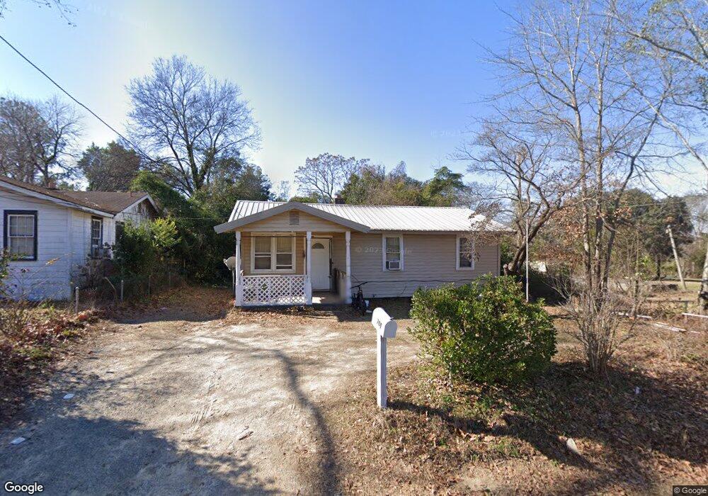
709 Bush St West Columbia, SC 29169
Estimated Value: $60,000 - $124,000
3
Beds
1
Bath
877
Sq Ft
$107/Sq Ft
Est. Value
About This Home
This home is located at 709 Bush St, West Columbia, SC 29169 and is currently estimated at $93,947, approximately $107 per square foot. 709 Bush St is a home located in Lexington County with nearby schools including Riverbank Elementary, Northside Middle, and Brookland-Cayce High School.
Ownership History
Date
Name
Owned For
Owner Type
Purchase Details
Closed on
Feb 28, 2020
Sold by
Gossett Jewell M and Rivera Jewell G
Bought by
Noochpoung Rakchanok
Current Estimated Value
Purchase Details
Closed on
Sep 28, 2007
Sold by
Oswald Melburn L and Oswald Mildred L
Bought by
Gossett Jewell M
Home Financials for this Owner
Home Financials are based on the most recent Mortgage that was taken out on this home.
Original Mortgage
$47,405
Interest Rate
6.57%
Mortgage Type
Purchase Money Mortgage
Create a Home Valuation Report for This Property
The Home Valuation Report is an in-depth analysis detailing your home's value as well as a comparison with similar homes in the area
Home Values in the Area
Average Home Value in this Area
Purchase History
| Date | Buyer | Sale Price | Title Company |
|---|---|---|---|
| Noochpoung Rakchanok | $38,000 | None Available | |
| Gossett Jewell M | $49,900 | None Available |
Source: Public Records
Mortgage History
| Date | Status | Borrower | Loan Amount |
|---|---|---|---|
| Previous Owner | Gossett Jewell M | $47,405 |
Source: Public Records
Tax History Compared to Growth
Tax History
| Year | Tax Paid | Tax Assessment Tax Assessment Total Assessment is a certain percentage of the fair market value that is determined by local assessors to be the total taxable value of land and additions on the property. | Land | Improvement |
|---|---|---|---|---|
| 2024 | $846 | $2,280 | $600 | $1,680 |
| 2023 | $787 | $2,280 | $600 | $1,680 |
| 2022 | $769 | $2,280 | $600 | $1,680 |
| 2020 | $769 | $2,480 | $563 | $1,917 |
| 2019 | $214 | $1,438 | $240 | $1,198 |
| 2018 | $210 | $1,438 | $240 | $1,198 |
| 2017 | $202 | $1,438 | $240 | $1,198 |
| 2016 | $208 | $1,437 | $240 | $1,197 |
| 2014 | $158 | $1,596 | $240 | $1,356 |
| 2013 | -- | $1,600 | $240 | $1,360 |
Source: Public Records
Map
Nearby Homes
- 1513 Gambrell St
- 617 Holland Cir
- 165 Cavendish Dr
- 1615 Holland St
- 1715 Gilvie Ave
- 106 Earl Ct
- 1344 Gilmore St
- 929-931 Central Dr
- 638 Carrington Dr
- 100 Double Branch Ct
- 2004 Dew Ave
- 108 Double Branch Ct
- 324 N Parson St
- 1100 Seminole Dr
- 623 Hook Ave
- 1235 Jensen St
- 0 Platt Springs Rd Unit 606355
- 529 Finnegan Ln
- 816 Fontanna Ave
- 207 Woodhaven Dr
- 707 Bush St
- 705 Bush St
- 716 China St
- 714 China St
- 712 China St
- 1644 Double Branch Rd
- 1640 Double Branch Rd
- 1624 Double Branch Rd
- 1624B Double Branch Rd
- 1646 Double Branch Rd
- 1654 Double Branch Rd
- 717 China St
- 29169 S Wesley Alford Rd Rd
- 729 China St
- 715 China St
- 719 China St
- 709 China St
- 741 China St
- 1651 Double Branch Rd
- 1639 Double Branch Rd