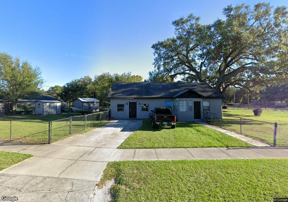
709 Chestnut Rd Auburndale, FL 33823
Estimated Value: $204,000 - $243,656
2
Beds
1
Bath
1,395
Sq Ft
$163/Sq Ft
Est. Value
About This Home
This home is located at 709 Chestnut Rd, Auburndale, FL 33823 and is currently estimated at $227,414, approximately $163 per square foot. 709 Chestnut Rd is a home located in Polk County with nearby schools including Auburndale Central Elementary School, Auburndale Senior High School, and Jewett School of the Arts.
Ownership History
Date
Name
Owned For
Owner Type
Purchase Details
Closed on
Dec 6, 2022
Sold by
Vaught Gary M
Bought by
Zealley Tyler D and Zealley Kira C
Current Estimated Value
Purchase Details
Closed on
May 10, 2014
Sold by
Vaught Elizabeth B and Schramm Lawrence W
Bought by
Vaught Gary M
Purchase Details
Closed on
Mar 19, 2014
Sold by
Lundy Larry C
Bought by
Vaught Elizabeth B
Purchase Details
Closed on
Feb 23, 2007
Sold by
Vaught Elizabeth B
Bought by
Lundy Larry C
Home Financials for this Owner
Home Financials are based on the most recent Mortgage that was taken out on this home.
Original Mortgage
$110,000
Interest Rate
4.5%
Mortgage Type
Seller Take Back
Create a Home Valuation Report for This Property
The Home Valuation Report is an in-depth analysis detailing your home's value as well as a comparison with similar homes in the area
Home Values in the Area
Average Home Value in this Area
Purchase History
| Date | Buyer | Sale Price | Title Company |
|---|---|---|---|
| Zealley Tyler D | $100 | -- | |
| Vaught Gary M | $47,000 | None Available | |
| Vaught Elizabeth B | $47,200 | None Available | |
| Lundy Larry C | -- | None Available | |
| Lundy Larry C | $110,000 | None Available |
Source: Public Records
Mortgage History
| Date | Status | Borrower | Loan Amount |
|---|---|---|---|
| Previous Owner | Lundy Larry C | $110,000 |
Source: Public Records
Tax History Compared to Growth
Tax History
| Year | Tax Paid | Tax Assessment Tax Assessment Total Assessment is a certain percentage of the fair market value that is determined by local assessors to be the total taxable value of land and additions on the property. | Land | Improvement |
|---|---|---|---|---|
| 2025 | $2,604 | $194,555 | $28,569 | $165,986 |
| 2024 | $2,536 | $200,953 | -- | -- |
| 2023 | $2,536 | $195,100 | $27,327 | $167,773 |
| 2022 | $871 | $93,945 | $0 | $0 |
| 2021 | $856 | $91,209 | $0 | $0 |
| 2020 | $842 | $89,950 | $0 | $0 |
| 2018 | $808 | $86,289 | $0 | $0 |
| 2017 | $780 | $84,514 | $0 | $0 |
| 2016 | $1,083 | $59,282 | $0 | $0 |
| 2015 | $999 | $53,893 | $0 | $0 |
| 2014 | $1,167 | $64,990 | $0 | $0 |
Source: Public Records
Map
Nearby Homes
- 714 Great Barford St
- 155 Pearl St
- 721 Pilaklakaha Ave
- 132 Mckean St Unit A,B
- 605 Alberta Ave
- 125 Nelson St
- 227 Mckean St
- 116 Palm Ave
- 2230 Lake Ariana Blvd
- 117 Noxon St
- 1311 U S 92 Unit 117
- 1311 U S 92 Unit 42
- 1311 U S 92 Unit 107
- 1311 U S 92 Unit 119
- 1311 U S 92 Unit 36
- 1311 U S 92 Unit 80
- 1311 U S 92 Unit 129
- 1311 U S 92 Unit 115
- 1311 U S 92 Unit 28
- 1311 U S 92 Unit 34
- 102 Ramsgate Rd
- 114 Pearl St
- 710 Chestnut Rd
- 120 Pearl St
- 708 Chestnut Rd
- 112 Pearl St
- 712 Chestnut Rd
- 110 Pearl St
- 700 Elizabeth Ln
- 712 Elizabeth Ln
- 126 Pearl St
- 125 Pearl St
- 715 Great Barford St
- 123 Pearl St
- 127 Pearl St
- 713 Great Barford St
- 108 Pearl St
- 711 Great Barford St
- 117 Pearl St
- 709 Great Barford St