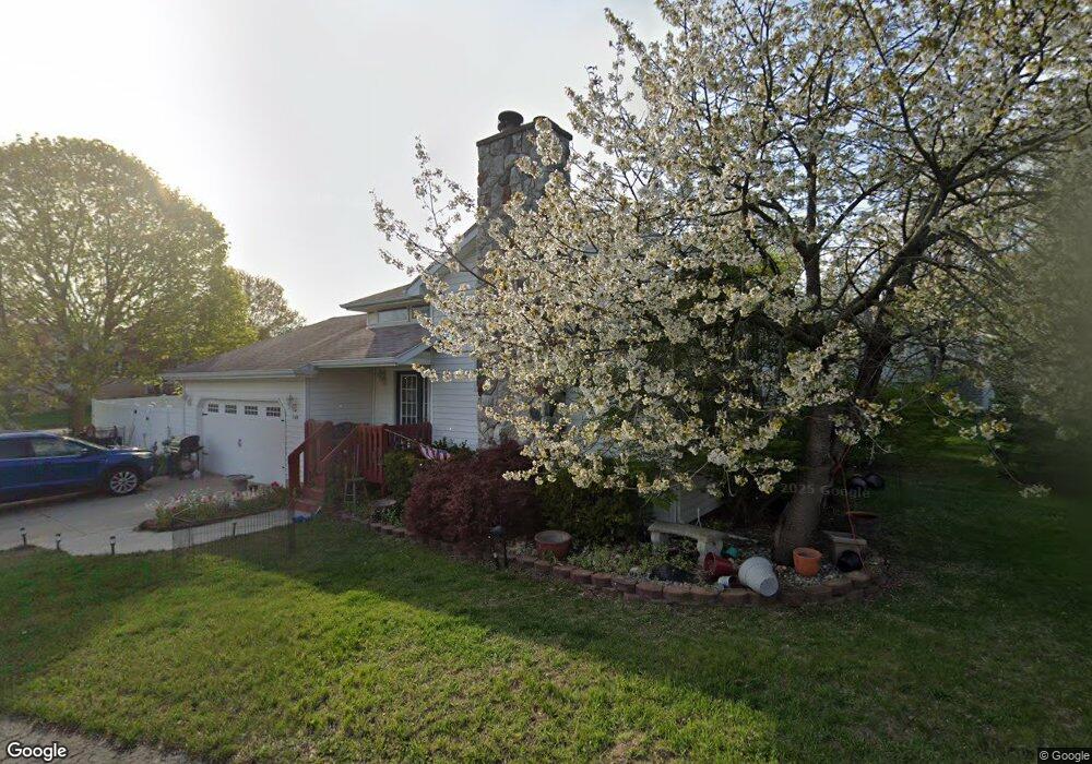
709 Illinois Ct Tecumseh, MI 49286
Estimated Value: $316,062 - $358,000
5
Beds
3
Baths
2,222
Sq Ft
$153/Sq Ft
Est. Value
About This Home
This home is located at 709 Illinois Ct, Tecumseh, MI 49286 and is currently estimated at $339,021, approximately $152 per square foot. 709 Illinois Ct is a home located in Lenawee County with nearby schools including Tecumseh Middle School, Herrick Park Intermediate Learning Center, and Tecumseh High School.
Ownership History
Date
Name
Owned For
Owner Type
Purchase Details
Closed on
Oct 14, 2009
Sold by
Trott and Trott P C
Bought by
Foster Laurie A
Current Estimated Value
Home Financials for this Owner
Home Financials are based on the most recent Mortgage that was taken out on this home.
Original Mortgage
$101,700
Outstanding Balance
$66,375
Interest Rate
5.07%
Mortgage Type
New Conventional
Estimated Equity
$272,646
Purchase Details
Closed on
Oct 30, 2008
Sold by
Martin Kay Lyn
Bought by
Federal National Mortgage Association
Purchase Details
Closed on
Jul 19, 2006
Sold by
Bertram Sherrie L and Hammond Jan
Bought by
Martin Kay Lynn
Home Financials for this Owner
Home Financials are based on the most recent Mortgage that was taken out on this home.
Original Mortgage
$164,900
Interest Rate
6.82%
Mortgage Type
New Conventional
Create a Home Valuation Report for This Property
The Home Valuation Report is an in-depth analysis detailing your home's value as well as a comparison with similar homes in the area
Home Values in the Area
Average Home Value in this Area
Purchase History
| Date | Buyer | Sale Price | Title Company |
|---|---|---|---|
| Foster Laurie A | $113,000 | Warranty Title Agency Llc | |
| Federal National Mortgage Association | $181,162 | None Available | |
| Martin Kay Lynn | $164,900 | Atcl |
Source: Public Records
Mortgage History
| Date | Status | Borrower | Loan Amount |
|---|---|---|---|
| Open | Foster Laurie A | $101,700 | |
| Previous Owner | Martin Kay Lynn | $164,900 |
Source: Public Records
Tax History Compared to Growth
Tax History
| Year | Tax Paid | Tax Assessment Tax Assessment Total Assessment is a certain percentage of the fair market value that is determined by local assessors to be the total taxable value of land and additions on the property. | Land | Improvement |
|---|---|---|---|---|
| 2025 | $3,219 | $129,600 | $0 | $0 |
| 2024 | $2,724 | $121,300 | $0 | $0 |
| 2023 | $3,166 | $109,000 | $0 | $0 |
| 2022 | $3,046 | $89,700 | $0 | $0 |
| 2021 | $3,230 | $86,400 | $0 | $0 |
| 2020 | $3,200 | $84,000 | $0 | $0 |
| 2019 | $3,145 | $80,400 | $11,500 | $68,900 |
| 2017 | $2,970 | $74,600 | $11,500 | $63,100 |
| 2016 | $2,964 | $70,900 | $10,500 | $60,400 |
| 2014 | $2,835 | $64,200 | $10,200 | $54,000 |
Source: Public Records
Map
Nearby Homes
- 395 Burt St
- 607 Shadow Brooke Ln
- 600 Center Dr
- 8917 Hawthorne Dr
- Parcel B Fieldstone Dr
- 6 Wheatland Dr
- 726 Red Mill Point
- 724 Red Mill Point
- 728 Red Mill Point
- 723 Red Mill Point
- 732 Red Mill Point
- 736 Eagle View Way
- 730 Red Mill Point
- 740 Eagle View Way
- 742 Eagle View Way
- 766 Eagle View Point
- 744 Eagle View Way
- 748 Eagle View Way
- 752 Eagle View Way
- 756 Eagle View Way
- 0 Clark Unit 56000919260
- 0 Clark Unit 56000920008
- 0 Clark Unit Bldg 11, Unit 50
- 0 Clark Unit 921242
- 0 Clark Unit 921041
- 0 Clark Unit Bldg 10, Unit 45
- 0 Clark Unit 921721
- 0 Clark Unit 921703
- 0 Clark Unit 921774
- 0 Clark Unit 921601
- 0 Clark Unit Bldg 10, Unit 47
- 0 Clark Unit Bldg 10, Unit 48
- 0 Clark Unit Bldg 10, Unit 46
- 0 Clark Unit Bldg 11, Unit 51
- 0 Clark Unit Bldg 12, Unit 54
- 0 Clark Unit 922125
- 0 Clark Unit 921648
- 0 Clark Unit Bldg 11, Unit 52
- 0 Clark Unit 920008
- 0 Clark Unit 919260