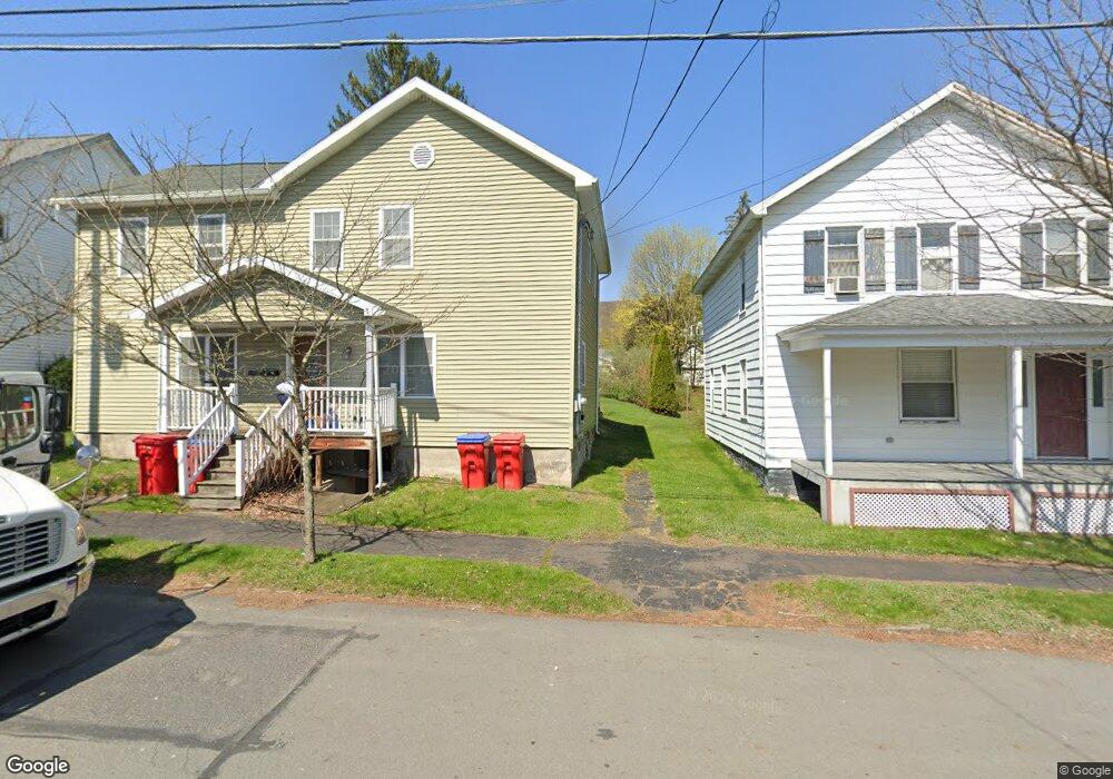
709 Jefferson Ave Unit 711 Jermyn, PA 18433
Estimated Value: $91,000 - $232,000
--
Bed
--
Bath
2,461
Sq Ft
$58/Sq Ft
Est. Value
About This Home
This home is located at 709 Jefferson Ave Unit 711, Jermyn, PA 18433 and is currently estimated at $142,308, approximately $57 per square foot. 709 Jefferson Ave Unit 711 is a home located in Lackawanna County with nearby schools including Lakeland Junior/Senior High School.
Ownership History
Date
Name
Owned For
Owner Type
Purchase Details
Closed on
Apr 11, 2011
Sold by
Rogan Michael
Bought by
The Honesdale National Bank
Current Estimated Value
Purchase Details
Closed on
Jul 9, 2008
Sold by
Zaleski Theresa
Bought by
Rogan Michael
Home Financials for this Owner
Home Financials are based on the most recent Mortgage that was taken out on this home.
Original Mortgage
$67,500
Interest Rate
6.35%
Mortgage Type
Commercial
Purchase Details
Closed on
Jan 12, 2007
Sold by
Terpak Michael
Bought by
Terpak Robert M
Create a Home Valuation Report for This Property
The Home Valuation Report is an in-depth analysis detailing your home's value as well as a comparison with similar homes in the area
Home Values in the Area
Average Home Value in this Area
Purchase History
| Date | Buyer | Sale Price | Title Company |
|---|---|---|---|
| The Honesdale National Bank | $2,451 | None Available | |
| Rogan Michael | $49,900 | None Available | |
| Terpak Robert M | -- | None Available |
Source: Public Records
Mortgage History
| Date | Status | Borrower | Loan Amount |
|---|---|---|---|
| Previous Owner | Rogan Michael | $67,500 |
Source: Public Records
Tax History Compared to Growth
Tax History
| Year | Tax Paid | Tax Assessment Tax Assessment Total Assessment is a certain percentage of the fair market value that is determined by local assessors to be the total taxable value of land and additions on the property. | Land | Improvement |
|---|---|---|---|---|
| 2025 | $2,866 | $7,800 | $0 | $7,800 |
| 2024 | $1,694 | $7,800 | $0 | $7,800 |
| 2023 | $1,694 | $7,800 | $0 | $7,800 |
| 2022 | $1,653 | $7,800 | $0 | $7,800 |
| 2021 | $1,653 | $7,800 | $0 | $7,800 |
| 2020 | $1,646 | $7,800 | $0 | $7,800 |
| 2019 | $1,568 | $7,800 | $0 | $7,800 |
| 2018 | $1,553 | $7,800 | $0 | $7,800 |
| 2017 | $1,553 | $7,800 | $0 | $7,800 |
| 2016 | $878 | $7,800 | $0 | $0 |
| 2015 | -- | $7,800 | $0 | $0 |
| 2014 | -- | $7,800 | $0 | $0 |
Source: Public Records
Map
Nearby Homes
- 603 Lincoln Ave
- 0 Bacon St
- 440 Washington Ave
- 441 Madison Ave
- 0 Scranton Carbondale Hwy
- 0 Chestnut St
- 118-120 Madison Ave
- 322 Shadow Wood Cir Unit U13
- 192 Shadow Wood Cir
- 333 Shadow Wood Cir
- 369 Upper Powderly St
- 15 Lower Powderly St
- 233 Shadow Wood Cir
- 880 Scranton - Carbondale
- 815 Oak St
- 590 N Main St
- 820 Oak St
- 115 Gordon Ave
- 426 Wildcat (Rt 247) Rd
- 723 Chestnut St
- 709-711 Jefferson Ave
- 713 Jefferson Ave
- 705 Jefferson Ave
- 711 Jefferson Ave
- 715 Jefferson Ave
- 701 Jefferson Ave
- 314 Rushbrook St
- 707 Jefferson Ave
- 719 Jefferson Ave
- 320 Rushbrook St
- 712 Lincoln Ave
- 710 Lincoln Ave
- 226 Rushbrook St
- 702 Lincoln Ave
- 303 Rushbrook St
- 313 Rushbrook St
- 315-317 Rushbrook St
- 708 Jefferson Ave Unit 710
- 0 Jefferson Ave Unit GSB008067
- 0 Jefferson Ave Unit GSB01447