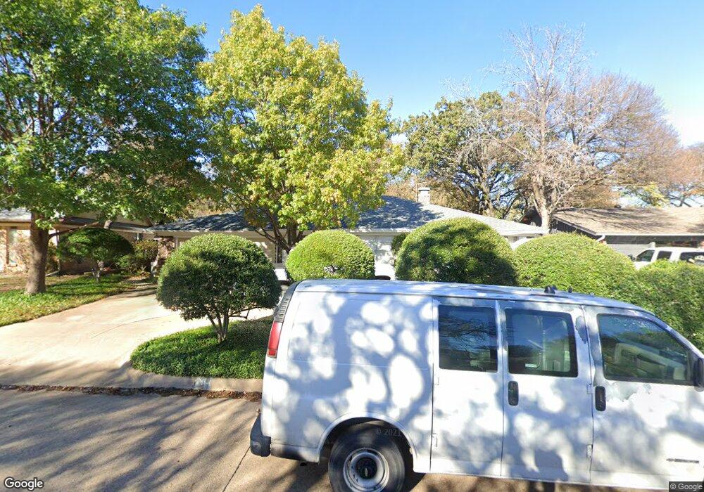
709 Kentwood Cir Bedford, TX 76021
Estimated Value: $343,000 - $363,000
3
Beds
2
Baths
1,785
Sq Ft
$196/Sq Ft
Est. Value
About This Home
This home is located at 709 Kentwood Cir, Bedford, TX 76021 and is currently estimated at $350,346, approximately $196 per square foot. 709 Kentwood Cir is a home located in Tarrant County with nearby schools including Shady Brook Elementary School, Bedford Junior High School, and L.D. Bell High School.
Ownership History
Date
Name
Owned For
Owner Type
Purchase Details
Closed on
Aug 24, 2016
Sold by
Nunn Laverne
Bought by
Diaz Ignacio and Meraz Silvestra
Current Estimated Value
Purchase Details
Closed on
May 12, 2010
Sold by
Nunn Laverne
Bought by
Nunn Laverne and The Laverne Nunn Family Trust
Purchase Details
Closed on
May 13, 2008
Sold by
Nunn Laverne
Bought by
Nunn Laverne and Nunn Ethel L
Purchase Details
Closed on
Aug 30, 1996
Sold by
Nunn Kay D and Nunn Laverne
Bought by
Nunn Kay D and Nunn Laverne
Create a Home Valuation Report for This Property
The Home Valuation Report is an in-depth analysis detailing your home's value as well as a comparison with similar homes in the area
Home Values in the Area
Average Home Value in this Area
Purchase History
| Date | Buyer | Sale Price | Title Company |
|---|---|---|---|
| Diaz Ignacio | -- | Attorney | |
| Nunn Laverne | -- | None Available | |
| Nunn Laverne | -- | None Available | |
| Nunn Kay D | -- | -- |
Source: Public Records
Tax History Compared to Growth
Tax History
| Year | Tax Paid | Tax Assessment Tax Assessment Total Assessment is a certain percentage of the fair market value that is determined by local assessors to be the total taxable value of land and additions on the property. | Land | Improvement |
|---|---|---|---|---|
| 2025 | $2,187 | $225,684 | $70,000 | $155,684 |
| 2024 | $2,287 | $225,684 | $70,000 | $155,684 |
| 2023 | $4,224 | $233,535 | $60,000 | $173,535 |
| 2022 | $4,373 | $200,213 | $60,000 | $140,213 |
| 2021 | $4,382 | $186,043 | $60,000 | $126,043 |
| 2020 | $4,924 | $207,092 | $60,000 | $147,092 |
| 2019 | $5,065 | $208,480 | $60,000 | $148,480 |
| 2018 | $3,654 | $202,176 | $60,000 | $142,176 |
| 2017 | $4,854 | $200,647 | $19,000 | $181,647 |
| 2016 | $3,119 | $160,524 | $19,000 | $141,524 |
| 2015 | $1,271 | $117,200 | $19,500 | $97,700 |
| 2014 | $1,271 | $117,200 | $19,500 | $97,700 |
Source: Public Records
Map
Nearby Homes
- 2116 Tamworth Ct
- 93 Regents Park
- 2420 Stonegate Dr N
- 140 Stonegate Ct
- 1740 Brown Trail
- 2436 Brookgreen Ct
- 258 Somerset Terrace
- 345 Somerset Cir
- 2225 Shady Brook Dr
- 817 Shady Lake Dr
- 1732 Jeannie Ln
- 124 Jeannie Ct
- 2317 Shady Grove Dr
- 49 Coffee Tavern Rd
- 121 Kay Ct
- 113 Sunnyvale Terrace
- 100 Hillview Ct
- 2501 Shady Grove Dr
- 18 Park Ln
- 432 Sunnybrook Ct
- 705 Kentwood Cir
- 713 Kentwood Cir
- 712 Saddlebrook Dr S
- 708 Saddlebrook Dr S
- 716 Saddlebrook Dr S
- 704 Kentwood Cir
- 701 Kentwood Cir
- 717 Kentwood Cir
- 700 Kentwood Cir
- 704 Saddlebrook Dr S
- 724 Kentwood Cir
- 721 Kentwood Cir
- 720 Saddlebrook Dr S
- 632 Kentwood Cir
- 633 Kentwood Cir
- 725 Kentwood Cir
- 705 Saddlebrook Dr S
- 713 Queens Ct
- 709 Queens Ct
- 724 Saddlebrook Dr S