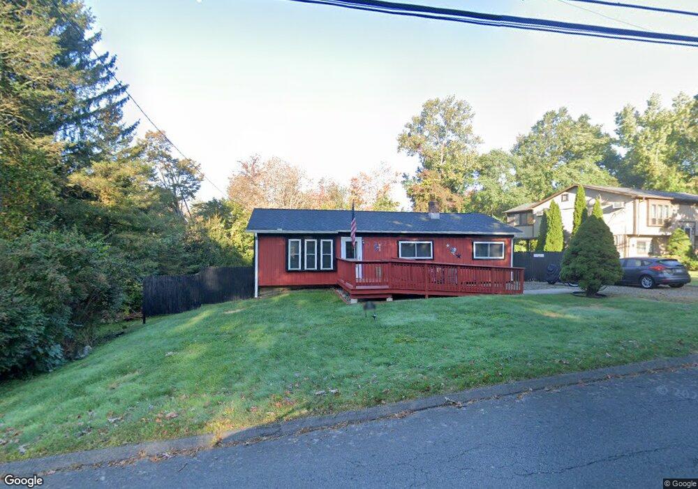
709 Maple Hill Rd Naugatuck, CT 06770
Estimated Value: $329,000 - $350,000
3
Beds
1
Bath
1,104
Sq Ft
$306/Sq Ft
Est. Value
About This Home
This home is located at 709 Maple Hill Rd, Naugatuck, CT 06770 and is currently estimated at $338,221, approximately $306 per square foot. 709 Maple Hill Rd is a home located in New Haven County with nearby schools including City Hill Middle School and Naugatuck High School.
Ownership History
Date
Name
Owned For
Owner Type
Purchase Details
Closed on
May 9, 1990
Sold by
Johanson Herbert
Bought by
Haney Robert
Current Estimated Value
Home Financials for this Owner
Home Financials are based on the most recent Mortgage that was taken out on this home.
Original Mortgage
$117,900
Interest Rate
10.15%
Mortgage Type
Purchase Money Mortgage
Create a Home Valuation Report for This Property
The Home Valuation Report is an in-depth analysis detailing your home's value as well as a comparison with similar homes in the area
Home Values in the Area
Average Home Value in this Area
Purchase History
| Date | Buyer | Sale Price | Title Company |
|---|---|---|---|
| Haney Robert | $128,000 | -- |
Source: Public Records
Mortgage History
| Date | Status | Borrower | Loan Amount |
|---|---|---|---|
| Closed | Haney Robert | $117,900 |
Source: Public Records
Tax History
| Year | Tax Paid | Tax Assessment Tax Assessment Total Assessment is a certain percentage of the fair market value that is determined by local assessors to be the total taxable value of land and additions on the property. | Land | Improvement |
|---|---|---|---|---|
| 2025 | $6,596 | $165,760 | $34,930 | $130,830 |
| 2024 | $6,927 | $165,760 | $34,930 | $130,830 |
| 2023 | $7,418 | $165,760 | $34,930 | $130,830 |
| 2022 | $5,264 | $110,240 | $37,100 | $73,140 |
| 2021 | $5,264 | $110,240 | $37,100 | $73,140 |
| 2020 | $5,264 | $110,240 | $37,100 | $73,140 |
| 2019 | $5,209 | $110,240 | $37,100 | $73,140 |
| 2018 | $5,166 | $106,850 | $47,450 | $59,400 |
| 2017 | $5,188 | $106,850 | $47,450 | $59,400 |
| 2016 | $5,094 | $106,850 | $47,450 | $59,400 |
| 2015 | $4,869 | $106,850 | $47,450 | $59,400 |
| 2014 | $4,815 | $106,850 | $47,450 | $59,400 |
| 2012 | $5,050 | $150,510 | $56,610 | $93,900 |
Source: Public Records
Map
Nearby Homes
- 463 Mulberry St
- 825 Maple Hill Rd
- 56 Morning Mist Rd
- 39 Fawn Meadow Dr
- 73 Warm Earth Rd
- 57 Warm Earth Rd
- 43 Warm Earth Rd
- 31 Warm Earth Rd
- 21 Longwood Dr
- 36 Longview Terrace
- 110 Meadow Lark Rd
- 93 Tawny Thrush Rd
- 77 Meadow Lark Rd
- 26 Geraldine Dr
- 418 Horton Hill Rd
- 109 Red Robin Rd
- Lot #9 Morning Dove Rd Unit Lot 9
- Lot 9II Morning Dove Rd
- 46 Mulberry St
- 125 Salem Rd
- 701 Maple Hill Rd
- 721 Maple Hill Rd
- 35 Woodside Dr
- 733 Maple Hill Rd
- 704 Maple Hill Rd
- 714 Maple Hill Rd
- 700 Maple Hill Rd
- 41 Woodside Dr
- 692 Maple Hill Rd
- 726 Maple Hill Rd
- 31 Woodside Dr
- 21 Woodside Dr
- 738 Maple Hill Rd
- 741 Maple Hill Rd
- 47 Woodside Dr
- 684 Maple Hill Rd
- 11 Woodside Dr
- 33 Kent St
- 41 Kent St
- 25 Kent St
Your Personal Tour Guide
Ask me questions while you tour the home.