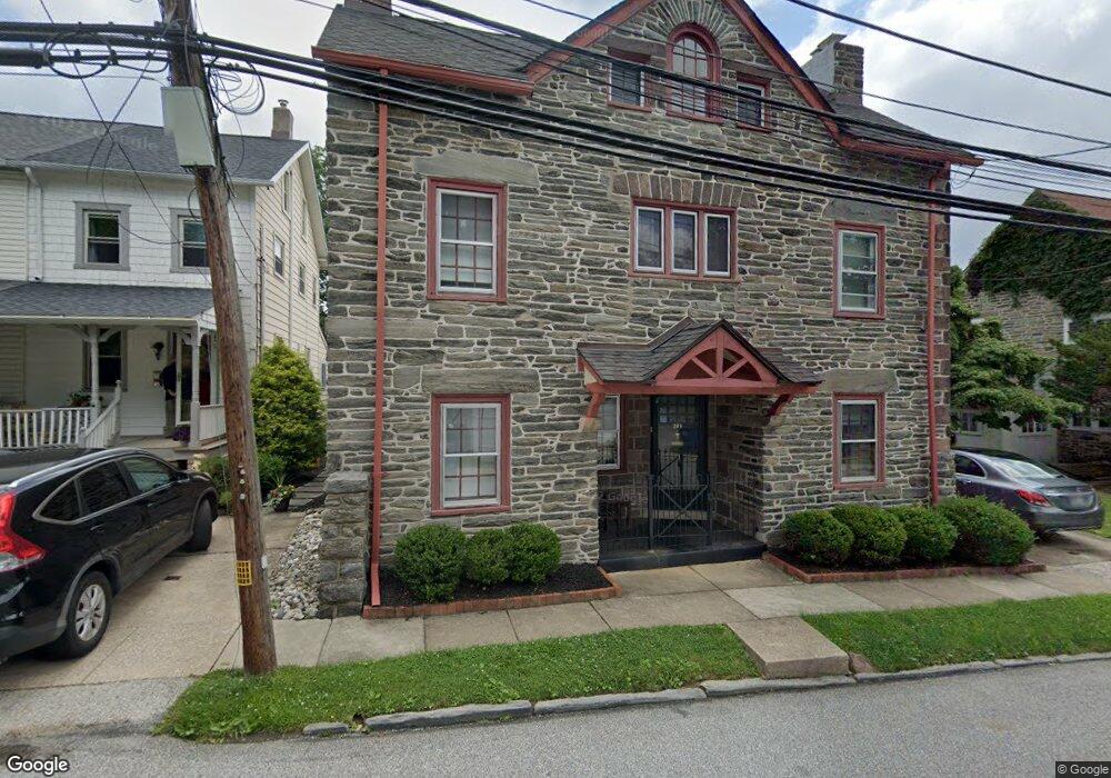
709 Moore Ave Bryn Mawr, PA 19010
Estimated Value: $530,000 - $581,000
4
Beds
3
Baths
1,762
Sq Ft
$310/Sq Ft
Est. Value
About This Home
This home is located at 709 Moore Ave, Bryn Mawr, PA 19010 and is currently estimated at $545,468, approximately $309 per square foot. 709 Moore Ave is a home located in Delaware County with nearby schools including Ithan Elementary School, Radnor Middle School, and Radnor Senior High School.
Ownership History
Date
Name
Owned For
Owner Type
Purchase Details
Closed on
Aug 21, 2006
Sold by
Dempsey Dennis J and Dempsey Elizabeth J
Bought by
Monroe Elizabeth Wentworth
Current Estimated Value
Home Financials for this Owner
Home Financials are based on the most recent Mortgage that was taken out on this home.
Original Mortgage
$268,000
Outstanding Balance
$161,514
Interest Rate
6.83%
Mortgage Type
New Conventional
Estimated Equity
$383,954
Purchase Details
Closed on
May 20, 2005
Sold by
Spiker Paul D and Spiker Suzanne Morin
Bought by
Dempsey Dennis J and Dempsey Elizabeth J
Home Financials for this Owner
Home Financials are based on the most recent Mortgage that was taken out on this home.
Original Mortgage
$262,000
Interest Rate
5.94%
Mortgage Type
Fannie Mae Freddie Mac
Create a Home Valuation Report for This Property
The Home Valuation Report is an in-depth analysis detailing your home's value as well as a comparison with similar homes in the area
Home Values in the Area
Average Home Value in this Area
Purchase History
| Date | Buyer | Sale Price | Title Company |
|---|---|---|---|
| Monroe Elizabeth Wentworth | $335,000 | None Available | |
| Dempsey Dennis J | $327,500 | Trident Land Transfer Co |
Source: Public Records
Mortgage History
| Date | Status | Borrower | Loan Amount |
|---|---|---|---|
| Open | Monroe Elizabeth Wentworth | $268,000 | |
| Previous Owner | Dempsey Dennis J | $262,000 |
Source: Public Records
Tax History Compared to Growth
Tax History
| Year | Tax Paid | Tax Assessment Tax Assessment Total Assessment is a certain percentage of the fair market value that is determined by local assessors to be the total taxable value of land and additions on the property. | Land | Improvement |
|---|---|---|---|---|
| 2025 | $7,312 | $361,640 | $73,060 | $288,580 |
| 2024 | $7,312 | $361,640 | $73,060 | $288,580 |
| 2023 | $7,022 | $361,640 | $73,060 | $288,580 |
| 2022 | $6,945 | $361,640 | $73,060 | $288,580 |
| 2021 | $11,156 | $361,640 | $73,060 | $288,580 |
| 2020 | $4,621 | $139,410 | $59,220 | $80,190 |
| 2019 | $4,713 | $139,410 | $59,220 | $80,190 |
| 2018 | $4,621 | $139,410 | $0 | $0 |
| 2017 | $2,991 | $139,410 | $0 | $0 |
| 2016 | $765 | $139,410 | $0 | $0 |
| 2015 | $765 | $139,410 | $0 | $0 |
| 2014 | $765 | $139,410 | $0 | $0 |
Source: Public Records
Map
Nearby Homes
- 145 Landover Rd
- 741 County Line Rd
- 173 Clemson Rd
- 258 Lee Cir
- 75 S Merion Ave
- 27 S Merion Ave
- 50 Prospect Ave
- 815 Penn St
- 28 S Warner Ave
- 732 Buck Ln
- 922 Montgomery Ave Unit B2
- 390 S Bryn Mawr Ave
- 601 Montgomery Ave Unit 204
- 1030 E Lancaster Ave Unit 216
- 1030 E Lancaster Ave Unit 923
- 530 New Gulph Rd
- 14 Westview Rd
- 215 Cornell Dr
- 53 Parkridge Dr
- 68 Garrett Ave
- 711 Moore Ave
- 713 Moore Ave
- 216 Landover Rd
- 216 Landover Rd Unit 2
- 218 Landover Rd Unit 2
- 218 Landover Rd
- 218 Landover Rd Unit 1
- 715 Moore Ave Unit B
- 715 Moore Ave Unit A
- 715 Moore Ave Unit B
- 715 Moore Ave Unit A
- 715 Moore Ave
- 230 Landover Rd
- 214 Landover Rd
- 717 Moore Ave
- 232 Landover Rd
- 710 Brook St
- 710 Moore Ave
- 714 Moore Ave
- 712 Brook St