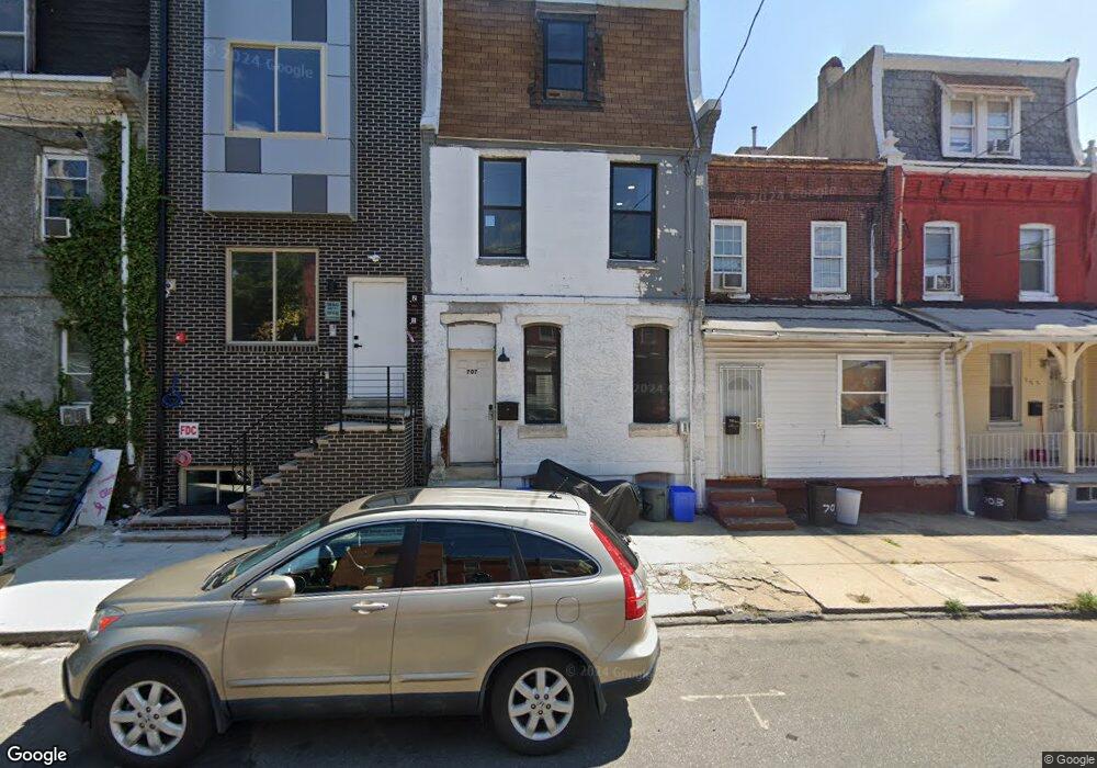
709 N 42nd St Philadelphia, PA 19104
Haverford North NeighborhoodEstimated Value: $63,000 - $229,000
--
Bed
--
Bath
2,700
Sq Ft
$51/Sq Ft
Est. Value
About This Home
This home is located at 709 N 42nd St, Philadelphia, PA 19104 and is currently estimated at $138,000, approximately $51 per square foot. 709 N 42nd St is a home with nearby schools including Martha Washington Academics Plus School, West Philadelphia High School, and Belmont Charter Elementary School.
Ownership History
Date
Name
Owned For
Owner Type
Purchase Details
Closed on
Jul 29, 2024
Sold by
North Broad Holdings Llc
Bought by
709 N 42Nd St Holdings Llc
Current Estimated Value
Purchase Details
Closed on
Sep 28, 2021
Sold by
Marzac Llc
Bought by
North Broad Holdings Llc
Purchase Details
Closed on
May 4, 2014
Sold by
Mcgriff Addie and First National Consumer Discou
Bought by
Marzac Llc
Purchase Details
Closed on
Oct 15, 1973
Bought by
Addie Mc Griff T and Addie F
Create a Home Valuation Report for This Property
The Home Valuation Report is an in-depth analysis detailing your home's value as well as a comparison with similar homes in the area
Home Values in the Area
Average Home Value in this Area
Purchase History
| Date | Buyer | Sale Price | Title Company |
|---|---|---|---|
| 709 N 42Nd St Holdings Llc | -- | None Listed On Document | |
| North Broad Holdings Llc | $45,000 | Global Abstract & Settlement | |
| Marzac Llc | $10,700 | None Available | |
| Addie Mc Griff T | -- | -- |
Source: Public Records
Tax History Compared to Growth
Tax History
| Year | Tax Paid | Tax Assessment Tax Assessment Total Assessment is a certain percentage of the fair market value that is determined by local assessors to be the total taxable value of land and additions on the property. | Land | Improvement |
|---|---|---|---|---|
| 2026 | $364 | $71,900 | $71,900 | -- |
| 2025 | $364 | $71,900 | $71,900 | -- |
| 2024 | $364 | $71,900 | $71,900 | -- |
| 2023 | $364 | $26,000 | $26,000 | $0 |
| 2022 | $280 | $26,000 | $26,000 | $0 |
| 2021 | $280 | $0 | $0 | $0 |
| 2020 | $280 | $0 | $0 | $0 |
| 2019 | $280 | $0 | $0 | $0 |
| 2018 | $280 | $0 | $0 | $0 |
| 2017 | $466 | $0 | $0 | $0 |
| 2016 | $111 | $0 | $0 | $0 |
| 2015 | $106 | $0 | $0 | $0 |
| 2014 | -- | $7,900 | $7,900 | $0 |
| 2012 | -- | $640 | $640 | $0 |
Source: Public Records
Map
Nearby Homes
- 4130 42 Aspen St
- 4207 Aspen St
- 638 Hutton St
- 627 Hutton St
- 619 Hutton St
- 636 Hutton St
- 629 N Hutton St
- 4234 Aspen St
- 617 N Hutton St
- 661 Brooklyn St
- 644 Brooklyn St
- 770 Brooklyn St
- 4220 Wallace St
- 1203 N 41st St
- 4207 Lancaster Ave
- 737 N 42nd St
- 1719 N 42nd St
- 731 N 42nd St
- 733 N 42nd St
- 724 N 42nd St
- 707 N 42nd St
- 711 N 42nd St
- 705 N 42nd St
- 703 N 42nd St
- 715 N 42nd St
- 701 N 42nd St
- 706 N 42nd St
- 708 N 42nd St
- 708 N 42nd St Unit 1
- 708 N 42nd St Unit 2
- 708 N 42nd St Unit 3
- 704 N 42nd St
- 710 N 42nd St
- 714 N 42nd St
- 702 N 42nd St
- 716 N 42nd St
- 700 N 42nd St
- 678 N 42nd St
- 676 N 42nd St
- 4140 Lancaster Ave