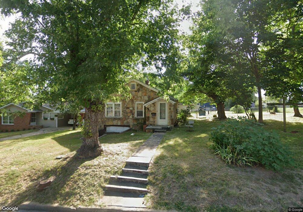
709 N Robinson St Harrison, AR 72601
Estimated Value: $128,365 - $148,000
2
Beds
1
Bath
1,410
Sq Ft
$98/Sq Ft
Est. Value
About This Home
This home is located at 709 N Robinson St, Harrison, AR 72601 and is currently estimated at $137,591, approximately $97 per square foot. 709 N Robinson St is a home located in Boone County with nearby schools including Harrison Kindergarten, Harrison Jr. High School, and Harrison High School.
Ownership History
Date
Name
Owned For
Owner Type
Purchase Details
Closed on
Apr 24, 2006
Sold by
Gary Dwayne Milam And Mary Lucy Milam Re
Bought by
Landrum Melvin and Landrum Dorothy
Current Estimated Value
Home Financials for this Owner
Home Financials are based on the most recent Mortgage that was taken out on this home.
Original Mortgage
$68,877
Outstanding Balance
$39,490
Interest Rate
6.32%
Mortgage Type
New Conventional
Estimated Equity
$98,101
Purchase Details
Closed on
Apr 18, 2006
Sold by
Milam Mary Lucy Mcfarlan and Milam Melva Lee
Bought by
Edgington Larry R and Edgington Janine M
Home Financials for this Owner
Home Financials are based on the most recent Mortgage that was taken out on this home.
Original Mortgage
$68,877
Outstanding Balance
$39,490
Interest Rate
6.32%
Mortgage Type
New Conventional
Estimated Equity
$98,101
Create a Home Valuation Report for This Property
The Home Valuation Report is an in-depth analysis detailing your home's value as well as a comparison with similar homes in the area
Purchase History
| Date | Buyer | Sale Price | Title Company |
|---|---|---|---|
| Landrum Melvin | -- | None Available | |
| Edgington Larry R | $67,000 | None Available |
Source: Public Records
Mortgage History
| Date | Status | Borrower | Loan Amount |
|---|---|---|---|
| Open | Edgington Larry R | $68,877 |
Source: Public Records
Tax History
| Year | Tax Paid | Tax Assessment Tax Assessment Total Assessment is a certain percentage of the fair market value that is determined by local assessors to be the total taxable value of land and additions on the property. | Land | Improvement |
|---|---|---|---|---|
| 2025 | $611 | $13,040 | $2,800 | $10,240 |
| 2024 | $587 | $13,040 | $2,800 | $10,240 |
| 2023 | $562 | $13,040 | $2,800 | $10,240 |
| 2022 | $163 | $13,040 | $2,800 | $10,240 |
| 2021 | $138 | $13,040 | $2,800 | $10,240 |
| 2020 | $114 | $9,580 | $2,800 | $6,780 |
| 2019 | $132 | $9,580 | $2,800 | $6,780 |
| 2018 | $157 | $9,580 | $2,800 | $6,780 |
| 2017 | $102 | $9,580 | $2,800 | $6,780 |
| 2016 | $102 | $8,870 | $2,800 | $6,070 |
| 2015 | $431 | $8,450 | $2,800 | $5,650 |
| 2014 | $81 | $8,450 | $2,800 | $5,650 |
Source: Public Records
Map
Nearby Homes
- 710 N Rowland St
- 702 E Argyle St
- 627 E Sherman Ave
- 315 Glines Ct
- 301 N Chestnut St
- 811 A E Fick Ave
- 117 E Erie St
- 303 N 2nd St
- 308 N 3rd St
- 421 W Bower Ave
- Lot 94 Restore Cir
- Lot 93 Restore Cir
- Lot 90 Restore Cir
- Lot 92 Restore Cir
- Lot 91 Restore Cir
- Lot 89 Restore Cir
- Lot 88 Restore Cir
- 410 N Maple St
- 0 N Sutton
- 624 E S
- 707 N Robinson St
- 0 Walking Stick Unit 20008874
- n/a Walking Stick
- n/a Silver Valley Rd
- 80 acres Cowetta Falls
- 705 N Robinson St
- 711 N Robinson St
- 0 Union Rd Unit 119929
- 0 Union Rd Unit 118594
- 0 Union Rd Unit 118593
- 0 Union Rd Unit 118592
- 0 Union Rd Unit 118591
- 0 Union Rd Unit 118559
- 0 Union Rd Unit 117135
- 0 Union Rd Unit 116514
- 0 Union Rd Unit 116513
- 0 Union Rd Unit 115413
- 0 Union Rd Unit 108136
Your Personal Tour Guide
Ask me questions while you tour the home.