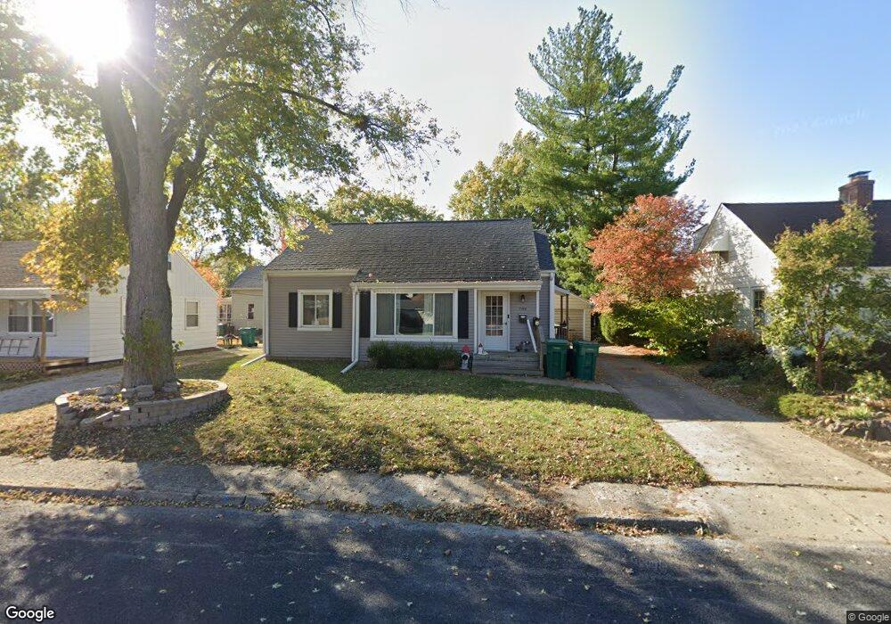
709 N Saint Anthony Place West Peoria, IL 61604
Estimated Value: $121,748 - $151,000
3
Beds
2
Baths
1,218
Sq Ft
$110/Sq Ft
Est. Value
About This Home
This home is located at 709 N Saint Anthony Place, West Peoria, IL 61604 and is currently estimated at $134,187, approximately $110 per square foot. 709 N Saint Anthony Place is a home located in Peoria County with nearby schools including Whittier Primary School, Harold B. Dawson Jr. Middle School, and Manual High School.
Ownership History
Date
Name
Owned For
Owner Type
Purchase Details
Closed on
Aug 21, 2020
Sold by
Clark and Blair
Bought by
Lawrence Jessica
Current Estimated Value
Home Financials for this Owner
Home Financials are based on the most recent Mortgage that was taken out on this home.
Original Mortgage
$82,437
Outstanding Balance
$72,991
Interest Rate
2.9%
Mortgage Type
FHA
Estimated Equity
$61,196
Purchase Details
Closed on
Feb 24, 2006
Bought by
Clark Jason
Create a Home Valuation Report for This Property
The Home Valuation Report is an in-depth analysis detailing your home's value as well as a comparison with similar homes in the area
Home Values in the Area
Average Home Value in this Area
Purchase History
| Date | Buyer | Sale Price | Title Company |
|---|---|---|---|
| Lawrence Jessica | $87,000 | Johnson Bunce & Noble Pc | |
| Clark Jason | $81,500 | -- |
Source: Public Records
Mortgage History
| Date | Status | Borrower | Loan Amount |
|---|---|---|---|
| Open | Lawrence Jessica | $82,437 | |
| Closed | Lawrence Jessica | $3,480 |
Source: Public Records
Tax History Compared to Growth
Tax History
| Year | Tax Paid | Tax Assessment Tax Assessment Total Assessment is a certain percentage of the fair market value that is determined by local assessors to be the total taxable value of land and additions on the property. | Land | Improvement |
|---|---|---|---|---|
| 2024 | $2,432 | $35,410 | $3,260 | $32,150 |
| 2023 | $2,243 | $31,900 | $2,940 | $28,960 |
| 2022 | $2,228 | $31,100 | $2,820 | $28,280 |
| 2021 | $2,145 | $29,340 | $2,660 | $26,680 |
| 2020 | $1,746 | $24,830 | $2,600 | $22,230 |
| 2019 | $1,798 | $25,080 | $2,630 | $22,450 |
| 2018 | $1,816 | $25,830 | $2,710 | $23,120 |
| 2017 | $1,812 | $26,090 | $2,740 | $23,350 |
| 2016 | $1,700 | $26,090 | $2,740 | $23,350 |
| 2015 | $1,620 | $25,080 | $2,630 | $22,450 |
| 2014 | $1,656 | $24,600 | $2,610 | $21,990 |
| 2013 | -- | $25,360 | $2,690 | $22,670 |
Source: Public Records
Map
Nearby Homes
- 2121 W Rohmann Ave
- 2119 W Clarke Ave
- 2011 W Barker Ave
- 2006 W Alice Ave
- 2316 W Ayres Ave
- 1913 W Laura Ave
- 2027 W Sherman Ave
- 1808 W Fredonia Ave
- 2626 W Heading Ave
- 1801 W Ayres Ave
- 807 N Ashland Ave
- 2321 W Manor Pkwy
- 617 N Coolidge Ct
- 1622 W Callender Ave
- 1320 N Rhodora Ave
- 1637 W Moss Ave
- 2112 W Colorado St
- 1325 N Park Rd
- 1027 N Maplewood Ave
- 120 S Cedar Ave
- 709 N Saint Anthony St
- 705 N Saint Anthony Place
- 711 N Saint Anthony Place
- 2305 W Rohmann Ave
- 710 N Clifton Ct
- 715 N Saint Anthony Place
- 712 N Clifton Ct
- 2219 W Rohmann Ave
- 702 N Clifton Ct
- 716 N Clifton Ct
- 714 N St Anthony Place
- 714 N Saint Anthony Place
- 719 N Saint Anthony Place
- 2217 W Rohmann Ave
- 719 N St Anthony Place
- 718 N Saint Anthony Place
- 2300 W Rohmann Ave
- 2224 W Rohmann Ave
- 720 N Clifton Ct
- 709 N Clifton Ct