Estimated Value: $245,000 - $262,000
3
Beds
2
Baths
1,435
Sq Ft
$177/Sq Ft
Est. Value
About This Home
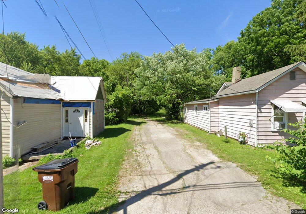
This home is located at 709 N West St, Xenia, OH 45385 and is currently estimated at $254,115, approximately $177 per square foot. 709 N West St is a home located in Greene County with nearby schools including Xenia High School, Summit Academy Community School for Alternative Learners - Xenia, and Legacy Christian Academy.
Ownership History
Date
Name
Owned For
Owner Type
Purchase Details
Closed on
Oct 30, 2020
Sold by
Angelopoulos Paul and Angelopoulos Sandra
Bought by
Stacy Morgan T and Minor Brandon D
Current Estimated Value
Home Financials for this Owner
Home Financials are based on the most recent Mortgage that was taken out on this home.
Original Mortgage
$169,750
Outstanding Balance
$151,053
Interest Rate
2.8%
Mortgage Type
New Conventional
Estimated Equity
$103,062
Purchase Details
Closed on
Sep 4, 2020
Sold by
Hutchinson Melva A and The Money Source Inc
Bought by
Angelopoulos Paul
Home Financials for this Owner
Home Financials are based on the most recent Mortgage that was taken out on this home.
Original Mortgage
$169,750
Outstanding Balance
$151,053
Interest Rate
2.8%
Mortgage Type
New Conventional
Estimated Equity
$103,062
Purchase Details
Closed on
Jul 7, 2017
Sold by
Barley Kendra K
Bought by
Hutchinson Melva A
Home Financials for this Owner
Home Financials are based on the most recent Mortgage that was taken out on this home.
Original Mortgage
$129,609
Interest Rate
4.25%
Mortgage Type
FHA
Purchase Details
Closed on
Mar 11, 2016
Sold by
Barley Michael L
Bought by
Barley Kendra K
Purchase Details
Closed on
Nov 11, 2012
Sold by
Barley Kendra K and Smith Kendra K
Bought by
Barley Kendra K and Barley Michael L
Purchase Details
Closed on
Feb 12, 2005
Sold by
Slesinger M Kay and Rich Paul
Bought by
Smith Kondra K
Home Financials for this Owner
Home Financials are based on the most recent Mortgage that was taken out on this home.
Original Mortgage
$103,050
Interest Rate
5.8%
Mortgage Type
Unknown
Purchase Details
Closed on
Jul 8, 2004
Sold by
Sheard Robert C and Sheard Cheryl J
Bought by
Slesinger Kay
Purchase Details
Closed on
Jul 7, 2004
Sold by
Vonohain Pamela Marie and Vonohain Christopher H
Bought by
Slesinger Kay
Create a Home Valuation Report for This Property
The Home Valuation Report is an in-depth analysis detailing your home's value as well as a comparison with similar homes in the area
Home Values in the Area
Average Home Value in this Area
Purchase History
| Date | Buyer | Sale Price | Title Company |
|---|---|---|---|
| Stacy Morgan T | -- | None Listed On Document | |
| Angelopoulos Paul | $122,407 | None Available | |
| Hutchinson Melva A | $132,000 | None Available | |
| Barley Kendra K | -- | None Available | |
| Barley Kendra K | -- | None Available | |
| Smith Kondra K | $114,500 | -- | |
| Slesinger Kay | $27,000 | -- | |
| Slesinger Kay | $27,000 | -- | |
| Slesinger Kay | $27,000 | -- | |
| Slesinger Kay | $27,000 | -- |
Source: Public Records
Mortgage History
| Date | Status | Borrower | Loan Amount |
|---|---|---|---|
| Open | Stacy Morgan T | $169,750 | |
| Previous Owner | Hutchinson Melva A | $129,609 | |
| Previous Owner | Smith Kondra K | $103,050 |
Source: Public Records
Tax History Compared to Growth
Tax History
| Year | Tax Paid | Tax Assessment Tax Assessment Total Assessment is a certain percentage of the fair market value that is determined by local assessors to be the total taxable value of land and additions on the property. | Land | Improvement |
|---|---|---|---|---|
| 2024 | $3,028 | $70,770 | $11,680 | $59,090 |
| 2023 | $3,028 | $70,770 | $11,680 | $59,090 |
| 2022 | $2,580 | $51,420 | $7,300 | $44,120 |
| 2021 | $2,614 | $43,040 | $7,300 | $35,740 |
| 2020 | $2,580 | $43,040 | $7,300 | $35,740 |
| 2019 | $2,580 | $40,450 | $7,810 | $32,640 |
| 2018 | $2,101 | $40,450 | $7,810 | $32,640 |
| 2017 | $1,943 | $40,450 | $7,810 | $32,640 |
| 2016 | $1,943 | $37,710 | $7,810 | $29,900 |
| 2015 | $1,948 | $37,710 | $7,810 | $29,900 |
| 2014 | $1,864 | $37,710 | $7,810 | $29,900 |
Source: Public Records
Map
Nearby Homes
- 725 N West St
- 695 N West St
- 737 N West St
- 714 N West St
- 702 N Galloway St
- 722 N Galloway St
- 688 N Galloway St
- 673 N West St
- 751 N West St
- 732 N Galloway St
- 694 N West St
- 738 N Galloway St
- 674 N Galloway St
- 686 N West St
- 653 N West St
- 740 N West St
- 754 N Galloway St
- 664 N West St
- 777 N West St
- 754 N West St