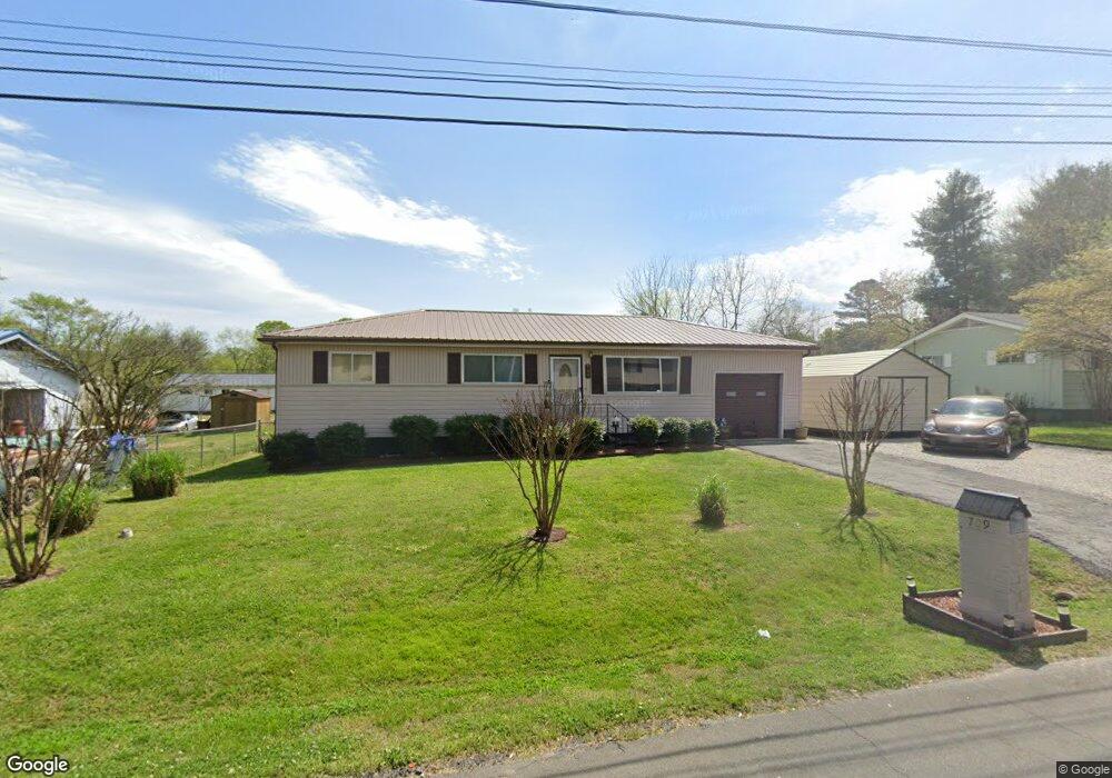
709 Roberta Dr Rossville, GA 30741
Estimated Value: $151,000 - $194,000
--
Bed
1
Bath
960
Sq Ft
$180/Sq Ft
Est. Value
About This Home
This home is located at 709 Roberta Dr, Rossville, GA 30741 and is currently estimated at $172,454, approximately $179 per square foot. 709 Roberta Dr is a home located in Walker County with nearby schools including Stone Creek Elementary School, Rossville Middle School, and Ridgeland High School.
Ownership History
Date
Name
Owned For
Owner Type
Purchase Details
Closed on
May 29, 2008
Sold by
Not Provided
Bought by
Turner Imogene
Current Estimated Value
Purchase Details
Closed on
Nov 24, 1987
Sold by
Lee Jo Ann and Imogene Turner
Bought by
Turner Imogene
Purchase Details
Closed on
May 8, 1986
Sold by
Harvey William C
Bought by
Lee Jo Ann and Imogene Turner
Purchase Details
Closed on
Mar 31, 1976
Sold by
Mcdonald J Cecil
Bought by
Harvey William C
Purchase Details
Closed on
Jun 5, 1970
Bought by
Mcdonald J Cecil
Create a Home Valuation Report for This Property
The Home Valuation Report is an in-depth analysis detailing your home's value as well as a comparison with similar homes in the area
Home Values in the Area
Average Home Value in this Area
Purchase History
| Date | Buyer | Sale Price | Title Company |
|---|---|---|---|
| Turner Imogene | -- | -- | |
| Turner Imogene | -- | -- | |
| Lee Jo Ann | $32,000 | -- | |
| Harvey William C | -- | -- | |
| Mcdonald J Cecil | -- | -- |
Source: Public Records
Tax History Compared to Growth
Tax History
| Year | Tax Paid | Tax Assessment Tax Assessment Total Assessment is a certain percentage of the fair market value that is determined by local assessors to be the total taxable value of land and additions on the property. | Land | Improvement |
|---|---|---|---|---|
| 2024 | $729 | $49,713 | $3,044 | $46,669 |
| 2023 | $692 | $47,230 | $3,044 | $44,186 |
| 2022 | $603 | $40,932 | $3,044 | $37,888 |
| 2021 | $390 | $26,878 | $3,044 | $23,834 |
| 2020 | $321 | $22,929 | $3,044 | $19,885 |
| 2019 | $321 | $22,929 | $3,044 | $19,885 |
| 2018 | $607 | $22,929 | $3,044 | $19,885 |
| 2017 | $391 | $22,929 | $3,044 | $19,885 |
| 2016 | $219 | $15,376 | $3,044 | $12,332 |
| 2015 | $322 | $21,007 | $3,052 | $17,955 |
| 2014 | $257 | $21,007 | $3,052 | $17,955 |
| 2013 | -- | $21,007 | $3,052 | $17,955 |
Source: Public Records
Map
Nearby Homes
- 724 Shelly Ln
- 717 W James St
- 610 Union Ave
- 715 W James St
- 732 Salem Rd
- 211 Pat Webb Cir
- 601 James St
- 635 N Sherry Dr
- 126 S Liner St
- 275 Quarter St
- 58 Quarter St
- 52 Quarter St
- 44 Quarter St
- 33 Quarter St
- 27 Quarter St
- 19 Quarter St
- 11 Quarter St
- Penwell Plan at Hawk's Ridge
- Hanover Plan at Hawk's Ridge
- Edmon Plan at Hawk's Ridge
- 711 Roberta Dr
- 707 Roberta Dr
- 706 Roberta Dr
- 705 Roberta Dr
- 708 Mary Agnes Dr
- 712 Mary Agnes Dr
- 713 Roberta Dr
- 714 Roberta Dr
- 703 Roberta Dr
- 706 Mary Agnes Dr
- 704 Roberta Dr
- 714 Mary Agnes Dr
- 716 Roberta Dr
- 715 Roberta Dr
- 701 Roberta Dr
- 705 Fricks Ln
- 707 Fricks Ln
- 702 Roberta Dr
- 703 Fricks Ln
- 704 Mary Agnes Dr