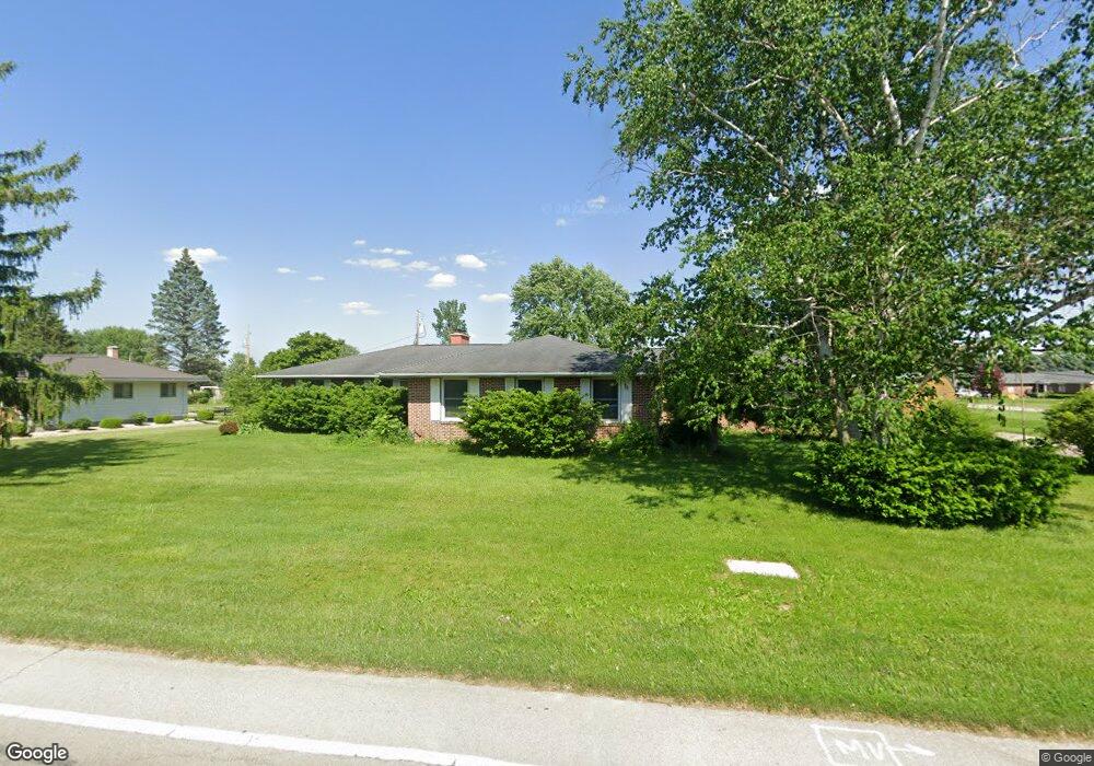
709 Smith Rd Fremont, OH 43420
Estimated Value: $252,000 - $439,000
5
Beds
4
Baths
2,953
Sq Ft
$119/Sq Ft
Est. Value
About This Home
This home is located at 709 Smith Rd, Fremont, OH 43420 and is currently estimated at $352,051, approximately $119 per square foot. 709 Smith Rd is a home located in Sandusky County with nearby schools including Fremont Ross High School, Sacred Heart School, and Temple Christian Academy.
Ownership History
Date
Name
Owned For
Owner Type
Purchase Details
Closed on
Nov 18, 2009
Sold by
Neeley A Bruce and Neeley Linda C
Bought by
Sutter Christopher J and Sutter Nancy P
Current Estimated Value
Home Financials for this Owner
Home Financials are based on the most recent Mortgage that was taken out on this home.
Original Mortgage
$125,930
Outstanding Balance
$81,806
Interest Rate
4.9%
Mortgage Type
New Conventional
Estimated Equity
$270,245
Purchase Details
Closed on
Jun 1, 1989
Sold by
Neeley Neeley A A and Neeley Linda
Bought by
Sutter Christopher J and Sutter Nancy P
Purchase Details
Closed on
Sep 1, 1986
Bought by
Sutter Christopher J and Sutter Nancy P
Create a Home Valuation Report for This Property
The Home Valuation Report is an in-depth analysis detailing your home's value as well as a comparison with similar homes in the area
Home Values in the Area
Average Home Value in this Area
Purchase History
| Date | Buyer | Sale Price | Title Company |
|---|---|---|---|
| Sutter Christopher J | $179,900 | First American Title | |
| Sutter Christopher J | $135,000 | -- | |
| Sutter Christopher J | -- | -- |
Source: Public Records
Mortgage History
| Date | Status | Borrower | Loan Amount |
|---|---|---|---|
| Open | Sutter Christopher J | $125,930 |
Source: Public Records
Tax History Compared to Growth
Tax History
| Year | Tax Paid | Tax Assessment Tax Assessment Total Assessment is a certain percentage of the fair market value that is determined by local assessors to be the total taxable value of land and additions on the property. | Land | Improvement |
|---|---|---|---|---|
| 2024 | $3,571 | $113,370 | $24,400 | $88,970 |
| 2023 | $4,418 | $83,970 | $18,060 | $65,910 |
| 2022 | $3,496 | $83,970 | $18,060 | $65,910 |
| 2021 | $3,602 | $83,970 | $18,060 | $65,910 |
| 2020 | $3,701 | $84,560 | $18,060 | $66,500 |
| 2019 | $3,697 | $84,560 | $18,060 | $66,500 |
| 2018 | $3,522 | $82,810 | $18,060 | $64,750 |
| 2017 | $3,181 | $74,380 | $18,060 | $56,320 |
| 2016 | $2,787 | $74,380 | $18,060 | $56,320 |
| 2015 | $2,741 | $74,380 | $18,060 | $56,320 |
| 2014 | $2,983 | $77,560 | $20,510 | $57,050 |
| 2013 | $2,920 | $77,560 | $20,510 | $57,050 |
Source: Public Records
Map
Nearby Homes
- 1739 E State St Unit 23
- 1526 Sunrise Blvd
- 800 Lawndale Dr
- 309 S Collinwood Blvd
- 315 Ethan Dr
- 131 Berkshire Dr
- 199 Saint Thomas Dr
- 335 Cottage St
- 2248 E State St
- 251 Saint Paul Dr
- 0 S Buchanan St
- 230 N Pennsylvania Ave
- 600 S Buchanan St
- 216 S Buchanan St
- 263 Saint Paul Dr
- 714 E State St
- 2120 Pinehurst Trail
- 1014 S County Road 198
- 322 4th St
- 1210 Castalia St
- 1624 Mario Place
- 0 Smith Rd
- 625 Smith Rd
- 710 Carmen Place
- 1541 Smith Ct
- 700 Carmen Place
- 1540 Smith Ct
- 800 Smith Rd
- 613 Smith Rd
- 618 Carmen Place
- 6304 Carmen Pl Lot 6304
- 1629 Mario Place
- 612 Smith Rd
- 808 Smith Rd
- 1537 Smith Ct
- 1536 Smith Ct
- 800 Greenfield Dr
- 0 Corner of Carmen & Mario Place Unit 20134565
- 612 Carmen Place
- 615 Greenfield Dr