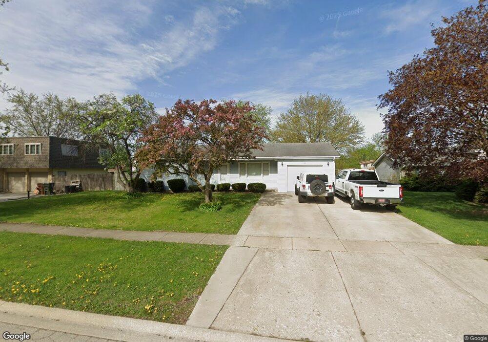
709 Southgate Rd New Lenox, IL 60451
Estimated Value: $309,386 - $384,000
--
Bed
--
Bath
--
Sq Ft
10,019
Sq Ft Lot
About This Home
This home is located at 709 Southgate Rd, New Lenox, IL 60451 and is currently estimated at $359,847. 709 Southgate Rd is a home located in Will County with nearby schools including Bentley Elementary School, Arnold J Tyler School, and Alex M Martino Jr High School.
Ownership History
Date
Name
Owned For
Owner Type
Purchase Details
Closed on
Jun 26, 1996
Sold by
Schiavone Carmen J and Schiavone Patricia
Bought by
Millsaps David A and Millsaps Lori A
Current Estimated Value
Home Financials for this Owner
Home Financials are based on the most recent Mortgage that was taken out on this home.
Original Mortgage
$130,675
Outstanding Balance
$9,355
Interest Rate
8.13%
Estimated Equity
$350,492
Purchase Details
Closed on
Aug 16, 1991
Bought by
Millsaps David A
Create a Home Valuation Report for This Property
The Home Valuation Report is an in-depth analysis detailing your home's value as well as a comparison with similar homes in the area
Home Values in the Area
Average Home Value in this Area
Purchase History
| Date | Buyer | Sale Price | Title Company |
|---|---|---|---|
| Millsaps David A | $137,000 | Premier Title Company | |
| Millsaps David A | $114,000 | -- |
Source: Public Records
Mortgage History
| Date | Status | Borrower | Loan Amount |
|---|---|---|---|
| Open | Millsaps David A | $130,675 |
Source: Public Records
Tax History Compared to Growth
Tax History
| Year | Tax Paid | Tax Assessment Tax Assessment Total Assessment is a certain percentage of the fair market value that is determined by local assessors to be the total taxable value of land and additions on the property. | Land | Improvement |
|---|---|---|---|---|
| 2024 | $7,144 | $96,031 | $33,360 | $62,671 |
| 2023 | $7,144 | $87,539 | $30,410 | $57,129 |
| 2022 | $6,459 | $80,644 | $28,015 | $52,629 |
| 2021 | $6,121 | $75,843 | $26,347 | $49,496 |
| 2020 | $5,941 | $73,137 | $25,407 | $47,730 |
| 2019 | $5,681 | $70,869 | $24,619 | $46,250 |
| 2018 | $5,543 | $68,426 | $23,770 | $44,656 |
| 2017 | $5,262 | $66,459 | $23,087 | $43,372 |
| 2016 | $5,103 | $64,680 | $22,469 | $42,211 |
| 2015 | $4,933 | $62,644 | $21,762 | $40,882 |
| 2014 | $4,933 | $61,870 | $21,493 | $40,377 |
| 2013 | $4,933 | $62,704 | $21,783 | $40,921 |
Source: Public Records
Map
Nearby Homes
- 808 Stonegate Rd
- 718 S Prairie Rd
- 105 Roy St
- 235 Roberts Rd
- 1046 Schoolgate Rd Unit 3
- 00 NE Corner Cherry Hill Road and Moss Lane Rd
- 203 Tonell Ave
- 920 Barnside Rd
- 315 S Pine St
- 1000 S Cedar Rd
- 328 E Lincoln Hwy
- 329 Hancock Dr
- 449 Somerset Ln Unit 1
- 513 Somerset Ln
- 574 Prairie Crossing Dr
- 416 Manor Ct Unit B
- 1017 E Lincoln Hwy
- 218 Manor Dr Unit A
- 709 Young Dr
- 709 Garadice Dr
- 705 Southgate Rd
- 713 Southgate Rd
- 246 E Woodlawn Rd Unit 16
- 242 E Woodlawn Rd Unit 13
- 242 E Woodlawn Rd Unit 242
- 266 E Woodlawn Rd
- 244 E Woodlawn Rd
- 244 E Woodlawn Rd Unit 244
- 240 E Woodlawn Rd Unit 14
- 218 E Woodlawn Rd Unit 2
- 218 E Woodlawn Rd Unit 218
- 264 E Woodlawn Rd Unit 26
- 304 E Woodlawn Rd
- 717 Southgate Rd
- 270 E Woodlawn Rd
- 270 E Woodlawn Rd Unit 207
- 270 E Woodlawn Rd Unit 270
- 216 E Woodlawn Rd Unit 1
- 268 E Woodlawn Rd Unit 27
- 220 E Woodlawn Rd Unit 3