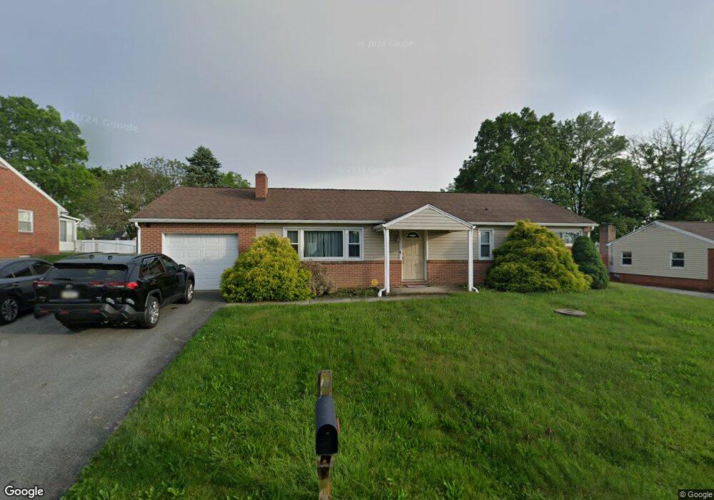
709 Summit Dr Dallastown, PA 17313
Estimated Value: $262,000 - $293,081
3
Beds
1
Bath
2,088
Sq Ft
$133/Sq Ft
Est. Value
About This Home
This home is located at 709 Summit Dr, Dallastown, PA 17313 and is currently estimated at $277,520, approximately $132 per square foot. 709 Summit Dr is a home located in York County with nearby schools including Dallastown Elementary School, Dallastown Area Middle School, and Dallastown Area High School.
Ownership History
Date
Name
Owned For
Owner Type
Purchase Details
Closed on
Feb 15, 2022
Sold by
Roland Daniel A and Roland Tammy A
Bought by
Roland Dylan A and Lloyd-Jones Emily
Current Estimated Value
Home Financials for this Owner
Home Financials are based on the most recent Mortgage that was taken out on this home.
Original Mortgage
$176,000
Outstanding Balance
$163,429
Interest Rate
3.55%
Mortgage Type
New Conventional
Estimated Equity
$114,091
Purchase Details
Closed on
Jan 30, 2017
Sold by
Bremer Joan M
Bought by
Roland Daniel A
Purchase Details
Closed on
Mar 22, 2011
Sold by
Fannie Mae
Bought by
Bremer Joan M
Purchase Details
Closed on
Jul 12, 2010
Sold by
Skopinski Walter J
Bought by
Fannie Mae
Purchase Details
Closed on
Oct 22, 1998
Sold by
Shaffer Robert A and Shaffer Trudy L
Bought by
Skopinski Walter J and Skopinski Mary E
Home Financials for this Owner
Home Financials are based on the most recent Mortgage that was taken out on this home.
Original Mortgage
$63,000
Interest Rate
6.74%
Create a Home Valuation Report for This Property
The Home Valuation Report is an in-depth analysis detailing your home's value as well as a comparison with similar homes in the area
Home Values in the Area
Average Home Value in this Area
Purchase History
| Date | Buyer | Sale Price | Title Company |
|---|---|---|---|
| Roland Dylan A | $220,000 | None Listed On Document | |
| Roland Daniel A | -- | None Available | |
| Bremer Joan M | $129,500 | None Available | |
| Fannie Mae | $1,783 | None Available | |
| Skopinski Walter J | $93,000 | -- |
Source: Public Records
Mortgage History
| Date | Status | Borrower | Loan Amount |
|---|---|---|---|
| Open | Roland Dylan A | $176,000 | |
| Previous Owner | Skopinski Walter J | $63,000 |
Source: Public Records
Tax History Compared to Growth
Tax History
| Year | Tax Paid | Tax Assessment Tax Assessment Total Assessment is a certain percentage of the fair market value that is determined by local assessors to be the total taxable value of land and additions on the property. | Land | Improvement |
|---|---|---|---|---|
| 2025 | $4,523 | $131,770 | $41,500 | $90,270 |
| 2024 | $4,457 | $131,770 | $41,500 | $90,270 |
| 2023 | $4,457 | $131,770 | $41,500 | $90,270 |
| 2022 | $4,211 | $128,700 | $41,500 | $87,200 |
| 2021 | $4,012 | $128,700 | $41,500 | $87,200 |
| 2020 | $4,012 | $128,700 | $41,500 | $87,200 |
| 2019 | $3,999 | $128,700 | $41,500 | $87,200 |
| 2018 | $3,972 | $128,700 | $41,500 | $87,200 |
| 2017 | $3,813 | $128,700 | $41,500 | $87,200 |
| 2016 | -- | $128,700 | $41,500 | $87,200 |
| 2015 | -- | $128,700 | $41,500 | $87,200 |
| 2014 | -- | $128,700 | $41,500 | $87,200 |
Source: Public Records
Map
Nearby Homes
- 56 E Frederick St
- 260 Country Ridge Dr
- 64 S Pleasant Ave
- 211 Country Ridge Dr
- 156 Country Ridge Dr
- 126 Country Ridge Dr
- 131 Country Ridge Dr
- 840 Country Club Rd
- 600 S Duke St
- 136 Teila Dr
- 435 Frederick Dr
- 106 Teila Dr
- 2855 Springwood Rd
- 661 S Duke St
- 424 Dartha Dr
- 0 S Franklin St
- 420 Greenway Dr
- 786 Arbor Dr
- 253 W Chestnut St Unit 11
- 400 Carriage Ln Unit 400