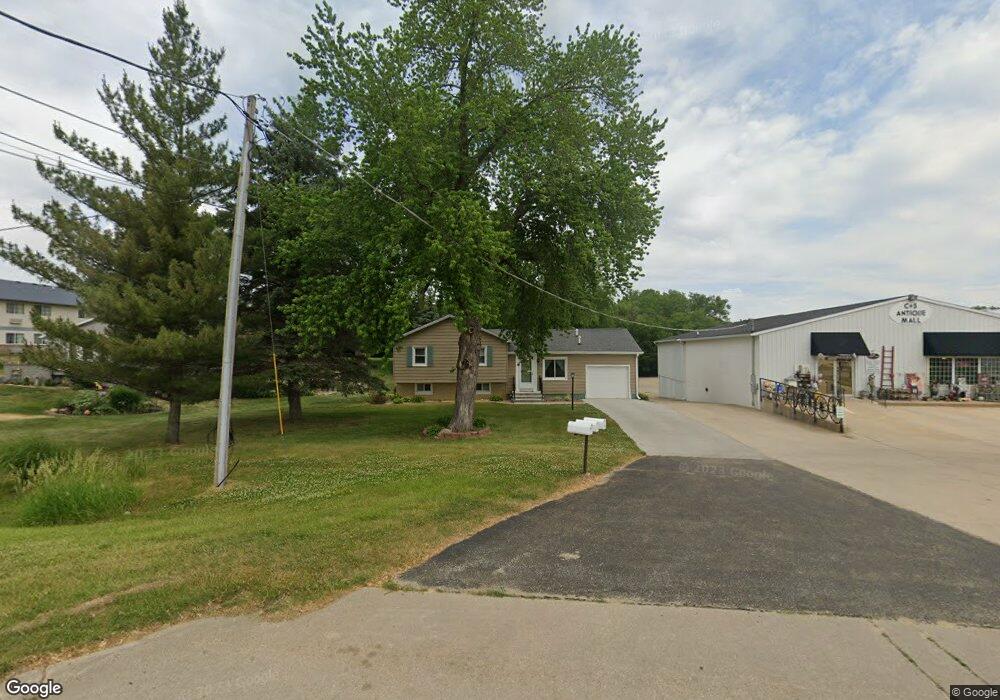
709 W Main St Geneseo, IL 61254
Estimated Value: $164,000 - $193,000
3
Beds
2
Baths
1,536
Sq Ft
$116/Sq Ft
Est. Value
About This Home
This home is located at 709 W Main St, Geneseo, IL 61254 and is currently estimated at $178,223, approximately $116 per square foot. 709 W Main St is a home located in Henry County with nearby schools including Geneseo High School and St. Malachy School.
Ownership History
Date
Name
Owned For
Owner Type
Purchase Details
Closed on
Sep 11, 2020
Sold by
Mallum Dawn and Gillis Dawn
Bought by
Hancock Steven A and Hancock Cindy J
Current Estimated Value
Purchase Details
Closed on
Nov 11, 2013
Sold by
Turner Richard
Bought by
Haff Mary Ann
Purchase Details
Closed on
May 8, 2006
Sold by
Haff James D
Bought by
Gillis Dawn
Home Financials for this Owner
Home Financials are based on the most recent Mortgage that was taken out on this home.
Original Mortgage
$75,000
Interest Rate
6.03%
Mortgage Type
New Conventional
Create a Home Valuation Report for This Property
The Home Valuation Report is an in-depth analysis detailing your home's value as well as a comparison with similar homes in the area
Home Values in the Area
Average Home Value in this Area
Purchase History
| Date | Buyer | Sale Price | Title Company |
|---|---|---|---|
| Hancock Steven A | $90,000 | Western Illinois Title | |
| Haff Mary Ann | -- | None Available | |
| Gillis Dawn | -- | None Available |
Source: Public Records
Mortgage History
| Date | Status | Borrower | Loan Amount |
|---|---|---|---|
| Previous Owner | Gillis Dawn | $75,000 |
Source: Public Records
Tax History Compared to Growth
Tax History
| Year | Tax Paid | Tax Assessment Tax Assessment Total Assessment is a certain percentage of the fair market value that is determined by local assessors to be the total taxable value of land and additions on the property. | Land | Improvement |
|---|---|---|---|---|
| 2024 | $5,105 | $62,808 | $8,161 | $54,647 |
| 2023 | $4,537 | $57,203 | $7,433 | $49,770 |
| 2022 | $4,320 | $53,163 | $6,908 | $46,255 |
| 2021 | $3,688 | $45,150 | $6,733 | $38,417 |
| 2020 | $3,187 | $45,569 | $6,795 | $38,774 |
| 2019 | $3,082 | $45,062 | $6,720 | $38,342 |
| 2018 | $2,898 | $42,592 | $6,352 | $36,240 |
| 2017 | $2,714 | $41,513 | $6,191 | $35,322 |
| 2016 | $2,819 | $40,461 | $6,034 | $34,427 |
| 2015 | $2,596 | $40,380 | $6,022 | $34,358 |
| 2013 | $2,596 | $39,625 | $5,910 | $33,715 |
Source: Public Records
Map
Nearby Homes
- 335 S Stewart St
- 101 S Stewart St
- 127 N Vail St
- 139 N Vail St
- 608 S Oakwood Ave
- 326 N Vail St
- 227 N State St
- 228 E Locust St
- 629 W Wells St
- 317 E South St
- 19025 Bluff Rd
- 909 S Spring St
- 513 W Elk St
- 321 Pin Oak Dr
- 522 N State St
- 513 E Pearl St
- 417 E Orange St
- 549 E Park St
- 624 E Chestnut St
- 623 E Park St
- 713 W Main St
- 705 W Main St
- 625 W Main St
- 765 W Main St
- 730 W Main St
- 730 W Main St
- 550 Dilenbeck Dr
- 535 W Main St
- 634 Dilenbeck Dr Unit 636
- 805 W Main St
- 633 Madison Ave Unit 635
- 640 Dilenbeck Dr Unit 642
- 641 Dilenbeck Dr Unit 643
- 735 Dilenbeck Dr
- 643 Dilenbeck Dr
- 641 Madison Ave Unit 643
- 641 Madison Ave
- 700 Dilenbeck Dr
- 775 Dilenbeck Dr
- 775 Dilenbeck Dr Unit 2