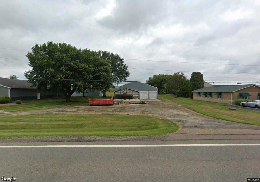
7099 Alliance Rd NW Malvern, OH 44644
Estimated Value: $39,716
--
Bed
--
Bath
5,370
Sq Ft
$7/Sq Ft
Est. Value
About This Home
This home is located at 7099 Alliance Rd NW, Malvern, OH 44644 and is currently estimated at $39,716, approximately $7 per square foot. 7099 Alliance Rd NW is a home located in Carroll County with nearby schools including Malvern Elementary School, Malvern Middle School, and Malvern High School.
Ownership History
Date
Name
Owned For
Owner Type
Purchase Details
Closed on
Jun 30, 2008
Sold by
Hohler Richard W and Hohler Ronanne S
Bought by
Carroll Gt Llc
Current Estimated Value
Purchase Details
Closed on
Jun 29, 2007
Sold by
Gregory Ilene M
Bought by
Hohler Richard W
Purchase Details
Closed on
Mar 10, 2006
Sold by
Howler Richard W
Bought by
Gregory Ilene M
Purchase Details
Closed on
Feb 17, 2006
Sold by
Carroll Gt Llc
Bought by
Hohler Richard W
Purchase Details
Closed on
Sep 8, 2005
Sold by
Hohler Richard W
Bought by
Carroll Gt Llc
Create a Home Valuation Report for This Property
The Home Valuation Report is an in-depth analysis detailing your home's value as well as a comparison with similar homes in the area
Home Values in the Area
Average Home Value in this Area
Purchase History
| Date | Buyer | Sale Price | Title Company |
|---|---|---|---|
| Carroll Gt Llc | -- | Attorney | |
| Hohler Richard W | $20,000 | Attorney | |
| Gregory Ilene M | $20,000 | Attorney | |
| Hohler Richard W | -- | Attorney | |
| Carroll Gt Llc | $1,000 | None Available |
Source: Public Records
Tax History Compared to Growth
Tax History
| Year | Tax Paid | Tax Assessment Tax Assessment Total Assessment is a certain percentage of the fair market value that is determined by local assessors to be the total taxable value of land and additions on the property. | Land | Improvement |
|---|---|---|---|---|
| 2024 | $1,020 | $33,000 | $7,560 | $25,440 |
| 2023 | $1,835 | $33,000 | $7,560 | $25,440 |
| 2022 | $1,898 | $33,010 | $7,560 | $25,450 |
| 2021 | $1,893 | $33,010 | $7,560 | $25,450 |
| 2020 | $1,890 | $33,010 | $7,560 | $25,450 |
| 2019 | $1,983 | $33,005 | $7,560 | $25,445 |
| 2018 | $1,978 | $31,740 | $6,800 | $24,940 |
| 2017 | $1,934 | $31,740 | $6,800 | $24,940 |
| 2016 | $1,917 | $31,740 | $6,800 | $24,940 |
| 2015 | $1,771 | $31,740 | $6,800 | $24,940 |
| 2014 | $1,825 | $31,740 | $6,800 | $24,940 |
| 2013 | $1,822 | $31,740 | $6,800 | $24,940 |
Source: Public Records
Map
Nearby Homes
- 9144 Malwayne Dr NW
- 7227 Maple St NW Unit 19A
- 7796 Mottice Dr SE
- 7803 Elson St SE
- 7678 Waynesburg Dr SE
- 7750 Waynesburg Dr SE
- 32 E Mohawk Dr
- 121 W Mohawk Dr
- 7145 Bluebird Rd NW
- 158 W Mohawk Dr
- 177 W Lisbon St
- 5051 Citrus Rd NW
- 409 Pleasant Ave
- 503 W Main St Unit 15
- 91 Oneida Trail
- 6 Cayuga Trail
- 58 Pueblo Trail
- 8038 Avalon Rd NW
- 39 Pueblo Trail
- 424 E Porter St Unit 21
- 7098 Alliance Rd NW
- 7080 Alliance Rd NW
- 7116 Alliance Rd NW Unit 14W
- 7062 Alliance Rd NW Unit 14WB
- 9163 Wayne Ave NW Unit 14WB
- 7056 Alliance Rd NW Unit 14WB
- 7060 Alliance Rd NW Unit 14WB
- 7044 Alliance Rd NW Unit 14WB
- 7106 Lardon Rd NW Unit 14WA
- 7036 Alliance Rd NW Unit 14WB
- 7108 Lardon Rd NW Unit 14WA
- 7110 Lardon Rd NW Unit 14WA
- 7024 Alliance Rd NW Unit 14WB
- 9137 Nelson Ln NW
- 7157 Alliance Rd NW Unit 14W
- 7112 Lardon Rd NW Unit 14WA
- 7105 Lardon Rd NW Unit 14W
- 7018 Alliance Rd NW Unit 14WB
- 7111 Lardon Rd NW Unit 14W
- 7004 Alliance Rd NW