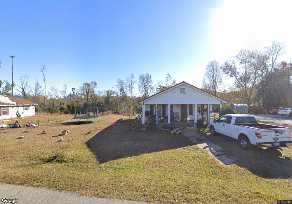
71 1st Ave West Point, GA 31833
Estimated Value: $96,000 - $127,000
3
Beds
1
Bath
1,316
Sq Ft
$85/Sq Ft
Est. Value
About This Home
This home is located at 71 1st Ave, West Point, GA 31833 and is currently estimated at $112,483, approximately $85 per square foot. 71 1st Ave is a home located in Troup County with nearby schools including West Point Elementary School, Long Cane Elementary School, and Berta Weathersbee Elementary School.
Ownership History
Date
Name
Owned For
Owner Type
Purchase Details
Closed on
May 1, 2017
Sold by
Brumfield Francis W
Bought by
Manley Crimson Nichole
Current Estimated Value
Home Financials for this Owner
Home Financials are based on the most recent Mortgage that was taken out on this home.
Original Mortgage
$47,130
Outstanding Balance
$38,812
Interest Rate
3.75%
Mortgage Type
FHA
Estimated Equity
$73,671
Purchase Details
Closed on
Mar 25, 1992
Sold by
Brumfield Francis W Etal
Bought by
Brumfeild Tracey
Purchase Details
Closed on
Aug 27, 1990
Sold by
Hollis Elijah D
Bought by
Brumfield Francis W Etal
Purchase Details
Closed on
Jul 1, 1943
Sold by
Winston Jessie Miss
Bought by
Hollis Elijah D
Create a Home Valuation Report for This Property
The Home Valuation Report is an in-depth analysis detailing your home's value as well as a comparison with similar homes in the area
Home Values in the Area
Average Home Value in this Area
Purchase History
| Date | Buyer | Sale Price | Title Company |
|---|---|---|---|
| Manley Crimson Nichole | $48,000 | -- | |
| Brumfeild Tracey | -- | -- | |
| Brumfield Francis W Etal | $24,500 | -- | |
| Hollis Elijah D | -- | -- |
Source: Public Records
Mortgage History
| Date | Status | Borrower | Loan Amount |
|---|---|---|---|
| Open | Manley Crimson Nichole | $47,130 |
Source: Public Records
Tax History Compared to Growth
Tax History
| Year | Tax Paid | Tax Assessment Tax Assessment Total Assessment is a certain percentage of the fair market value that is determined by local assessors to be the total taxable value of land and additions on the property. | Land | Improvement |
|---|---|---|---|---|
| 2024 | $779 | $28,580 | $3,560 | $25,020 |
| 2023 | $514 | $18,828 | $3,560 | $15,268 |
| 2022 | $757 | $27,108 | $3,560 | $23,548 |
| 2021 | $674 | $22,340 | $2,200 | $20,140 |
| 2020 | $674 | $22,340 | $2,200 | $20,140 |
| 2019 | $669 | $22,172 | $2,200 | $19,972 |
| 2018 | $579 | $20,348 | $2,200 | $18,148 |
| 2017 | $626 | $20,748 | $2,200 | $18,548 |
| 2016 | $608 | $20,174 | $2,220 | $17,954 |
| 2015 | $609 | $20,174 | $2,220 | $17,954 |
| 2014 | $582 | $19,230 | $2,220 | $17,010 |
| 2013 | -- | $20,519 | $2,220 | $18,299 |
Source: Public Records
Map
Nearby Homes
- 1599 Highway 29
- 0 Ga Highway 0116 Unit 10619139
- 1903 Ridgewood Dr
- 508 Pine St
- 1505 Wisteria Dr
- 0 Sunset Dr Unit 10451831
- 1008 E 12th St
- 1410 Roper Ave
- 1314 4th Ave
- 4517 Georgia 18
- 4509 Georgia 18
- 4523 Georgia 18
- 4527 Georgia 18
- 0 Arrowhead Dr Unit 10451860
- 713 Avenue H
- 1007 4th Ave
- 111 Tudor Way
- 804 E 6th St
- 509 Cleveland St
- 1095 County Road 212
- 25 1st Ave
- 16 1st Ave
- 24 1st Ave
- 7877 Westpoint Rd
- 7877 Westpoint Rd
- 36 1st Ave
- 37 1st Ave
- 7893 Westpoint Rd
- 46 1st Ave
- 7837 Westpoint Rd
- 54 1st Ave
- 7901 Westpoint Rd
- 7868 W Point Rd
- 7868 Westpoint Rd
- 45 1st Ave
- 236 Samples Rd
- 7827 Westpoint Rd
- 0 W Point Rd Unit 18 8278524
- 7890 Westpoint Rd
- 7915 Westpoint Rd