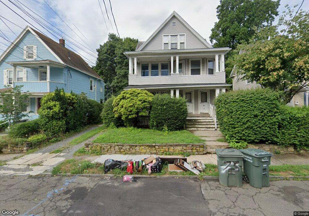
71-73 Morehouse St Unit 2nd Floor Bridgeport, CT 06605
Black Rock NeighborhoodEstimated Value: $539,374 - $746,000
6
Beds
3
Baths
3,319
Sq Ft
$189/Sq Ft
Est. Value
About This Home
This home is located at 71-73 Morehouse St Unit 2nd Floor, Bridgeport, CT 06605 and is currently estimated at $628,094, approximately $189 per square foot. 71-73 Morehouse St Unit 2nd Floor is a home located in Fairfield County with nearby schools including Holland Hill Elementary, Fairfield Ludlowe High School, and St. Ann Campus - Catholic Academy of Bridgeport.
Ownership History
Date
Name
Owned For
Owner Type
Purchase Details
Closed on
Sep 1, 2006
Sold by
Mceldowney Ralph
Bought by
Tantz-Sell Robert
Current Estimated Value
Home Financials for this Owner
Home Financials are based on the most recent Mortgage that was taken out on this home.
Original Mortgage
$300,000
Interest Rate
6.83%
Purchase Details
Closed on
Jan 28, 1988
Sold by
Clara Baksay Trusts
Bought by
Mceldowney Ralph
Create a Home Valuation Report for This Property
The Home Valuation Report is an in-depth analysis detailing your home's value as well as a comparison with similar homes in the area
Home Values in the Area
Average Home Value in this Area
Purchase History
| Date | Buyer | Sale Price | Title Company |
|---|---|---|---|
| Tantz-Sell Robert | $375,000 | -- | |
| Tantz-Sell Robert | $375,000 | -- | |
| Mceldowney Ralph | $214,000 | -- |
Source: Public Records
Mortgage History
| Date | Status | Borrower | Loan Amount |
|---|---|---|---|
| Open | Mceldowney Ralph | $278,700 | |
| Closed | Mceldowney Ralph | $300,000 | |
| Previous Owner | Mceldowney Ralph | $145,000 |
Source: Public Records
Tax History Compared to Growth
Tax History
| Year | Tax Paid | Tax Assessment Tax Assessment Total Assessment is a certain percentage of the fair market value that is determined by local assessors to be the total taxable value of land and additions on the property. | Land | Improvement |
|---|---|---|---|---|
| 2025 | $12,537 | $288,530 | $114,160 | $174,370 |
| 2024 | $12,537 | $288,530 | $114,160 | $174,370 |
| 2023 | $12,537 | $288,530 | $114,160 | $174,370 |
| 2022 | $12,537 | $288,530 | $114,160 | $174,370 |
| 2021 | $12,537 | $288,530 | $114,160 | $174,370 |
| 2020 | $11,411 | $211,360 | $74,100 | $137,260 |
| 2019 | $11,411 | $211,360 | $74,100 | $137,260 |
| 2018 | $11,492 | $211,360 | $74,100 | $137,260 |
| 2017 | $11,492 | $211,360 | $74,100 | $137,260 |
| 2016 | $11,492 | $211,360 | $74,100 | $137,260 |
| 2015 | $10,455 | $247,760 | $62,270 | $185,490 |
| 2014 | $10,455 | $247,760 | $62,270 | $185,490 |
Source: Public Records
Map
Nearby Homes
- 105 Fox St Unit 107
- 450 Davidson St
- 165 Bennett St
- 39 Jetland Place Unit 41
- 855 Brewster St Unit 857
- 554 Brewster St Unit 4
- 166 Alfred St
- 51 Princeton St
- 37 Rowsley St Unit 6
- 20 Haddon St Unit 5
- 26 Rowsley St Unit 3
- 75 Homestead Ave Unit 77
- 317 Brewster St
- 167 Scofield Ave
- 222 Ellsworth St
- 361 Riverside Dr
- 82 Waldorf Ave
- 2180 Kings Hwy Unit 1
- 135 Whittier St
- 31 Whittier St
- 71 Morehouse St Unit 73
- 73 Morehouse St Unit 2
- 73 Morehouse St
- 63 Morehouse St
- 81 Morehouse St
- 57 Morehouse St Unit 59
- 65 Morehouse St Unit 2ND
- 65 Morehouse St Unit 2
- 65 Morehouse St Unit 2 & 3
- 65 Morehouse St
- 91 Morehouse St Unit 95
- 59 Morehouse St
- 380 Davidson St
- 388 Davidson St Unit 1
- 388 Davidson St Unit 390
- 370 Davidson St
- 53 Morehouse St Unit 55
- 410 Davidson St Unit 412
- 390 Davidson St Unit 3
- 103 Morehouse St