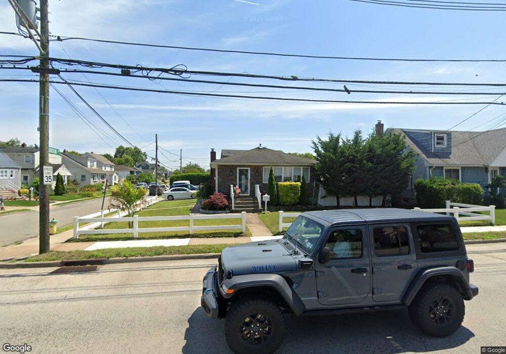
71 Atlantic Ave Freeport, NY 11520
Estimated Value: $537,000 - $583,568
Studio
1
Bath
1,087
Sq Ft
$515/Sq Ft
Est. Value
About This Home
This home is located at 71 Atlantic Ave, Freeport, NY 11520 and is currently estimated at $560,284, approximately $515 per square foot. 71 Atlantic Ave is a home located in Nassau County with nearby schools including Columbus Avenue School, Caroline G. Atkinson Intermediate School, and John W Dodd Middle School.
Ownership History
Date
Name
Owned For
Owner Type
Purchase Details
Closed on
Feb 24, 2017
Sold by
Suarez Alejandro
Bought by
Ramirez Jorge A
Current Estimated Value
Home Financials for this Owner
Home Financials are based on the most recent Mortgage that was taken out on this home.
Original Mortgage
$247,939
Outstanding Balance
$207,462
Interest Rate
4.5%
Mortgage Type
FHA
Estimated Equity
$352,822
Purchase Details
Closed on
Jul 27, 2009
Sold by
Ramirez Jorge A
Bought by
Suarez Alejandro
Home Financials for this Owner
Home Financials are based on the most recent Mortgage that was taken out on this home.
Original Mortgage
$274,928
Interest Rate
5.47%
Mortgage Type
Purchase Money Mortgage
Purchase Details
Closed on
Sep 29, 1997
Create a Home Valuation Report for This Property
The Home Valuation Report is an in-depth analysis detailing your home's value as well as a comparison with similar homes in the area
Home Values in the Area
Average Home Value in this Area
Purchase History
| Date | Buyer | Sale Price | Title Company |
|---|---|---|---|
| Ramirez Jorge A | $256,500 | First American Title Insuran | |
| Suarez Alejandro | $280,000 | -- | |
| -- | -- | -- |
Source: Public Records
Mortgage History
| Date | Status | Borrower | Loan Amount |
|---|---|---|---|
| Open | Ramirez Jorge A | $247,939 | |
| Previous Owner | Suarez Alejandro | $274,928 |
Source: Public Records
Tax History
| Year | Tax Paid | Tax Assessment Tax Assessment Total Assessment is a certain percentage of the fair market value that is determined by local assessors to be the total taxable value of land and additions on the property. | Land | Improvement |
|---|---|---|---|---|
| 2025 | $7,439 | $349 | $156 | $193 |
| 2024 | $757 | $349 | $156 | $193 |
Source: Public Records
Map
Nearby Homes
- 51 Atlantic Ave
- 41 Atlantic Ave
- 21 Stillwell Place
- 120 Sportsmans Ave
- 121 Garfield St
- 130 Gordon Place
- 159 Southside Ave
- 96 East Ave
- 252 Arthur St
- 5 Sportsmans Ave
- 18 Halsey St
- 308 Bedell St
- 177 Sportsmans Ave
- 280 Guy Lombardo Ave Unit 2H
- 280 Guy Lombardo Ave Unit 3D
- 61 East Ave
- 175 Archer St Unit 1C
- 175 Archer St Unit 3A
- 47 East Ave
- 176 Gordon Place
- 75 Atlantic Ave
- 44 Gordon Place
- 79 Atlantic Ave
- 61 Atlantic Ave
- 41 Gordon Place
- 52 Gordon Place
- 45 Gordon Place
- 57 Hayes St
- 87 Atlantic Ave
- 47 Gordon Place
- 70 Atlantic Ave
- 54 Gordon Place
- 61 Hayes St
- 55 Gordon Place
- 55 Atlantic Ave
- 74 Atlantic Ave
- 62 Gordon Place
- 88 Atlantic Ave
- 60 Atlantic Ave
- 69 Hayes St
Your Personal Tour Guide
Ask me questions while you tour the home.