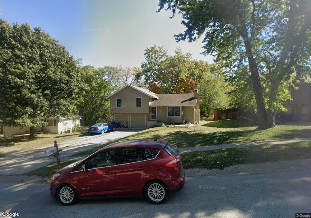
71 Beauregarde Cir Liberty, MO 64068
Estimated Value: $241,297 - $269,000
3
Beds
2
Baths
1,096
Sq Ft
$232/Sq Ft
Est. Value
About This Home
This home is located at 71 Beauregarde Cir, Liberty, MO 64068 and is currently estimated at $254,574, approximately $232 per square foot. 71 Beauregarde Cir is a home located in Clay County with nearby schools including Manor Hill Elementary School, Liberty Middle School, and Liberty High School.
Ownership History
Date
Name
Owned For
Owner Type
Purchase Details
Closed on
Oct 14, 2005
Sold by
Marr Melissa A and Marr Daniel A
Bought by
Marr Daniel A and Marr Melissa A
Current Estimated Value
Home Financials for this Owner
Home Financials are based on the most recent Mortgage that was taken out on this home.
Original Mortgage
$123,500
Interest Rate
5.69%
Mortgage Type
Stand Alone Refi Refinance Of Original Loan
Purchase Details
Closed on
Nov 15, 2002
Sold by
Wohler Richard
Bought by
Wohler Melissa
Home Financials for this Owner
Home Financials are based on the most recent Mortgage that was taken out on this home.
Original Mortgage
$19,625
Interest Rate
9%
Mortgage Type
Seller Take Back
Create a Home Valuation Report for This Property
The Home Valuation Report is an in-depth analysis detailing your home's value as well as a comparison with similar homes in the area
Home Values in the Area
Average Home Value in this Area
Purchase History
| Date | Buyer | Sale Price | Title Company |
|---|---|---|---|
| Marr Daniel A | -- | Titleamerica Inc | |
| Wohler Melissa | -- | -- |
Source: Public Records
Mortgage History
| Date | Status | Borrower | Loan Amount |
|---|---|---|---|
| Closed | Marr Daniel A | $123,500 | |
| Closed | Wohler Melissa | $19,625 |
Source: Public Records
Tax History
| Year | Tax Paid | Tax Assessment Tax Assessment Total Assessment is a certain percentage of the fair market value that is determined by local assessors to be the total taxable value of land and additions on the property. | Land | Improvement |
|---|---|---|---|---|
| 2025 | $2,052 | $30,310 | -- | -- |
| 2024 | $2,052 | $26,680 | -- | -- |
| 2023 | $2,087 | $26,680 | $0 | $0 |
| 2022 | $1,925 | $24,300 | $0 | $0 |
| 2021 | $1,910 | $24,301 | $5,320 | $18,981 |
| 2020 | $1,901 | $22,710 | $0 | $0 |
| 2019 | $1,900 | $22,710 | $0 | $0 |
| 2018 | $1,693 | $19,860 | $0 | $0 |
| 2017 | $1,677 | $19,860 | $3,420 | $16,440 |
| 2016 | $1,677 | $19,860 | $3,420 | $16,440 |
| 2015 | $1,677 | $19,860 | $3,420 | $16,440 |
| 2014 | $1,559 | $18,320 | $3,420 | $14,900 |
Source: Public Records
Map
Nearby Homes
- 1705 Johnston St
- 409 Lilly Ln
- 813 S Main St
- 516 Sharon Dr
- 408 W Murray Rd
- 339 S Missouri St
- 1516 Glen Brook Ln
- 1505 Ashton Dr
- 822 Sherrill Ave
- 1515 Trumpet Ct
- 2600 Magnolia Ave
- 823 Reed St
- 336 Georgia Ct
- 904 Paw Ln
- 1829 White Tail Ln
- 441 Spring Ave
- 29 Fulkerson Cir
- 114 S Jewell St
- 53 Fulkerson Cir
- 324 Harrison St
Your Personal Tour Guide
Ask me questions while you tour the home.