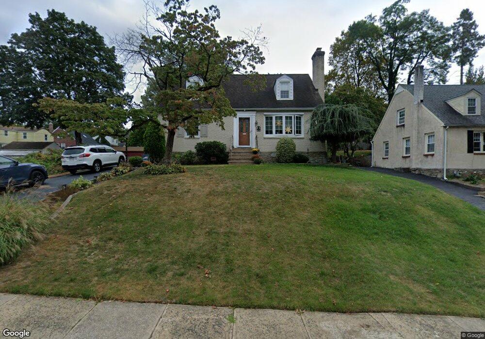
71 Bonsall Ave Broomall, PA 19008
Marple Township Delaware NeighborhoodEstimated Value: $503,000 - $599,000
3
Beds
2
Baths
1,764
Sq Ft
$317/Sq Ft
Est. Value
About This Home
This home is located at 71 Bonsall Ave, Broomall, PA 19008 and is currently estimated at $558,398, approximately $316 per square foot. 71 Bonsall Ave is a home located in Delaware County with nearby schools including Russell Elementary School, Paxon Hollow Middle School, and Marple Newtown Senior High School.
Ownership History
Date
Name
Owned For
Owner Type
Purchase Details
Closed on
Jul 5, 2001
Sold by
Farrell Michael R
Bought by
Digiannantonio Claudio and Digiannantonio Wendi
Current Estimated Value
Home Financials for this Owner
Home Financials are based on the most recent Mortgage that was taken out on this home.
Original Mortgage
$161,029
Outstanding Balance
$62,327
Interest Rate
7.2%
Mortgage Type
FHA
Estimated Equity
$496,071
Purchase Details
Closed on
Jan 15, 1997
Sold by
Kelly Brian M and Kelly Carol L
Bought by
Farrell Michael R
Home Financials for this Owner
Home Financials are based on the most recent Mortgage that was taken out on this home.
Original Mortgage
$128,000
Interest Rate
7.11%
Mortgage Type
Purchase Money Mortgage
Create a Home Valuation Report for This Property
The Home Valuation Report is an in-depth analysis detailing your home's value as well as a comparison with similar homes in the area
Home Values in the Area
Average Home Value in this Area
Purchase History
| Date | Buyer | Sale Price | Title Company |
|---|---|---|---|
| Digiannantonio Claudio | $164,000 | Commonwealth Land Title Ins | |
| Farrell Michael R | $160,000 | -- |
Source: Public Records
Mortgage History
| Date | Status | Borrower | Loan Amount |
|---|---|---|---|
| Open | Digiannantonio Claudio | $161,029 | |
| Previous Owner | Farrell Michael R | $128,000 |
Source: Public Records
Tax History Compared to Growth
Tax History
| Year | Tax Paid | Tax Assessment Tax Assessment Total Assessment is a certain percentage of the fair market value that is determined by local assessors to be the total taxable value of land and additions on the property. | Land | Improvement |
|---|---|---|---|---|
| 2025 | $5,621 | $325,280 | $116,470 | $208,810 |
| 2024 | $5,621 | $325,280 | $116,470 | $208,810 |
| 2023 | $5,443 | $325,280 | $116,470 | $208,810 |
| 2022 | $5,340 | $325,280 | $116,470 | $208,810 |
| 2021 | $8,059 | $325,280 | $116,470 | $208,810 |
| 2020 | $4,432 | $154,000 | $57,470 | $96,530 |
| 2019 | $4,378 | $154,000 | $57,470 | $96,530 |
| 2018 | $4,333 | $154,000 | $0 | $0 |
| 2017 | $4,335 | $154,000 | $0 | $0 |
| 2016 | $845 | $154,000 | $0 | $0 |
| 2015 | $845 | $154,000 | $0 | $0 |
| 2014 | $845 | $154,000 | $0 | $0 |
Source: Public Records
Map
Nearby Homes
- 2604 Cynwyd Ave
- Lot 2 Cynwyd
- Lot1 Cynwyd
- 2839 Springfield Rd
- 50 Schoolhouse Ln
- 117 Bella Dr Unit 3AD
- 119 Bella Dr Unit 2MD
- 15 Oakland Rd
- 115 Newby Dr
- 12 Lincoln Ln
- 2025 S Sproul Rd
- 106 2nd Ave
- 132 S Sproul Rd
- 88 4th Ave
- 126 1st Ave
- 202 Rolling Rd
- 2606 Springfield Rd
- 31 Barren Rd
- 63 S Greenhill Rd
- 202 Barren Rd
- 69 Bonsall Ave
- 2650 Summit Ave
- 2639 Cynwyd Ave
- 70 Bonsall Ave
- 68 Bonsall Ave
- 2637 Cynwyd Ave
- 2635 Cynwyd Ave
- 2648 Summit Ave
- 72 Bonsall Ave
- 66 Bonsall Ave
- 2633 Cynwyd Ave
- 74 Bonsall Ave
- 64 Bonsall Ave
- 2646 Summit Ave
- 2631 Cynwyd Ave
- 2644 Summit Ave
- 2661 Summit Ave
- 62 Bonsall Ave
- 60 Bonsall Ave
- 2659 Summit Ave