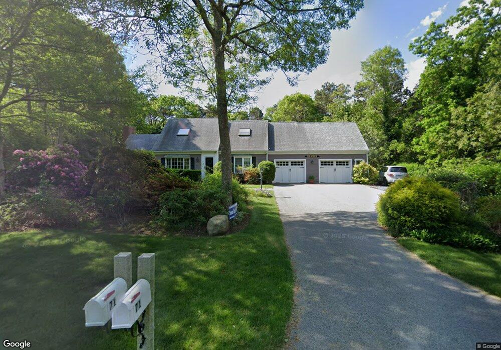
71 Brentwood Dr Yarmouth Port, MA 02675
Barnstable Village NeighborhoodEstimated Value: $789,000 - $937,000
3
Beds
3
Baths
1,908
Sq Ft
$452/Sq Ft
Est. Value
About This Home
This home is located at 71 Brentwood Dr, Yarmouth Port, MA 02675 and is currently estimated at $863,298, approximately $452 per square foot. 71 Brentwood Dr is a home located in Barnstable County with nearby schools including West Barnstable Elementary School, Barnstable United Elementary School, and Barnstable Intermediate School.
Ownership History
Date
Name
Owned For
Owner Type
Purchase Details
Closed on
Jul 17, 2009
Sold by
Meadows Louis W and Meadows Katherine W
Bought by
Kramer Michael J
Current Estimated Value
Home Financials for this Owner
Home Financials are based on the most recent Mortgage that was taken out on this home.
Original Mortgage
$260,000
Outstanding Balance
$169,693
Interest Rate
5.31%
Mortgage Type
Purchase Money Mortgage
Estimated Equity
$693,605
Create a Home Valuation Report for This Property
The Home Valuation Report is an in-depth analysis detailing your home's value as well as a comparison with similar homes in the area
Home Values in the Area
Average Home Value in this Area
Purchase History
| Date | Buyer | Sale Price | Title Company |
|---|---|---|---|
| Kramer Michael J | $405,000 | -- |
Source: Public Records
Mortgage History
| Date | Status | Borrower | Loan Amount |
|---|---|---|---|
| Open | Kramer Michael J | $260,000 |
Source: Public Records
Tax History Compared to Growth
Tax History
| Year | Tax Paid | Tax Assessment Tax Assessment Total Assessment is a certain percentage of the fair market value that is determined by local assessors to be the total taxable value of land and additions on the property. | Land | Improvement |
|---|---|---|---|---|
| 2025 | $7,058 | $763,900 | $203,900 | $560,000 |
| 2024 | $6,407 | $731,400 | $203,900 | $527,500 |
| 2023 | $6,019 | $670,300 | $201,600 | $468,700 |
| 2022 | $6,009 | $538,400 | $143,700 | $394,700 |
| 2021 | $1,377 | $485,200 | $143,700 | $341,500 |
| 2020 | $5,828 | $475,400 | $153,000 | $322,400 |
| 2019 | $5,380 | $440,300 | $153,000 | $287,300 |
| 2018 | $5,272 | $419,100 | $167,800 | $251,300 |
| 2017 | $5,090 | $407,200 | $167,800 | $239,400 |
| 2016 | $5,068 | $411,000 | $171,600 | $239,400 |
| 2015 | $4,748 | $392,100 | $162,000 | $230,100 |
Source: Public Records
Map
Nearby Homes
- 92 Brentwood Ln
- 92 Brentwood Dr
- 41 Dromoland Ln
- 44 Iris Ln
- 65 Oakmont Rd
- 294 Salt Rock Rd
- 67 Spy Glass Hill Rd
- 17 Indian Trail
- 30 Indian Trail
- 21 Indian Trail
- 83 Sisters Cir
- 83 Sisters Cir
- 81 Desert Sands Ln
- 33 Midpine Rd
- 25 Congressional Dr
- 240 Braggs Ln
- 4390 Main St
- 99 Old Hyannis Rd
- 3528 Main St
- 111 Old Hyannis Rd
- 61 Brentwood Dr
- 55 Brentwood Ln
- 55 Brentwood Dr
- 76 Brentwood Dr
- 89 Brentwood Dr
- 46 Brentwood Dr
- 45 Brentwood Dr
- 105 Brentwood Dr
- 14 Brentwood Ln
- 37 Brentwood Ln
- 14 Brentwood
- 14 Brentwood Dr
- 130 Brentwood Dr
- 115 Brentwood Dr
- 115 Brentwood Ln
- 37 Brentwood Dr
- 125 Althea Dr
- 19 Brentwood Dr
- 140 Brentwood Ln
- 140 Brentwood Dr