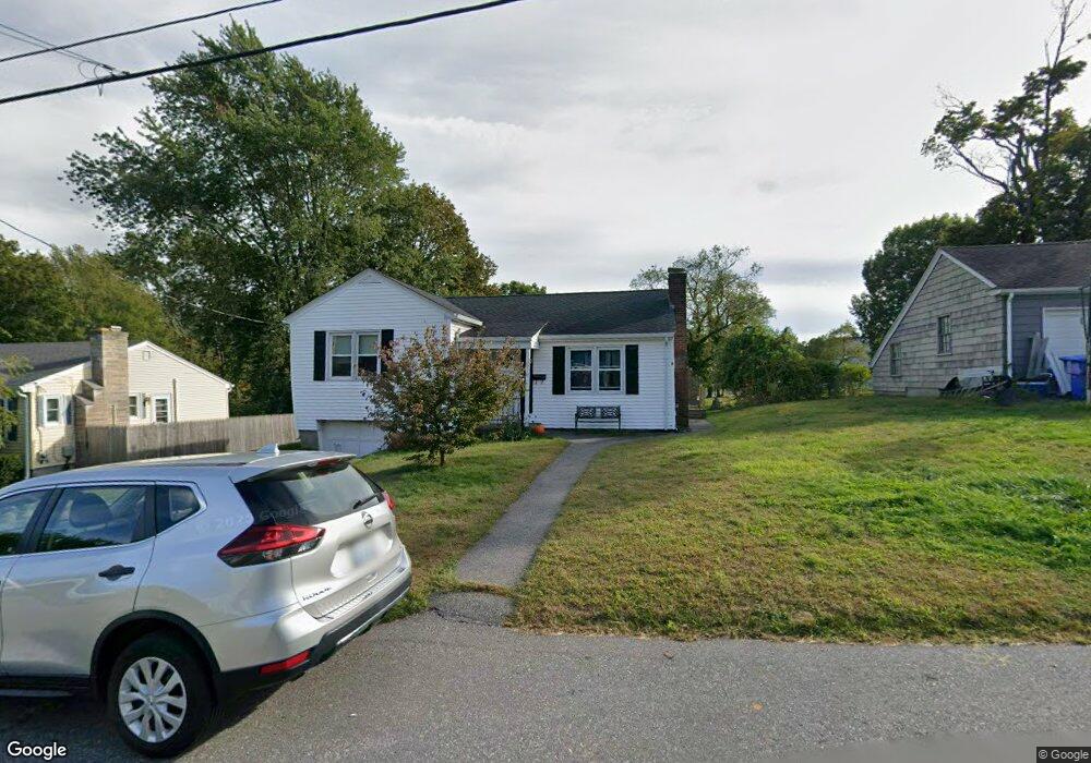
71 Brookfield Rd Riverside, RI 02915
Kent Heights NeighborhoodEstimated Value: $481,000 - $529,506
3
Beds
2
Baths
1,860
Sq Ft
$271/Sq Ft
Est. Value
About This Home
This home is located at 71 Brookfield Rd, Riverside, RI 02915 and is currently estimated at $503,627, approximately $270 per square foot. 71 Brookfield Rd is a home located in Providence County with nearby schools including East Providence High School, St Mary Academy-Bay View, and The Gordon School.
Ownership History
Date
Name
Owned For
Owner Type
Purchase Details
Closed on
Sep 28, 2001
Sold by
Loffredo Vincent C and Loffredo Steven
Bought by
Jennings Robert and Jennings Laura
Current Estimated Value
Purchase Details
Closed on
Jul 1, 1991
Sold by
Azevedo Frank R
Bought by
Greaves Scott D
Create a Home Valuation Report for This Property
The Home Valuation Report is an in-depth analysis detailing your home's value as well as a comparison with similar homes in the area
Home Values in the Area
Average Home Value in this Area
Purchase History
| Date | Buyer | Sale Price | Title Company |
|---|---|---|---|
| Jennings Robert | $134,000 | -- | |
| Greaves Scott D | $110,000 | -- | |
| Jennings Robert | $134,000 | -- | |
| Greaves Scott D | $110,000 | -- |
Source: Public Records
Mortgage History
| Date | Status | Borrower | Loan Amount |
|---|---|---|---|
| Open | Greaves Scott D | $60,000 | |
| Open | Greaves Scott D | $115,500 | |
| Closed | Greaves Scott D | $60,000 |
Source: Public Records
Tax History
| Year | Tax Paid | Tax Assessment Tax Assessment Total Assessment is a certain percentage of the fair market value that is determined by local assessors to be the total taxable value of land and additions on the property. | Land | Improvement |
|---|---|---|---|---|
| 2025 | $6,434 | $492,300 | $177,600 | $314,700 |
| 2024 | $6,753 | $440,500 | $148,000 | $292,500 |
| 2023 | $6,502 | $440,500 | $148,000 | $292,500 |
| 2022 | $6,547 | $299,500 | $93,600 | $205,900 |
| 2021 | $6,439 | $299,500 | $92,300 | $207,200 |
| 2020 | $6,167 | $299,500 | $92,300 | $207,200 |
| 2019 | $5,996 | $299,500 | $92,300 | $207,200 |
| 2018 | $5,656 | $247,200 | $71,600 | $175,600 |
| 2017 | $5,530 | $247,200 | $71,600 | $175,600 |
| 2016 | $5,503 | $247,200 | $71,600 | $175,600 |
| 2015 | $5,251 | $228,800 | $66,300 | $162,500 |
| 2014 | $5,251 | $228,800 | $66,300 | $162,500 |
Source: Public Records
Map
Nearby Homes
- 2941 Pawtucket Ave
- 14 Waterview Ave Unit 16
- 53 Wampanoag Trail
- 34 Commack Rd
- 50 Kettle Point Ave Unit 50
- 106 Wannamoisett Rd
- 6 Fuller Ave
- 25 Bullocks Point Ave Unit 5C
- 33 Bullocks Point Ave Unit 5C
- 43 Bullocks Point Ave Unit 4A
- 29 Ide Ave
- 74 Brookhaven Dr
- 151 Dover Ave
- 151 Willett Ave Unit 2
- 26 Callender Ave
- 25 Arnold St
- 158 S Rose St
- 191 S Spruce St
- 28 Jefferson Ave
- 103 Burnside Ave
- 75 Brookfield Rd
- 53 Brookfield Rd
- 79 Brookfield Rd
- 60 Brookfield Rd
- 83 Brookfield Rd
- 50 Brookfield Rd
- 45 Brookfield Rd
- 80 Brookfield Rd
- 40 Brookfield Rd
- 89 Brookfield Rd
- 35 Brookfield Rd
- 88 Brookfield Rd
- 36 Brookfield Rd Unit 38
- 96 Brookfield Rd
- 95 Brookfield Rd
- 26 Brookfield Rd
- 19 Brookfield Rd
- 104 Brookfield Rd
- 71 Merritt Rd
- 115 Brookfield Rd
Your Personal Tour Guide
Ask me questions while you tour the home.