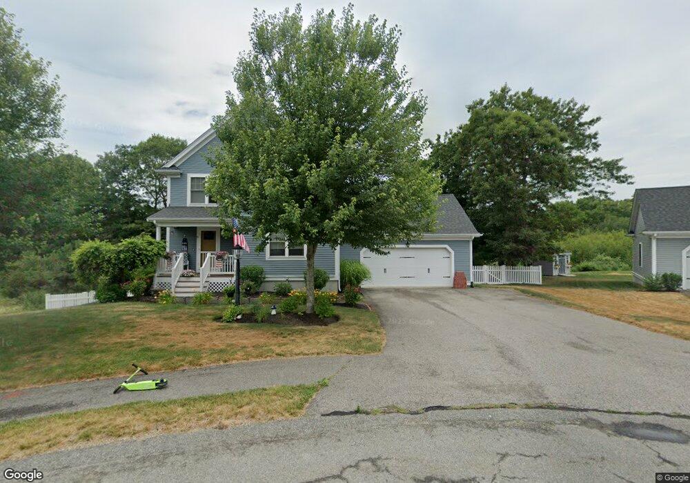
71 Christmas Tree Ln Kingston, MA 02364
Estimated Value: $675,000 - $748,000
3
Beds
3
Baths
1,636
Sq Ft
$438/Sq Ft
Est. Value
About This Home
This home is located at 71 Christmas Tree Ln, Kingston, MA 02364 and is currently estimated at $716,115, approximately $437 per square foot. 71 Christmas Tree Ln is a home with nearby schools including Kingston Elementary School, Silver Lake Regional High School, and Kingston Intermediate School.
Ownership History
Date
Name
Owned For
Owner Type
Purchase Details
Closed on
Aug 3, 2017
Sold by
William J Chase Ret
Bought by
Fox William R and Fox Cheri J
Current Estimated Value
Home Financials for this Owner
Home Financials are based on the most recent Mortgage that was taken out on this home.
Original Mortgage
$359,100
Outstanding Balance
$297,709
Interest Rate
3.9%
Mortgage Type
New Conventional
Estimated Equity
$418,406
Create a Home Valuation Report for This Property
The Home Valuation Report is an in-depth analysis detailing your home's value as well as a comparison with similar homes in the area
Home Values in the Area
Average Home Value in this Area
Purchase History
| Date | Buyer | Sale Price | Title Company |
|---|---|---|---|
| Fox William R | $423,300 | -- |
Source: Public Records
Mortgage History
| Date | Status | Borrower | Loan Amount |
|---|---|---|---|
| Open | Fox William R | $359,100 |
Source: Public Records
Tax History
| Year | Tax Paid | Tax Assessment Tax Assessment Total Assessment is a certain percentage of the fair market value that is determined by local assessors to be the total taxable value of land and additions on the property. | Land | Improvement |
|---|---|---|---|---|
| 2025 | $8,132 | $627,000 | $198,900 | $428,100 |
| 2024 | $7,521 | $591,700 | $198,900 | $392,800 |
| 2023 | $7,213 | $539,900 | $198,900 | $341,000 |
| 2022 | $6,921 | $474,700 | $176,300 | $298,400 |
| 2021 | $7,030 | $437,200 | $163,300 | $273,900 |
| 2020 | $6,955 | $427,200 | $163,300 | $263,900 |
| 2019 | $6,811 | $413,800 | $163,300 | $250,500 |
| 2018 | $4,313 | $262,200 | $163,300 | $98,900 |
| 2017 | $2,615 | $158,500 | $158,500 | $0 |
| 2016 | $549 | $31,200 | $31,200 | $0 |
| 2015 | $529 | $31,200 | $31,200 | $0 |
| 2014 | $520 | $31,200 | $31,200 | $0 |
Source: Public Records
Map
Nearby Homes
- 0 Spring St
- 3 Alec Ln
- 6 Twin Pines Ln Unit 6
- 14 Mariner's Way Unit 14
- 122 High St
- 1 Mariner's Way Unit 309
- 2 Mariner's Way Unit 306
- 62 Mariners Way Unit 305
- 6 Sterling Blvd Unit 6
- 19 Roosevelt Rd
- 28 Brook St
- 24 Jamies Path
- 6 Stone Gate Dr
- 91 Monks Hill Rd
- 19 Coachman Terrace
- 144 Industrial Park Rd
- 17 Lydia Dr
- 412 Elm St
- 6 Deer Hill Ln
- 16 Filmore St
- 67 Christmas Tree Ln
- 78 Christmas Tree Ln
- 63 Christmas Tree Ln
- 70 Christmas Tree Ln
- 59 Christmas Tree Ln
- 74 Christmas Tree Ln
- 66 Christmas Tree Ln
- 58 Christmas Tree Ln
- 51 Christmas Tree Ln
- 54 Christmas Tree Ln
- 19 Sapling Cir
- 15 Sapling Cir
- 11 Sapling Cir
- 26 Sapling Cir
- 22 Sapling Cir
- 43 Christmas Tree Ln
- 10 Sapling Cir
- 14 Sapling Cir
- 183 Parting Ways Rd
- 42 Christmas Tree Ln