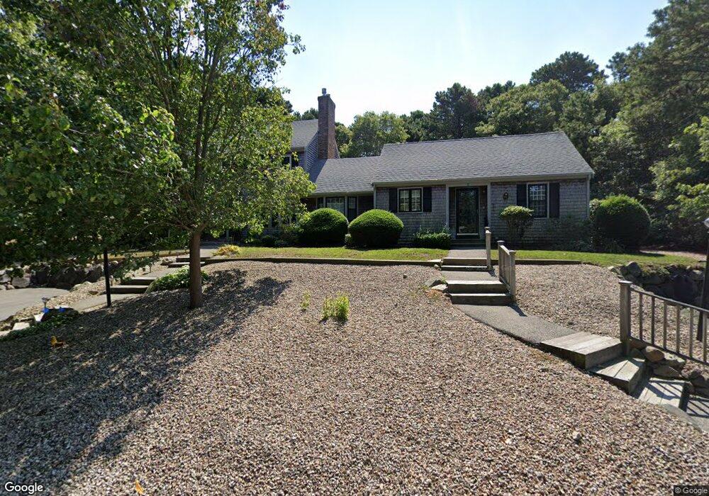
71 Debs Hill Rd Yarmouth Port, MA 02675
Yarmouth Port NeighborhoodEstimated Value: $450,000 - $589,000
2
Beds
3
Baths
1,170
Sq Ft
$428/Sq Ft
Est. Value
About This Home
This home is located at 71 Debs Hill Rd, Yarmouth Port, MA 02675 and is currently estimated at $500,315, approximately $427 per square foot. 71 Debs Hill Rd is a home located in Barnstable County with nearby schools including Dennis-Yarmouth Regional High School and St. Pius X. School.
Ownership History
Date
Name
Owned For
Owner Type
Purchase Details
Closed on
Dec 15, 2021
Sold by
Lipp Peter E
Bought by
Peter E Lipp T E and Peter Lipp
Current Estimated Value
Purchase Details
Closed on
Jul 5, 2011
Sold by
Boyle Michele E Est and Boyle
Bought by
Lipp Peter E and Lipp Joan F
Purchase Details
Closed on
Sep 10, 2003
Sold by
Currie Daniel P and Currie Marianne
Bought by
Boyle Michele E
Home Financials for this Owner
Home Financials are based on the most recent Mortgage that was taken out on this home.
Original Mortgage
$210,800
Interest Rate
6.22%
Mortgage Type
Purchase Money Mortgage
Purchase Details
Closed on
Jun 1, 1995
Sold by
Nightingale William H and Nightingale Donna
Bought by
Currie Daniel P and Currie Marianne
Create a Home Valuation Report for This Property
The Home Valuation Report is an in-depth analysis detailing your home's value as well as a comparison with similar homes in the area
Home Values in the Area
Average Home Value in this Area
Purchase History
| Date | Buyer | Sale Price | Title Company |
|---|---|---|---|
| Peter E Lipp T E | -- | None Available | |
| Lipp Peter E | $250,000 | -- | |
| Boyle Michele E | $264,000 | -- | |
| Currie Daniel P | $117,000 | -- |
Source: Public Records
Mortgage History
| Date | Status | Borrower | Loan Amount |
|---|---|---|---|
| Previous Owner | Currie Daniel P | $195,500 | |
| Previous Owner | Currie Daniel P | $210,800 |
Source: Public Records
Tax History Compared to Growth
Tax History
| Year | Tax Paid | Tax Assessment Tax Assessment Total Assessment is a certain percentage of the fair market value that is determined by local assessors to be the total taxable value of land and additions on the property. | Land | Improvement |
|---|---|---|---|---|
| 2025 | $3,020 | $426,600 | $0 | $426,600 |
| 2024 | $3,307 | $448,100 | $0 | $448,100 |
| 2023 | $3,123 | $385,100 | $0 | $385,100 |
| 2022 | $2,537 | $276,400 | $0 | $276,400 |
| 2021 | $2,708 | $283,300 | $0 | $283,300 |
| 2020 | $2,732 | $273,200 | $0 | $273,200 |
| 2019 | $2,432 | $240,800 | $0 | $240,800 |
| 2018 | $2,396 | $232,800 | $0 | $232,800 |
| 2017 | $2,333 | $232,800 | $0 | $232,800 |
| 2016 | $2,081 | $208,500 | $0 | $208,500 |
| 2015 | $2,072 | $206,400 | $0 | $206,400 |
Source: Public Records
Map
Nearby Homes
- 16 Warren Rd Unit 16
- 16 Warren Rd
- 0 Forsyth Ave
- 209 Union St
- 4 Old Colony Way
- 1 Barnacle Rd
- 10 Upton Rd
- 882 W Yarmouth Rd
- 17 Trowbridge Path
- 29 Boxwood Cir Unit 29
- 129 Driftwood Ln
- 933-935 W Yarmouth Rd
- 111 Merchant Ave
- 50 Cottonwood St
- 118 Driftwood Ln
- 49 Captain Besse Rd
- 24 Minnetuxet Way
- 10 Balsam Way
- 21 Hazelmoor Rd
- 43 Canterbury Rd
- 69 Debs Hill Rd
- 71 Debs Hill Rd Unit 71
- 71 Debs Hill Rd Unit 71 (43B)
- 71 Debs Hill Rd Unit 43B
- 77 Debs Hill Rd
- 75 Debs Hill Rd
- 77 Debs Hill Rd Unit 29B
- 61 Debs Hill Rd
- 59 Debs Hill Rd
- 61 Debs Hill Rd Unit 42B
- 59 Debs Hill Rd Unit 42A
- 70 Debs Hill Rd
- 72 Debs Hill Rd
- 16 Thistle Cir
- 18 Thistle Cir
- 16 Thistle Cir Unit 35B
- 64 Debs Hill Rd
- 66 Debs Hill Rd
- 64 Debs Hill Rd
- 64 Debs Hill Rd Unit 43B