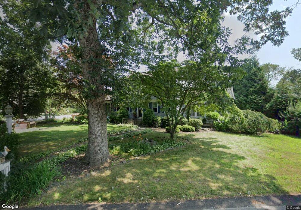
71 Donald Lewis Dr Seekonk, MA 02771
Estimated Value: $657,029 - $833,000
4
Beds
3
Baths
2,570
Sq Ft
$296/Sq Ft
Est. Value
About This Home
This home is located at 71 Donald Lewis Dr, Seekonk, MA 02771 and is currently estimated at $760,007, approximately $295 per square foot. 71 Donald Lewis Dr is a home located in Bristol County with nearby schools including Seekonk High School, Ocean State Montessori School, and St Mary Academy-Bay View.
Ownership History
Date
Name
Owned For
Owner Type
Purchase Details
Closed on
Dec 8, 2022
Sold by
Demty Nadine M
Bought by
Nadine M Demty Lt and Demty
Current Estimated Value
Purchase Details
Closed on
Jan 3, 2000
Sold by
Perry David J and Perry Donna J
Bought by
Demty Keith R and Demty Nadine M
Home Financials for this Owner
Home Financials are based on the most recent Mortgage that was taken out on this home.
Original Mortgage
$174,000
Interest Rate
7.71%
Mortgage Type
Purchase Money Mortgage
Purchase Details
Closed on
Aug 17, 1992
Sold by
Rushlow Peter J and Rushlow Eva L
Bought by
Perry David J and Perry Deborah M
Create a Home Valuation Report for This Property
The Home Valuation Report is an in-depth analysis detailing your home's value as well as a comparison with similar homes in the area
Home Values in the Area
Average Home Value in this Area
Purchase History
| Date | Buyer | Sale Price | Title Company |
|---|---|---|---|
| Nadine M Demty Lt | -- | None Available | |
| Demty Keith R | $239,000 | -- | |
| Perry David J | $127,000 | -- |
Source: Public Records
Mortgage History
| Date | Status | Borrower | Loan Amount |
|---|---|---|---|
| Previous Owner | Perry David J | $98,645 | |
| Previous Owner | Perry David J | $173,000 | |
| Previous Owner | Perry David J | $174,000 |
Source: Public Records
Tax History Compared to Growth
Tax History
| Year | Tax Paid | Tax Assessment Tax Assessment Total Assessment is a certain percentage of the fair market value that is determined by local assessors to be the total taxable value of land and additions on the property. | Land | Improvement |
|---|---|---|---|---|
| 2025 | $6,587 | $533,400 | $162,600 | $370,800 |
| 2024 | $6,311 | $511,000 | $162,600 | $348,400 |
| 2023 | $6,142 | $468,500 | $145,700 | $322,800 |
| 2022 | $5,621 | $421,400 | $145,700 | $275,700 |
| 2021 | $5,367 | $395,500 | $125,000 | $270,500 |
| 2020 | $5,002 | $379,800 | $125,000 | $254,800 |
| 2019 | $4,834 | $370,100 | $125,000 | $245,100 |
| 2018 | $4,730 | $354,300 | $125,000 | $229,300 |
| 2017 | $4,591 | $341,100 | $126,400 | $214,700 |
| 2016 | $4,248 | $316,800 | $126,400 | $190,400 |
| 2015 | $3,847 | $290,800 | $95,600 | $195,200 |
Source: Public Records
Map
Nearby Homes
- 57 Mohawk Dr
- 358 Olney St
- 31 King Philip Rd
- 454 Fall River Ave
- 147 Olney St
- 759 Fall River Ave
- 698 Fall River Ave
- 349 County St
- 25 Pimental Dr
- 42 Tee Jay Dr
- 524 County St
- 679 County St
- 420 Chestnut St
- 296 Fall River Ave
- 0 Milton St Unit 72633661
- 62 Chestnut St
- 7 Jill Ct
- 39 John Alden Rd
- 467 Forbes St
- 442 Taunton Ave
- 61 Donald Lewis Dr
- 105 Donald Lewis Dr
- 70 Donald Lewis Dr
- 4 Massasoit Dr
- 60 Donald Lewis Dr
- 51 Donald Lewis Dr
- 100 Donald Lewis Dr
- 117 Donald Lewis Dr
- 50 Donald Lewis Dr
- 112 Donald Lewis Dr
- 41 Donald Lewis Dr
- 190 Cole St
- 124 Donald Lewis Dr
- 5 Massasoit Dr
- 216 Cole St
- 19 Massasoit Dr
- 40 Donald Lewis Dr
- 60 Massasoit Dr
- 0 Cole St
- 230 Cole St