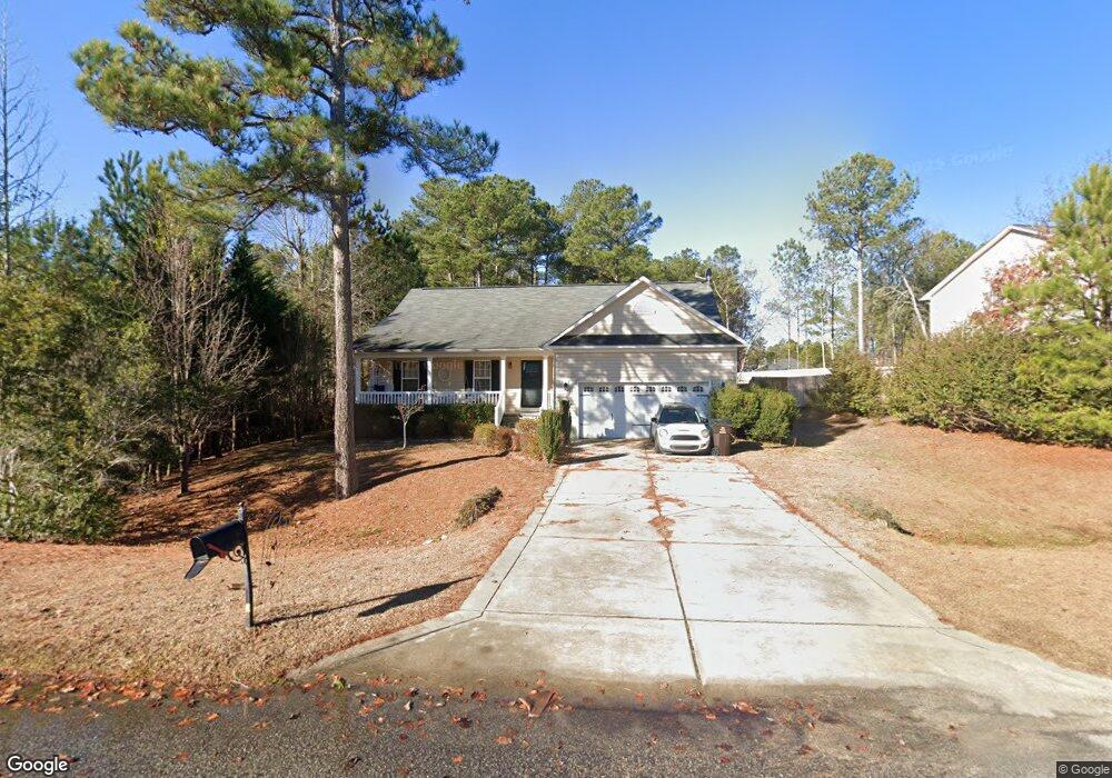
71 English Oak Dr Bunnlevel, NC 28323
Estimated Value: $311,000 - $354,000
4
Beds
3
Baths
2,227
Sq Ft
$147/Sq Ft
Est. Value
About This Home
This home is located at 71 English Oak Dr, Bunnlevel, NC 28323 and is currently estimated at $327,729, approximately $147 per square foot. 71 English Oak Dr is a home located in Harnett County with nearby schools including Anderson Creek Primary School, South Harnett Elementary School, and Western Harnett Middle School.
Ownership History
Date
Name
Owned For
Owner Type
Purchase Details
Closed on
Apr 30, 2008
Sold by
Caviness Land Development Inc
Bought by
Cox Lewis E and Cox Sarah B
Current Estimated Value
Home Financials for this Owner
Home Financials are based on the most recent Mortgage that was taken out on this home.
Original Mortgage
$188,875
Outstanding Balance
$119,238
Interest Rate
5.82%
Mortgage Type
VA
Estimated Equity
$208,491
Purchase Details
Closed on
Mar 7, 2007
Sold by
Woodshire Partners Llc
Bought by
Gaviness Land Development Inc
Create a Home Valuation Report for This Property
The Home Valuation Report is an in-depth analysis detailing your home's value as well as a comparison with similar homes in the area
Home Values in the Area
Average Home Value in this Area
Purchase History
| Date | Buyer | Sale Price | Title Company |
|---|---|---|---|
| Cox Lewis E | $185,000 | -- | |
| Gaviness Land Development Inc | $57,000 | None Available |
Source: Public Records
Mortgage History
| Date | Status | Borrower | Loan Amount |
|---|---|---|---|
| Open | Cox Lewis E | $188,875 |
Source: Public Records
Tax History Compared to Growth
Tax History
| Year | Tax Paid | Tax Assessment Tax Assessment Total Assessment is a certain percentage of the fair market value that is determined by local assessors to be the total taxable value of land and additions on the property. | Land | Improvement |
|---|---|---|---|---|
| 2025 | $1,989 | $271,655 | $0 | $0 |
| 2024 | $1,944 | $265,235 | $0 | $0 |
| 2023 | $1,944 | $265,235 | $0 | $0 |
| 2022 | $1,730 | $265,235 | $0 | $0 |
| 2021 | $1,730 | $191,280 | $0 | $0 |
| 2020 | $1,730 | $191,280 | $0 | $0 |
| 2019 | $1,715 | $191,280 | $0 | $0 |
| 2018 | $1,715 | $191,280 | $0 | $0 |
| 2017 | $1,715 | $191,280 | $0 | $0 |
| 2016 | $1,683 | $187,590 | $0 | $0 |
| 2015 | -- | $187,590 | $0 | $0 |
| 2014 | -- | $187,590 | $0 | $0 |
Source: Public Records
Map
Nearby Homes
- 159 English Oak Dr
- 225 Valley Oak Dr
- 254 Angel Oak Dr
- 352 Wood Point Dr
- 77 Teak Wood Ct
- 1009 Micahs Way N
- 112 Holly Oak Cir
- 519 Wood Point Dr
- Wayfare Plan at Creekside Oaks North
- Embark Plan at Creekside Oaks North
- Prelude Plan at Creekside Oaks North
- Freelance Plan at Creekside Oaks North
- 296 Greenbay St
- Engage Plan at Creekside Oaks North
- 1234 Micahs Way N
- 758 Micahs Way N
- 95 Silk Oak Dr
- 293 Harborwood St
- 71 English Oak Dr
- 51 English Oak Dr
- 91 English Oak Dr
- 72 English Oak Dr
- 41 English Oak Dr
- 52 English Oak Dr
- 143 English Oak Dr
- 265 Valley Oak Dr
- 42 English Oak Dr
- 21 English Oak Dr
- 159 English Oak (Lot 36) Dr
- 42 Eastwood Ct
- 95 Burr Oak Cir
- 95 Burr Oak Cir
- 158 English Oak (Lot 212) Dr
- 245 Valley Oak Dr
- 158 English Oak Dr
- 215 Valley Oak Dr
- 22 English Oak Dr
- 85 Bur Oak Ct