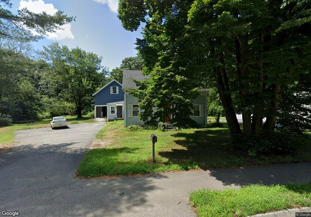
71 Ferry Rd Saco, ME 04072
East Saco NeighborhoodEstimated Value: $542,000 - $634,000
4
Beds
2
Baths
1,918
Sq Ft
$303/Sq Ft
Est. Value
About This Home
This home is located at 71 Ferry Rd, Saco, ME 04072 and is currently estimated at $581,350, approximately $303 per square foot. 71 Ferry Rd is a home located in York County with nearby schools including C K Burns School, Saco Middle School, and Saint James School.
Ownership History
Date
Name
Owned For
Owner Type
Purchase Details
Closed on
Sep 6, 2011
Sold by
Roberge Laurie A
Bought by
Bradford Benjamin F and Bradford Mara N
Current Estimated Value
Home Financials for this Owner
Home Financials are based on the most recent Mortgage that was taken out on this home.
Original Mortgage
$171,000
Outstanding Balance
$118,544
Interest Rate
4.52%
Mortgage Type
Purchase Money Mortgage
Estimated Equity
$462,806
Purchase Details
Closed on
May 31, 2005
Sold by
Henaire Evelyn S Est
Bought by
Roberge Laurie A
Home Financials for this Owner
Home Financials are based on the most recent Mortgage that was taken out on this home.
Original Mortgage
$204,250
Interest Rate
6%
Mortgage Type
Adjustable Rate Mortgage/ARM
Create a Home Valuation Report for This Property
The Home Valuation Report is an in-depth analysis detailing your home's value as well as a comparison with similar homes in the area
Home Values in the Area
Average Home Value in this Area
Purchase History
| Date | Buyer | Sale Price | Title Company |
|---|---|---|---|
| Bradford Benjamin F | -- | -- | |
| Roberge Laurie A | -- | -- |
Source: Public Records
Mortgage History
| Date | Status | Borrower | Loan Amount |
|---|---|---|---|
| Open | Bradford Benjamin F | $171,000 | |
| Previous Owner | Roberge Laurie A | $204,250 |
Source: Public Records
Tax History
| Year | Tax Paid | Tax Assessment Tax Assessment Total Assessment is a certain percentage of the fair market value that is determined by local assessors to be the total taxable value of land and additions on the property. | Land | Improvement |
|---|---|---|---|---|
| 2024 | $6,164 | $438,700 | $202,000 | $236,700 |
| 2023 | $6,471 | $438,700 | $202,000 | $236,700 |
| 2022 | $5,686 | $310,200 | $154,200 | $156,000 |
| 2021 | $5,443 | $288,300 | $140,300 | $148,000 |
| 2020 | $5,126 | $260,600 | $125,500 | $135,100 |
| 2019 | $5,050 | $260,600 | $125,500 | $135,100 |
| 2018 | $4,957 | $255,800 | $120,700 | $135,100 |
| 2017 | $4,756 | $245,400 | $109,900 | $135,500 |
| 2016 | $4,645 | $239,200 | $105,900 | $133,300 |
| 2015 | $4,563 | $237,400 | $105,900 | $131,500 |
| 2014 | $4,420 | $237,400 | $105,900 | $131,500 |
| 2013 | $4,411 | $237,400 | $105,900 | $131,500 |
Source: Public Records
Map
Nearby Homes
- 2 Breakwater Way Unit 2
- 4 Mainsail Ln Unit 4
- 11 Peabody Ln Unit 101
- 38 Pine Ridge Rd
- 8 Heritage Way Unit 21
- 16 Heritage Way Unit 17
- 20 Heritage Way Unit 15
- 25 Heritage Way Unit 11
- 6 Decary Rd
- 12 Marial Ave
- 343 Pool St
- 170 Cleaves St
- 16 Bartlett St
- 18 Coolidge Ave
- 8 Horseshoe Dr Unit 8
- 1 Horseshoe Dr Unit 1
- 353 Pool St
- 378 Pool St
- 5 Trix Ln
- TBD 530 Ferry Rd
Your Personal Tour Guide
Ask me questions while you tour the home.