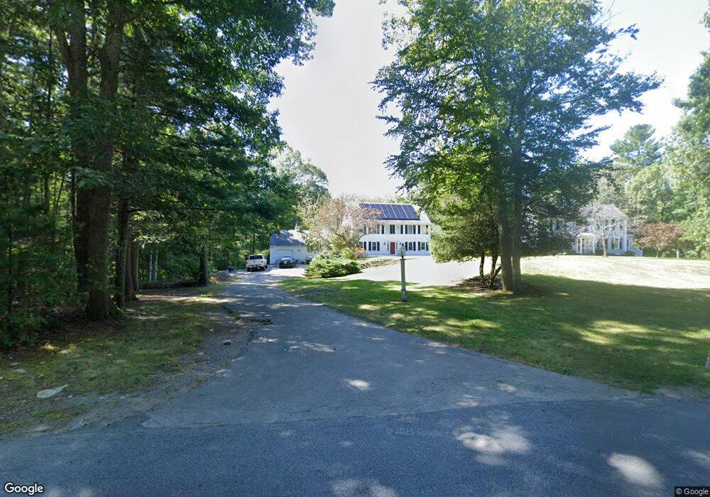
71 First Parish Rd Norwell, MA 02061
Estimated Value: $1,141,000 - $1,389,881
4
Beds
3
Baths
2,760
Sq Ft
$474/Sq Ft
Est. Value
About This Home
This home is located at 71 First Parish Rd, Norwell, MA 02061 and is currently estimated at $1,309,470, approximately $474 per square foot. 71 First Parish Rd is a home located in Plymouth County with nearby schools including William Gould Vinal, Norwell Middle School, and Norwell High School.
Ownership History
Date
Name
Owned For
Owner Type
Purchase Details
Closed on
Apr 5, 2002
Sold by
Shute Donald E
Bought by
Davis Joann and Davis Josepj
Current Estimated Value
Home Financials for this Owner
Home Financials are based on the most recent Mortgage that was taken out on this home.
Original Mortgage
$445,600
Interest Rate
6.84%
Purchase Details
Closed on
Oct 2, 2000
Sold by
Dalessandro Robert and Dalessandro Helen
Bought by
Shute Donald E
Create a Home Valuation Report for This Property
The Home Valuation Report is an in-depth analysis detailing your home's value as well as a comparison with similar homes in the area
Home Values in the Area
Average Home Value in this Area
Purchase History
| Date | Buyer | Sale Price | Title Company |
|---|---|---|---|
| Davis Joann | $557,000 | -- | |
| Davis Joann | $557,000 | -- | |
| Shute Donald E | $525,000 | -- | |
| Shute Donald E | $525,000 | -- |
Source: Public Records
Mortgage History
| Date | Status | Borrower | Loan Amount |
|---|---|---|---|
| Open | Shute Donald E | $104,996 | |
| Open | Shute Donald E | $500,000 | |
| Closed | Shute Donald E | $445,600 |
Source: Public Records
Tax History Compared to Growth
Tax History
| Year | Tax Paid | Tax Assessment Tax Assessment Total Assessment is a certain percentage of the fair market value that is determined by local assessors to be the total taxable value of land and additions on the property. | Land | Improvement |
|---|---|---|---|---|
| 2025 | $14,519 | $1,110,900 | $406,100 | $704,800 |
| 2024 | $13,604 | $1,010,700 | $383,200 | $627,500 |
| 2023 | $13,789 | $901,800 | $294,800 | $607,000 |
| 2022 | $13,203 | $794,400 | $257,300 | $537,100 |
| 2021 | $6,966 | $737,700 | $270,400 | $467,300 |
| 2020 | $11,977 | $720,200 | $270,400 | $449,800 |
| 2019 | $11,354 | $692,300 | $270,400 | $421,900 |
| 2018 | $11,105 | $679,600 | $270,400 | $409,200 |
| 2017 | $11,179 | $679,600 | $270,400 | $409,200 |
| 2016 | $10,839 | $656,900 | $270,400 | $386,500 |
| 2015 | $10,573 | $640,800 | $270,400 | $370,400 |
| 2014 | $10,776 | $658,300 | $269,100 | $389,200 |
Source: Public Records
Map
Nearby Homes
- 334 Summer St
- 0 Mt Blue Unit 73374335
- 342 Summer St
- 449 Clapp Rd
- 455 Clapp Rd
- 453 Clapp Rd
- 451 Clapp Rd
- 453 - 455 Clapp Rd
- 16 Cranberry Ln
- 25 Gendarme Place
- 575 First Parish Rd
- 131 Maple St
- 293 Cross St
- 0 Bates Ln (Lot E Kevin's Way) Unit 73419598
- 2 Webster Farm Way
- 166 Norwell Ave
- 0 Mount Blue St
- 9 Kyle Path
- 479 Clapp Brook Rd
- 21 Norwell Ave
- 83 First Parish Rd
- 59 First Parish Rd
- 53 First Parish Rd
- 10 Laurelwood Dr
- 12 Laurelwood Dr
- 14 Laurelwood Dr
- 16 Laurelwood Dr
- 18 Laurelwood Dr
- 24 Laurelwood Dr
- 28 Laurelwood Dr
- 20 Laurelwood Dr
- 18 Laurelwood Dr
- 822 First Parish Rd
- 817 First Parish Rd
- 70 First Parish Rd
- 35 First Parish Rd
- 811 First Parish Rd
- 818 First Parish Rd
- 803 First Parish Rd
- 810 First Parish Rd