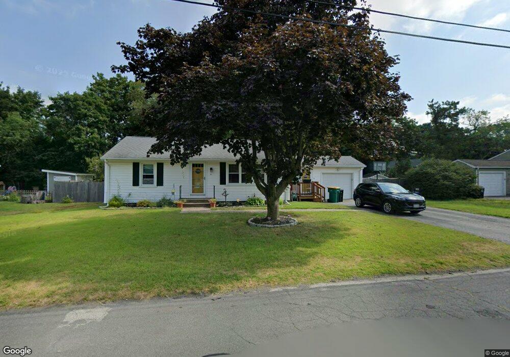
71 George St North Attleboro, MA 02760
North Attleboro NeighborhoodEstimated Value: $498,000 - $546,000
2
Beds
1
Bath
936
Sq Ft
$549/Sq Ft
Est. Value
About This Home
This home is located at 71 George St, North Attleboro, MA 02760 and is currently estimated at $514,270, approximately $549 per square foot. 71 George St is a home located in Bristol County with nearby schools including North Attleboro High School, Cadence Academy Preschool - North Attleborough, and Bishop Feehan High School.
Ownership History
Date
Name
Owned For
Owner Type
Purchase Details
Closed on
Jul 20, 2022
Sold by
Peavey Ralph V and Peavey Diane M
Bought by
Dnr Peavey T
Current Estimated Value
Purchase Details
Closed on
Mar 29, 2007
Sold by
Senseney Donna O and Amaral Cynthia B
Bought by
Peavey Ralph and Peavey Diane M
Home Financials for this Owner
Home Financials are based on the most recent Mortgage that was taken out on this home.
Original Mortgage
$202,500
Interest Rate
6.33%
Mortgage Type
Purchase Money Mortgage
Create a Home Valuation Report for This Property
The Home Valuation Report is an in-depth analysis detailing your home's value as well as a comparison with similar homes in the area
Home Values in the Area
Average Home Value in this Area
Purchase History
| Date | Buyer | Sale Price | Title Company |
|---|---|---|---|
| Dnr Peavey T | -- | None Available | |
| Peavey Ralph | $265,000 | -- | |
| Senseney Donna O | -- | -- |
Source: Public Records
Mortgage History
| Date | Status | Borrower | Loan Amount |
|---|---|---|---|
| Previous Owner | Peavey Ralph | $202,500 |
Source: Public Records
Tax History Compared to Growth
Tax History
| Year | Tax Paid | Tax Assessment Tax Assessment Total Assessment is a certain percentage of the fair market value that is determined by local assessors to be the total taxable value of land and additions on the property. | Land | Improvement |
|---|---|---|---|---|
| 2025 | $5,173 | $438,800 | $141,900 | $296,900 |
| 2024 | $4,900 | $424,600 | $141,900 | $282,700 |
| 2023 | $4,828 | $377,500 | $141,900 | $235,600 |
| 2022 | $4,466 | $320,600 | $141,900 | $178,700 |
| 2021 | $4,636 | $324,900 | $141,900 | $183,000 |
| 2020 | $4,374 | $304,800 | $141,900 | $162,900 |
| 2019 | $4,157 | $291,900 | $129,000 | $162,900 |
| 2018 | $3,664 | $274,700 | $129,000 | $145,700 |
| 2017 | $3,536 | $267,500 | $129,000 | $138,500 |
| 2016 | $3,264 | $246,900 | $143,300 | $103,600 |
| 2015 | $3,127 | $238,000 | $143,300 | $94,700 |
| 2014 | $2,902 | $219,200 | $125,800 | $93,400 |
Source: Public Records
Map
Nearby Homes
- 116 George St
- 16 Raymond Hall Dr
- 15 Old Wood Rd
- 10 Sleepy Hollow Cir
- 11 Landry Ave
- 28 Messenger St
- 33 Dublin Way
- 2 George St Unit C
- 9 Sunnyside Dr Unit 9
- 166 E Bacon St Unit 4
- 57 Vine St
- Lot 5 Jeffrey Dr
- Lot 2 Jeffrey Dr
- 24 Red Coat Ln
- 2 Woodridge St Unit 2
- 12 Houde St
- 115 Westfield Dr
- 52 George St Unit B
- 4 Garden Ln
- 17 Peters Way
- 63 George St
- 79 George St
- 34 William Tanner Ave
- 77 Eldridge Dr
- 33 William Tanner Ave
- 86 George St
- 89 George St
- 26 William Tanner Ave
- 34 Esther Ave
- 27 William Tanner Ave
- 69 Eldridge Dr
- 51 George St
- 27 Ellen St
- 78 Eldridge Dr
- 28 Esther Ave
- 20 William Tanner Ave
- 56 Eldridge Dr
- 19 William Tanner Ave
- 97 George St
- 100 George St