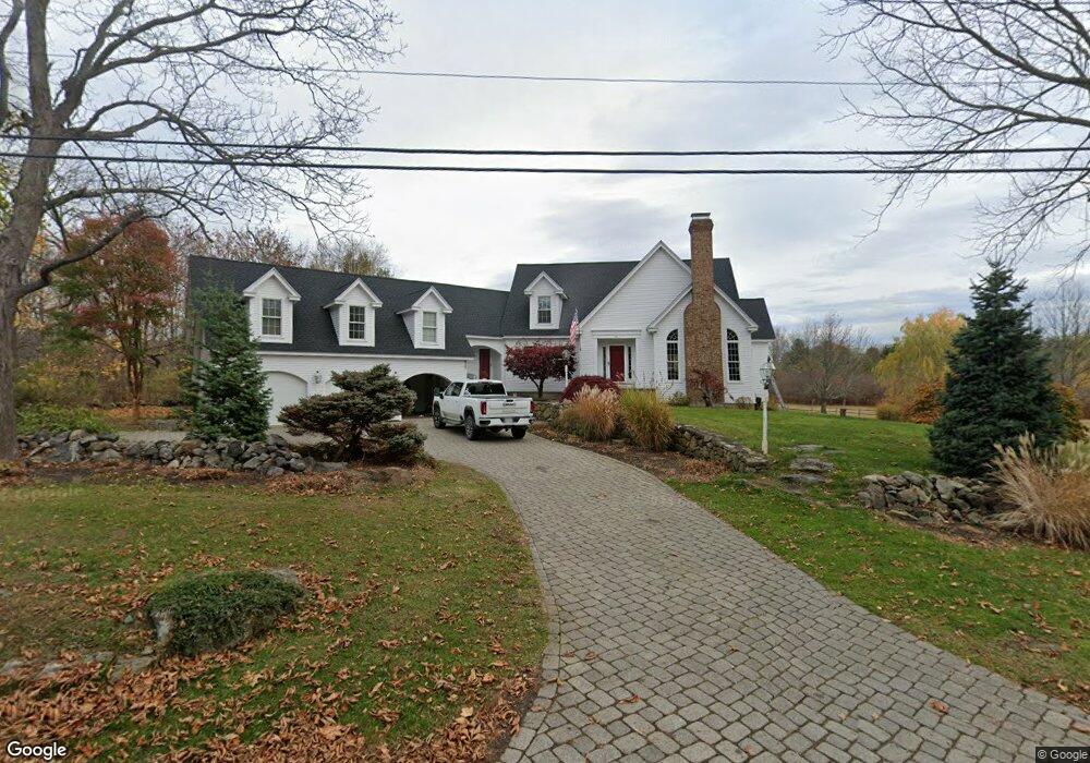
71 Green St Newbury, MA 01951
Estimated Value: $1,970,711 - $2,751,000
4
Beds
4
Baths
6,158
Sq Ft
$370/Sq Ft
Est. Value
About This Home
This home is located at 71 Green St, Newbury, MA 01951 and is currently estimated at $2,276,178, approximately $369 per square foot. 71 Green St is a home located in Essex County with nearby schools including Triton Regional High School, River Valley Charter School, and Immaculate Conception School.
Ownership History
Date
Name
Owned For
Owner Type
Purchase Details
Closed on
Apr 4, 2012
Sold by
Dao Trang and Pierce Andrew
Bought by
Andrew M Pierce Ret
Current Estimated Value
Purchase Details
Closed on
Jul 19, 2010
Sold by
Mccandless Dawn K
Bought by
Dao Trang and Pierce Andrew
Home Financials for this Owner
Home Financials are based on the most recent Mortgage that was taken out on this home.
Original Mortgage
$650,000
Interest Rate
4.82%
Mortgage Type
Purchase Money Mortgage
Purchase Details
Closed on
Oct 17, 2005
Sold by
Barney Jeanne L and Barney Kenneth C
Bought by
Mccandless Dawn K
Create a Home Valuation Report for This Property
The Home Valuation Report is an in-depth analysis detailing your home's value as well as a comparison with similar homes in the area
Home Values in the Area
Average Home Value in this Area
Purchase History
| Date | Buyer | Sale Price | Title Company |
|---|---|---|---|
| Andrew M Pierce Ret | -- | -- | |
| Andrew M Pierce Ret | -- | -- | |
| Dao Trang | $960,000 | -- | |
| Dao Trang | $960,000 | -- | |
| Mccandless Dawn K | $1,100,000 | -- | |
| Mccandless Dawn K | $1,100,000 | -- |
Source: Public Records
Mortgage History
| Date | Status | Borrower | Loan Amount |
|---|---|---|---|
| Previous Owner | Mccandless Dawn K | $650,000 |
Source: Public Records
Tax History Compared to Growth
Tax History
| Year | Tax Paid | Tax Assessment Tax Assessment Total Assessment is a certain percentage of the fair market value that is determined by local assessors to be the total taxable value of land and additions on the property. | Land | Improvement |
|---|---|---|---|---|
| 2025 | $13,093 | $1,757,500 | $512,400 | $1,245,100 |
| 2024 | $12,760 | $1,661,400 | $460,900 | $1,200,500 |
| 2023 | $12,838 | $1,480,700 | $417,400 | $1,063,300 |
| 2022 | $12,649 | $1,300,000 | $373,800 | $926,200 |
| 2021 | $12,759 | $1,196,900 | $330,200 | $866,700 |
| 2020 | $12,671 | $1,153,000 | $321,500 | $831,500 |
| 2019 | $12,160 | $1,124,900 | $321,500 | $803,400 |
| 2018 | $11,494 | $1,054,500 | $321,500 | $733,000 |
| 2017 | $11,050 | $1,041,500 | $308,500 | $733,000 |
| 2016 | $11,226 | $984,700 | $258,400 | $726,300 |
| 2015 | $11,344 | $984,700 | $258,400 | $726,300 |
| 2014 | $11,147 | $984,700 | $258,400 | $726,300 |
Source: Public Records
Map
Nearby Homes
- 100 High Rd
- 105 High Rd Unit Lot 2
- 1 Littles Ln
- 4 Hanover St
- 144 High Rd
- 1 Lancaster Rd
- 182 High Rd
- 7 Pine Island Rd
- 26 Beacon Ave
- 33 Union St
- 4 Goodwin Ave
- 222 High Rd
- 17 Madison St
- 113 Prospect St Unit B
- 62 Middle Rd
- 239 High Rd
- 24 Seaview Ln
- 57 Lime St Unit 1
- 58 Lime St Unit 5
- 164 Water St Unit A