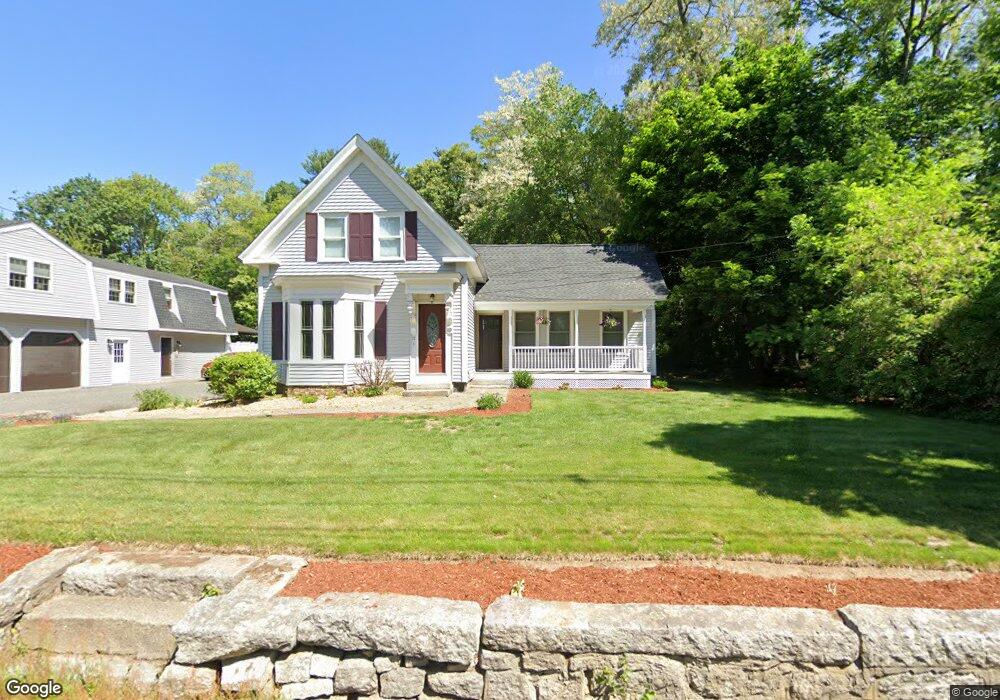
71 Hazel St Uxbridge, MA 01569
Estimated Value: $594,000 - $664,000
5
Beds
2
Baths
2,849
Sq Ft
$217/Sq Ft
Est. Value
About This Home
This home is located at 71 Hazel St, Uxbridge, MA 01569 and is currently estimated at $617,166, approximately $216 per square foot. 71 Hazel St is a home located in Worcester County with nearby schools including Uxbridge High School, Our Lady of the Valley Regional School, and Whitinsville Christian School.
Ownership History
Date
Name
Owned For
Owner Type
Purchase Details
Closed on
May 25, 1994
Sold by
Baltic Realty Corp
Bought by
Dion Thomas A and Dion Chrisitne
Current Estimated Value
Purchase Details
Closed on
Jan 5, 1994
Sold by
Poudrier Michael G
Bought by
Baltic Realty Corp
Create a Home Valuation Report for This Property
The Home Valuation Report is an in-depth analysis detailing your home's value as well as a comparison with similar homes in the area
Home Values in the Area
Average Home Value in this Area
Purchase History
| Date | Buyer | Sale Price | Title Company |
|---|---|---|---|
| Dion Thomas A | $105,000 | -- | |
| Baltic Realty Corp | $100,000 | -- |
Source: Public Records
Mortgage History
| Date | Status | Borrower | Loan Amount |
|---|---|---|---|
| Open | Baltic Realty Corp | $272,000 | |
| Closed | Baltic Realty Corp | $50,000 | |
| Closed | Baltic Realty Corp | $143,000 |
Source: Public Records
Tax History
| Year | Tax Paid | Tax Assessment Tax Assessment Total Assessment is a certain percentage of the fair market value that is determined by local assessors to be the total taxable value of land and additions on the property. | Land | Improvement |
|---|---|---|---|---|
| 2025 | $66 | $505,600 | $143,800 | $361,800 |
| 2024 | $6,243 | $483,200 | $132,100 | $351,100 |
| 2023 | $6,093 | $436,800 | $119,700 | $317,100 |
| 2022 | $5,599 | $369,300 | $108,700 | $260,600 |
| 2021 | $5,768 | $364,600 | $104,000 | $260,600 |
| 2020 | $5,670 | $338,700 | $108,000 | $230,700 |
| 2019 | $5,526 | $318,500 | $100,100 | $218,400 |
| 2018 | $5,410 | $315,100 | $100,100 | $215,000 |
| 2017 | $5,617 | $331,200 | $94,600 | $236,600 |
| 2016 | $5,977 | $340,200 | $97,100 | $243,100 |
| 2015 | $5,852 | $336,300 | $97,100 | $239,200 |
Source: Public Records
Map
Nearby Homes
- 86 Hunter Rd
- 26 Rivulet St
- 16 Farnum St
- 71 Rivulet St Unit B
- 5 Peter St Unit D
- 79 High St
- 12 Hartford Ave E
- 3 Strathmore Shire Unit A
- 376 Douglas St
- 138 Elm St
- 61 Spring Hill Dr Unit 61
- 0 Homestead Ave
- 24 Olde Canal Way Unit 24
- 395 High St
- 235 Rivulet St
- 218 E Hartford Ave Unit 218
- 11 Summerfield Dr Unit 11
- 223 Mendon St
- 145 Mantell Rd
- 169 Mantell Rd
Your Personal Tour Guide
Ask me questions while you tour the home.