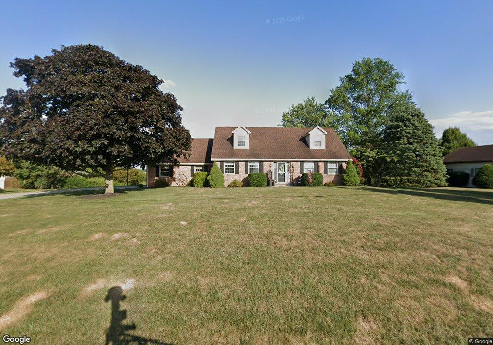
71 Littlestown Rd Littlestown, PA 17340
Estimated Value: $338,000 - $439,000
3
Beds
2
Baths
2,100
Sq Ft
$180/Sq Ft
Est. Value
About This Home
This home is located at 71 Littlestown Rd, Littlestown, PA 17340 and is currently estimated at $378,381, approximately $180 per square foot. 71 Littlestown Rd is a home located in Adams County with nearby schools including Rolling Acres El School, Maple Avenue Middle School, and Littlestown Senior High School.
Ownership History
Date
Name
Owned For
Owner Type
Purchase Details
Closed on
Apr 17, 1986
Bought by
Staub Alan P and Staub Sandra K
Current Estimated Value
Create a Home Valuation Report for This Property
The Home Valuation Report is an in-depth analysis detailing your home's value as well as a comparison with similar homes in the area
Home Values in the Area
Average Home Value in this Area
Purchase History
| Date | Buyer | Sale Price | Title Company |
|---|---|---|---|
| Staub Alan P | $14,500 | -- |
Source: Public Records
Tax History Compared to Growth
Tax History
| Year | Tax Paid | Tax Assessment Tax Assessment Total Assessment is a certain percentage of the fair market value that is determined by local assessors to be the total taxable value of land and additions on the property. | Land | Improvement |
|---|---|---|---|---|
| 2025 | $4,923 | $260,100 | $62,400 | $197,700 |
| 2024 | $4,706 | $260,100 | $62,400 | $197,700 |
| 2023 | $4,613 | $260,100 | $62,400 | $197,700 |
| 2022 | $4,611 | $260,100 | $62,400 | $197,700 |
| 2021 | $4,448 | $260,100 | $62,400 | $197,700 |
| 2020 | $4,384 | $260,100 | $62,400 | $197,700 |
| 2019 | $4,291 | $260,100 | $62,400 | $197,700 |
| 2018 | $4,197 | $260,100 | $62,400 | $197,700 |
| 2017 | $4,052 | $260,100 | $62,400 | $197,700 |
| 2016 | -- | $260,100 | $62,400 | $197,700 |
| 2015 | -- | $260,100 | $62,400 | $197,700 |
| 2014 | -- | $260,100 | $62,400 | $197,700 |
Source: Public Records
Map
Nearby Homes
- 349 Basehoar School Rd Unit 5
- 0 Locust Dr Unit PAAD2015910
- 20c Locust Dr
- 20 Locust Dr
- 162 Newark St
- 0 Littlestown Rd
- 58 Windsor Ct
- 48 Windsor Ct
- 41 Smith Cir
- 440 N Queen St
- 5 Manor Cir Unit 103
- 449 Glenwyn Dr
- 58 N Gala Unit 397
- 140 Apple Grove Ln Unit 425
- 135 Apple Grove Ln Unit 438
- 43 Ashfield Dr Unit 14
- 211 E King St
- 52 Stayman Way Unit 81
- 535 Lumber St
- 559 Lumber St
- 59 Littlestown Rd Unit 6
- 93 Littlestown Rd Unit 4
- 45 Littlestown Rd Unit 7
- 101 Littlestown Rd Unit 3
- 240 Spring Hill Ln Unit 11A
- 31 Littlestown Rd Unit 8
- 121 Littlestown Rd Unit 2
- 206 Spring Hill Ln Unit 10
- 27 Littlestown Rd Unit 9
- 215 Spring Hill Ln Unit 6
- 5 Littlestown Rd Unit 10
- 20 Littlestown Rd
- 1810 White Hall Rd
- 20 Basehoar School Rd Unit 11
- 000 Littlestown Rd
- 000000 Littlestown Rd
- 34 Basehoar School Rd
- 1 Basehoar School Rd
- 150 Spring Hill Ln Unit 9
- 1685 White Hall Rd Unit 1