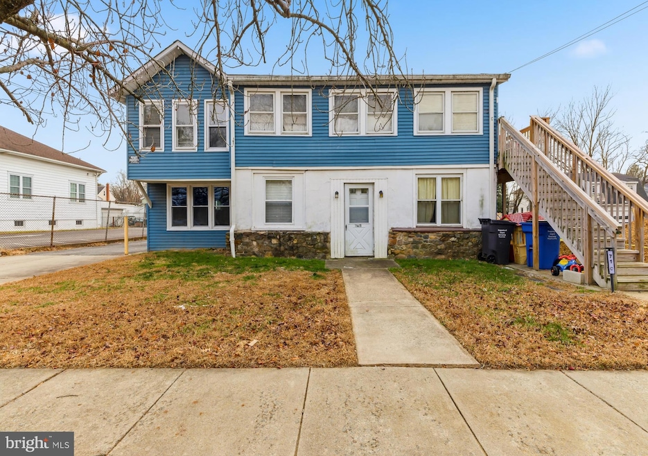
71 Main St Bridgeport, NJ 08014
Logan Township NeighborhoodEstimated payment $2,417/month
About This Home
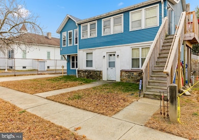
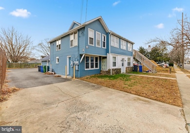
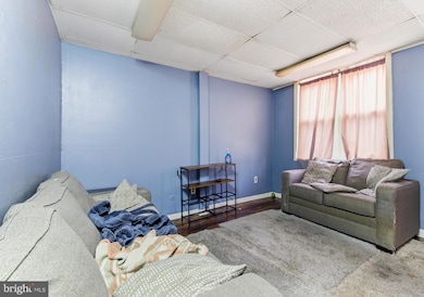
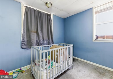
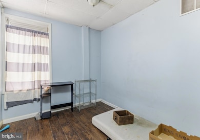
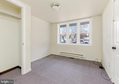
OWNER-OCCUPANT OR INVESTOR TRIPLEX WITH SEPARATE UTILITIES & PRIVATE ENTRANCES. Well-maintained three-unit property offering flexible layouts and multiple ownership strategies. Ideal for buyers looking to live in one unit while offsetting the mortgage, or investors seeking stable rental income with value-add potential. Serviced by public water and sewer and conveniently located just minutes from Route 295 and the Commodore Barry Bridge for easy commuting. HIGHLIGHTS: Triplex with two ground-level units and one second-floor unit, separate gas meters for each unit, four electrical panels (three units plus owner/exterior), three water heaters (two gas, one electric), private entrances throughout, paved off-street parking, backyard with two storage sheds, and basement access via Bilco doors. NEW replacement windows are included and stored in the basement (not yet installed). UNITS: Unit A (ground floor) offers a flexible 3-bedroom layout with two entrances, gas forced-air heat, laundry hookups, and direct backyard access. Unit B (ground floor) features a private entrance, efficient layout, electric baseboard heat, kitchen access to rear parking, and washer/dryer hookup area. Unit C (second floor) is a 2-bedroom, 1-bath unit with private exterior access, in-unit washer/dryer, gas boiler heat, and is currently occupied providing immediate rental income. A strong multi-unit opportunity in a commuter-friendly Logan Township location.
Listing Agent
Harshilkumar Desai
hdesai255@gmail.com HOF Realty License #2556699 Listed on: 12/07/2025
Property Details
Home Type
- Multi-Family
Est. Annual Taxes
- $4,036
Year Built
- Built in 1945
Parking
- Driveway
Home Design
- 2,693 Sq Ft Home
- Triplex
- Block Foundation
- Frame Construction
- Shingle Roof
Utilities
- Window Unit Cooling System
- 90% Forced Air Heating System
- Hot Water Baseboard Heater
- Natural Gas Water Heater
Additional Features
- Shed
- 5,227 Sq Ft Lot
Community Details
- 3 Units
- 2 Vacant Units
Listing and Financial Details
- Assessor Parcel Number 367
Map
Home Values in the Area
Average Home Value in this Area
Tax History
| Year | Tax Paid | Tax Assessment Tax Assessment Total Assessment is a certain percentage of the fair market value that is determined by local assessors to be the total taxable value of land and additions on the property. | Land | Improvement |
|---|---|---|---|---|
| 2025 | $3,631 | $279,300 | $31,800 | $247,500 |
| 2024 | $3,363 | $279,300 | $31,800 | $247,500 |
| 2023 | $3,363 | $167,300 | $12,700 | $154,600 |
| 2022 | $3,495 | $167,300 | $12,700 | $154,600 |
| 2021 | $2,721 | $167,300 | $12,700 | $154,600 |
| 2020 | $3,639 | $167,300 | $12,700 | $154,600 |
| 2019 | $3,634 | $167,300 | $12,700 | $154,600 |
| 2018 | $3,533 | $167,300 | $12,700 | $154,600 |
| 2017 | $3,888 | $155,100 | $12,200 | $142,900 |
| 2016 | $3,825 | $155,100 | $12,200 | $142,900 |
| 2015 | $3,381 | $155,100 | $12,200 | $142,900 |
| 2014 | $3,279 | $155,100 | $12,200 | $142,900 |
Property History
| Date | Event | Price | List to Sale | Price per Sq Ft |
|---|---|---|---|---|
| 12/07/2025 12/07/25 | For Sale | $396,777 | -- | $147 / Sq Ft |
Purchase History
| Date | Type | Sale Price | Title Company |
|---|---|---|---|
| Deed | $230,000 | Wfg National Title | |
| Deed | $195,000 | Security Title Agency | |
| Bargain Sale Deed | $115,000 | Victorian Title |
Mortgage History
| Date | Status | Loan Amount | Loan Type |
|---|---|---|---|
| Open | $250,000 | New Conventional | |
| Previous Owner | $156,000 | Fannie Mae Freddie Mac |
Source: Bright MLS
MLS Number: NJGL2067326
APN: 09-01404-0000-00013
Disclaimer: Certain information contained herein is derived from information provided by parties other than Homes.com. All information provided is deemed reliable, but is not guaranteed to be accurate and should be independently verified.
![]() The data relating to real estate for sale on this website appears in part through the BRIGHT Internet Data Exchange program, a voluntary cooperative exchange of property listing data between licensed real estate brokerage firms, and is provided by BRIGHT through a licensing agreement.
The data relating to real estate for sale on this website appears in part through the BRIGHT Internet Data Exchange program, a voluntary cooperative exchange of property listing data between licensed real estate brokerage firms, and is provided by BRIGHT through a licensing agreement.
Listing information is from various brokers who participate in the Bright MLS IDX program and not all listings may be visible on the site.
The property information being provided on or through the website is for the personal, non-commercial use of consumers and such information may not be used for any purpose other than to identify prospective properties consumers may be interested in purchasing.
Some properties which appear for sale on the website may no longer be available because they are for instance, under contract, sold or are no longer being offered for sale.
Property information displayed is deemed reliable but is not guaranteed.
Copyright 2025 Bright MLS, Inc.
- 33 Mechanic St
- 126 Repaupo Station Rd
- 17 Hickory Ln
- 13 Sweet Bay Ln
- 43 45 Repaupo Station Rd
- 788 Paulsboro Rd
- 792 Paulsboro Rd
- 103 Highland Ave
- 103 Thurlow St Unit 306
- 12 Parker St
- 223 Jeffrey St
- 112 Carriage Ln
- 2153 Route 322
- 0 Palmer St Unit PADE2073654
- 803 W Mary St
- 1402 W 3rd St
- 220 Kerlin St
- 2821 W 3rd St
- 321 Tilghman St
- 2325 W 4th St
- 89 Main St
- 620 W 2nd St
- 2308 W 3rd St
- 220 Kerlin St
- 2106 W 4th St Unit 2
- 312 Concord Ave
- 330 Kerlin St Unit 3
- 425 Highland Ave Unit B
- 425 Highland Ave Unit A
- 548 Dorian Dr
- 2528 W 6th St
- 523 Concord Ave
- 1001 W 7th St
- 1213 W 9th St
- 912 Pennell St
- 1006 Butler St
- 1021 E Williams Cir
- 348 Taylor Terrace
- 309 Green St Unit A
- 429 E 9th St Unit 1