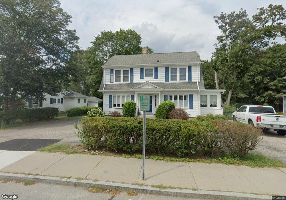
71 Main St Wakefield, RI 02879
Estimated Value: $595,000 - $807,000
3
Beds
2
Baths
1,862
Sq Ft
$370/Sq Ft
Est. Value
About This Home
This home is located at 71 Main St, Wakefield, RI 02879 and is currently estimated at $688,979, approximately $370 per square foot. 71 Main St is a home with nearby schools including South Kingstown High School, Monsignor Matthew Clarke Catholic Regional School, and Bradley School-South.
Ownership History
Date
Name
Owned For
Owner Type
Purchase Details
Closed on
May 15, 2014
Sold by
Kehoe Tracey L
Bought by
Kehoe Chrstopher G and Kehoe Tracey L
Current Estimated Value
Purchase Details
Closed on
Jun 24, 1997
Sold by
Kehoe Mary A
Bought by
Kehoe Christopher G
Home Financials for this Owner
Home Financials are based on the most recent Mortgage that was taken out on this home.
Original Mortgage
$50,000
Interest Rate
7.87%
Mortgage Type
Commercial
Create a Home Valuation Report for This Property
The Home Valuation Report is an in-depth analysis detailing your home's value as well as a comparison with similar homes in the area
Home Values in the Area
Average Home Value in this Area
Purchase History
| Date | Buyer | Sale Price | Title Company |
|---|---|---|---|
| Kehoe Chrstopher G | -- | -- | |
| Kehoe Christopher G | $73,000 | -- |
Source: Public Records
Mortgage History
| Date | Status | Borrower | Loan Amount |
|---|---|---|---|
| Previous Owner | Kehoe Christopher G | $50,000 |
Source: Public Records
Tax History
| Year | Tax Paid | Tax Assessment Tax Assessment Total Assessment is a certain percentage of the fair market value that is determined by local assessors to be the total taxable value of land and additions on the property. | Land | Improvement |
|---|---|---|---|---|
| 2025 | $6,043 | $675,900 | $327,200 | $348,700 |
| 2024 | $6,020 | $544,800 | $248,500 | $296,300 |
| 2023 | $6,020 | $544,800 | $248,500 | $296,300 |
| 2022 | $5,520 | $504,100 | $248,500 | $255,600 |
| 2021 | $6,419 | $444,200 | $224,300 | $219,900 |
| 2020 | $6,419 | $444,200 | $224,300 | $219,900 |
| 2019 | $6,419 | $444,200 | $224,300 | $219,900 |
| 2018 | $6,140 | $391,600 | $200,000 | $191,600 |
| 2017 | $5,995 | $391,600 | $200,000 | $191,600 |
| 2016 | $5,909 | $391,600 | $200,000 | $191,600 |
| 2015 | $5,922 | $381,600 | $230,300 | $151,300 |
| 2014 | $5,907 | $381,600 | $230,300 | $151,300 |
Source: Public Records
Map
Nearby Homes
- 45 Cherry Ln Unit C
- 39 Hazard Ave
- 20 Cleveland St
- 37 Columbia St
- 131 Columbia St
- 66 Christopher St
- 15 Jessica Ln
- 48 Stone Bridge Dr
- 301 Church St Unit 103
- 143 Summit Ave
- 35 Abbey Rd
- 23 Rockland Dr
- 13 Prospect Ave
- 57 Rocky Brook Way
- 100 Spartina Cove Way
- 216 S Pier Rd
- 56 Wanda St
- 39 Secluded Dr
- 260 Sweet Allen Farm Rd Unit 3
- 54 Othmar St
Your Personal Tour Guide
Ask me questions while you tour the home.