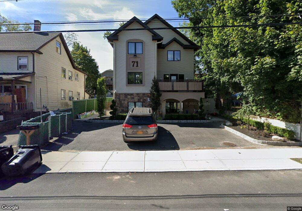
71 N Cole Ave Spring Valley, NY 10977
Estimated Value: $1,258,000 - $1,853,000
10
Beds
4
Baths
4,496
Sq Ft
$337/Sq Ft
Est. Value
About This Home
This home is located at 71 N Cole Ave, Spring Valley, NY 10977 and is currently estimated at $1,517,339, approximately $337 per square foot. 71 N Cole Ave is a home located in Rockland County with nearby schools including Margetts Elementary School, Chestnut Ridge Middle School, and Spring Valley High School.
Ownership History
Date
Name
Owned For
Owner Type
Purchase Details
Closed on
Dec 31, 2021
Sold by
North Cole Management Llc
Bought by
Oberlander David
Current Estimated Value
Purchase Details
Closed on
Jun 14, 2011
Sold by
Friedman Shloma
Bought by
Oberlander Gedalia
Home Financials for this Owner
Home Financials are based on the most recent Mortgage that was taken out on this home.
Original Mortgage
$116,250
Interest Rate
4.74%
Mortgage Type
New Conventional
Purchase Details
Closed on
May 4, 1999
Sold by
Casteluccio Michael Joseph and Casteluccio Michael
Bought by
Friedman Shloha
Home Financials for this Owner
Home Financials are based on the most recent Mortgage that was taken out on this home.
Original Mortgage
$82,800
Interest Rate
6.88%
Create a Home Valuation Report for This Property
The Home Valuation Report is an in-depth analysis detailing your home's value as well as a comparison with similar homes in the area
Home Values in the Area
Average Home Value in this Area
Purchase History
| Date | Buyer | Sale Price | Title Company |
|---|---|---|---|
| Oberlander David | -- | None Available | |
| Oberlander Gedalia | $155,000 | None Available | |
| Friedman Shloha | $92,000 | Chicago Title Insurance Co |
Source: Public Records
Mortgage History
| Date | Status | Borrower | Loan Amount |
|---|---|---|---|
| Previous Owner | Oberlander Gedalia | $116,250 | |
| Previous Owner | Friedman Shloha | $82,800 |
Source: Public Records
Tax History Compared to Growth
Tax History
| Year | Tax Paid | Tax Assessment Tax Assessment Total Assessment is a certain percentage of the fair market value that is determined by local assessors to be the total taxable value of land and additions on the property. | Land | Improvement |
|---|---|---|---|---|
| 2024 | $39,722 | $87,800 | $8,800 | $79,000 |
| 2023 | $39,722 | $87,800 | $8,800 | $79,000 |
| 2022 | $37,346 | $87,800 | $8,800 | $79,000 |
| 2021 | $15,385 | $87,800 | $8,800 | $79,000 |
| 2020 | $27,110 | $87,800 | $8,800 | $79,000 |
| 2019 | $29,728 | $87,800 | $8,800 | $79,000 |
| 2018 | $29,728 | $87,800 | $8,800 | $79,000 |
| 2017 | $20,306 | $87,800 | $8,800 | $79,000 |
| 2016 | $9,147 | $16,000 | $8,800 | $7,200 |
| 2015 | -- | $29,600 | $8,800 | $20,800 |
| 2014 | -- | $29,600 | $8,800 | $20,800 |
Source: Public Records
Map
Nearby Homes
- 79 N Cole Ave
- 64 N Cole Ave Unit 111
- 96 N Cole Ave
- 6 Schevchenko Place
- 468 W Central Ave Unit 112
- 478 W Central Ave Unit 111
- 222-230 Adar Ct
- 27 Ellish Pkwy Unit 112
- 30 Twin Ave
- 470 W Central Ave Unit 202
- 480 W Central Ave
- 3 Argo Ln
- 11 Argo Ln
- 17 Union Rd Unit 111
- 17 Union Rd Unit 104
- 17 Union Rd Unit 106
- 17 Union Rd Unit 107
- 17 Union Rd Unit 203
- 17 Union Rd Unit 204
- 17 Union Rd Unit 209
- 80 Decatur Ave
- 73 N Cole Ave
- 69 N Cole Ave
- 78 Decatur Ave Unit 3
- 76 Decatur Ave Unit 2
- 67 N Cole Ave
- 82 Decatur Ave
- 67 N Cole Ave
- 77 N Cole Ave
- 84 Decatur Ave
- 74 Decatur Ave Unit 301
- 74 Decatur Ave Unit 201
- 74 Decatur Ave Unit 101
- 65 N Cole Ave
- 72 Decatur Ave Unit 301
- 72 Decatur Ave Unit 201
- 72 Decatur Ave Unit 101
- 70 N Cole Ave
- 68 N Cole Ave
- 72 N Cole Ave