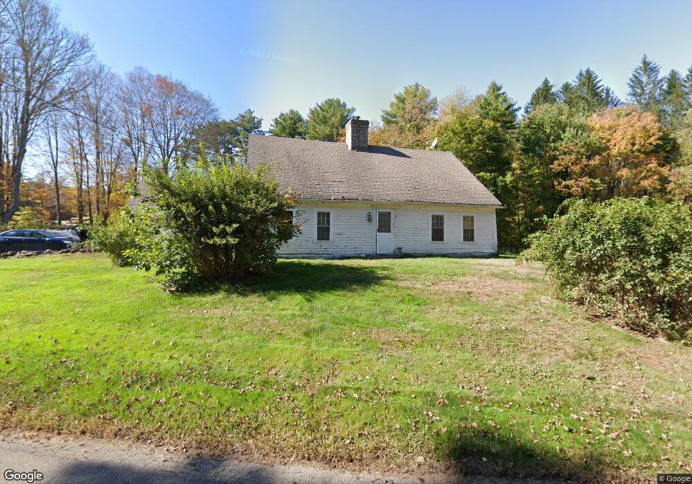
71 N River Rd Tolland, CT 06084
Estimated Value: $319,000 - $502,000
2
Beds
2
Baths
1,920
Sq Ft
$200/Sq Ft
Est. Value
About This Home
This home is located at 71 N River Rd, Tolland, CT 06084 and is currently estimated at $384,714, approximately $200 per square foot. 71 N River Rd is a home located in Tolland County with nearby schools including Birch Grove Primary School, Tolland Intermediate School, and Tolland Middle School.
Ownership History
Date
Name
Owned For
Owner Type
Purchase Details
Closed on
May 21, 2021
Sold by
Sd Williams Llc
Bought by
Bane Prop Management Llc
Current Estimated Value
Home Financials for this Owner
Home Financials are based on the most recent Mortgage that was taken out on this home.
Original Mortgage
$1
Outstanding Balance
$1
Interest Rate
3%
Mortgage Type
Purchase Money Mortgage
Create a Home Valuation Report for This Property
The Home Valuation Report is an in-depth analysis detailing your home's value as well as a comparison with similar homes in the area
Home Values in the Area
Average Home Value in this Area
Purchase History
| Date | Buyer | Sale Price | Title Company |
|---|---|---|---|
| Bane Prop Management Llc | $50,000 | None Available | |
| Bane Prop Management Llc | $50,000 | None Available | |
| Bane Prop Management Llc | $50,000 | None Available |
Source: Public Records
Mortgage History
| Date | Status | Borrower | Loan Amount |
|---|---|---|---|
| Open | Bane Prop Management Llc | $1 | |
| Closed | Bane Prop Management Llc | $0 |
Source: Public Records
Tax History Compared to Growth
Tax History
| Year | Tax Paid | Tax Assessment Tax Assessment Total Assessment is a certain percentage of the fair market value that is determined by local assessors to be the total taxable value of land and additions on the property. | Land | Improvement |
|---|---|---|---|---|
| 2025 | $3,173 | $116,700 | $66,100 | $50,600 |
| 2024 | $3,539 | $93,700 | $63,100 | $30,600 |
| 2023 | $3,498 | $93,700 | $63,100 | $30,600 |
| 2022 | $3,428 | $93,700 | $63,100 | $30,600 |
| 2021 | $3,477 | $93,700 | $63,100 | $30,600 |
| 2020 | $4,838 | $134,200 | $63,100 | $71,100 |
| 2019 | $4,622 | $128,200 | $65,100 | $63,100 |
| 2018 | $4,487 | $128,200 | $65,100 | $63,100 |
| 2017 | $4,383 | $128,200 | $65,100 | $63,100 |
| 2016 | $4,383 | $128,200 | $65,100 | $63,100 |
| 2015 | $4,277 | $128,200 | $65,100 | $63,100 |
| 2014 | $4,341 | $139,800 | $72,300 | $67,500 |
Source: Public Records
Map
Nearby Homes
- 0 Tolland Stage Rd Unit 24101836
- 152 Buff Cap Rd
- 0 Tolland Turnpike Unit 24107059
- 120 Derek Dr
- 0 River Rd Unit 24120753
- 95 Derek Dr
- 322 Buff Cap Rd
- 28 Angela Dr
- 368 Buff Cap Rd
- 35 Schofield Rd
- 128 Slater Rd
- 0 Ruby Rd
- 38 Lucerne Dr
- 66 Deerwood Rd
- 10 Depot Rd Unit 25
- 43 Deerwood Rd
- 243 Tolland Turnpike
- 257 Torry Rd
- 476 Old Stafford Rd
- 461 Old Stafford Rd
- 74 N River Rd
- 80 N River Rd
- 39 N River Rd
- 47 Pero Rd
- 86 Buff Cap Rd Unit D08
- 86 Buff Cap Rd Unit D09
- 86 Buff Cap Rd Unit D-5
- 86 Buff Cap Rd
- 387 River Rd
- 377 River Rd
- 44 Buff Cap Rd
- 383 River Rd
- 1504 Tolland Stage Rd
- 4 George St
- 0 Tolland Stage Rd Unit 170079040
- 0 Tolland Stage Rd Unit G10093671
- 0 Tolland Stage Rd Unit G10135318
- 0 Tolland Stage Rd Unit G10185364
- 0 Tolland Stage Rd
- 0 Tolland Stage Rd Unit 170474647