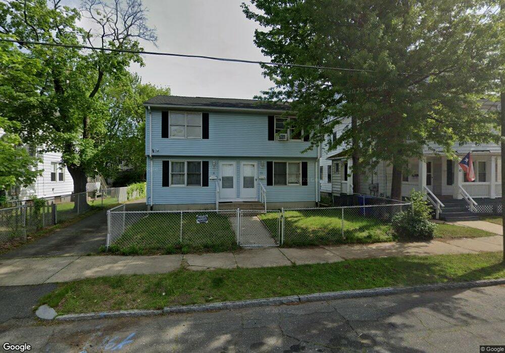
71 Parkside St Unit 73 Springfield, MA 01104
Liberty Heights NeighborhoodEstimated Value: $248,000 - $392,000
4
Beds
2
Baths
1,728
Sq Ft
$186/Sq Ft
Est. Value
About This Home
This home is located at 71 Parkside St Unit 73, Springfield, MA 01104 and is currently estimated at $320,878, approximately $185 per square foot. 71 Parkside St Unit 73 is a home located in Hampden County with nearby schools including Edward P. Boland School, High School Of Commerce, and Springfield High School of Science and Technology.
Ownership History
Date
Name
Owned For
Owner Type
Purchase Details
Closed on
Aug 25, 2003
Sold by
Margosiak Edward W and Shea Francis J
Bought by
Gark Bill A
Current Estimated Value
Home Financials for this Owner
Home Financials are based on the most recent Mortgage that was taken out on this home.
Original Mortgage
$106,400
Outstanding Balance
$46,513
Interest Rate
5.52%
Mortgage Type
Purchase Money Mortgage
Estimated Equity
$274,365
Create a Home Valuation Report for This Property
The Home Valuation Report is an in-depth analysis detailing your home's value as well as a comparison with similar homes in the area
Home Values in the Area
Average Home Value in this Area
Purchase History
| Date | Buyer | Sale Price | Title Company |
|---|---|---|---|
| Gark Bill A | $112,000 | -- |
Source: Public Records
Mortgage History
| Date | Status | Borrower | Loan Amount |
|---|---|---|---|
| Open | Gark Bill A | $106,400 | |
| Closed | Gark Bill A | $3,000 |
Source: Public Records
Tax History Compared to Growth
Tax History
| Year | Tax Paid | Tax Assessment Tax Assessment Total Assessment is a certain percentage of the fair market value that is determined by local assessors to be the total taxable value of land and additions on the property. | Land | Improvement |
|---|---|---|---|---|
| 2025 | $4,525 | $288,600 | $30,300 | $258,300 |
| 2024 | $4,330 | $269,600 | $30,300 | $239,300 |
| 2023 | $4,114 | $241,300 | $27,600 | $213,700 |
| 2022 | $3,645 | $193,700 | $25,700 | $168,000 |
| 2021 | $3,659 | $193,600 | $23,400 | $170,200 |
| 2020 | $3,508 | $179,600 | $23,400 | $156,200 |
| 2019 | $3,292 | $167,300 | $23,400 | $143,900 |
| 2018 | $3,090 | $157,000 | $23,400 | $133,600 |
| 2017 | $2,823 | $143,600 | $24,900 | $118,700 |
| 2016 | $2,481 | $126,200 | $24,900 | $101,300 |
| 2015 | $2,486 | $126,400 | $24,900 | $101,500 |
Source: Public Records
Map
Nearby Homes
- 75-77 Mooreland St
- 122-124 Mooreland St
- 129 Mooreland St
- 46-48 Wait St
- 62-64 Governor St
- 55 Governor St
- 24 Morrell St
- 661 Carew St
- 92 Miller St
- 708-710 Carew St
- 156 Knollwood St
- 60-62 Desrosiers St
- 723-725 Carew St
- 392-394 Carew St
- 750 Liberty St
- 774-776 Liberty St
- 11 Leroy Place
- 30 Beauchamp St
- 37 Phoenix St
- 56-58 Phoenix St
- 71 Pear St
- 67 Parkside St Unit 69
- 83 Parkside St
- 61 Parkside St Unit 63
- 78 Mooreland St Unit 80
- 74 Mooreland St Unit 76
- 84 Mooreland St Unit 86
- 84 -86 Mooreland
- 84-86 Mooreland St
- 80 Parkside St
- 68 Parkside St
- 70 Mooreland St
- 90 Mooreland St
- 68 Mooreland St Unit 70
- 87 Parkside St Unit 89
- 87-89 Parkside St
- 57 Parkside St Unit 59
- 60 Parkside St
- 64-66 Mooreland St
- 315 Lexington St